 with our Megalithic Portal iPhone app")


<< Our Photo Pages >> The Knapp (Bredwardine) - Ancient Village or Settlement in England in Herefordshire
Submitted by Andy B on Saturday, 18 June 2011 Page Views: 8558
Multi-periodSite Name: The Knapp (Bredwardine)Country: England
NOTE: This site is 4.372 km away from the location you searched for.
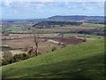
County: Herefordshire Type: Ancient Village or Settlement
Nearest Village: Bredwardine
Map Ref: SO32454467
Latitude: 52.096229N Longitude: 2.987482W
Condition:
| 5 | Perfect |
| 4 | Almost Perfect |
| 3 | Reasonable but with some damage |
| 2 | Ruined but still recognisable as an ancient site |
| 1 | Pretty much destroyed, possibly visible as crop marks |
| 0 | No data. |
| -1 | Completely destroyed |
| 5 | Superb |
| 4 | Good |
| 3 | Ordinary |
| 2 | Not Good |
| 1 | Awful |
| 0 | No data. |
| 5 | Can be driven to, probably with disabled access |
| 4 | Short walk on a footpath |
| 3 | Requiring a bit more of a walk |
| 2 | A long walk |
| 1 | In the middle of nowhere, a nightmare to find |
| 0 | No data. |
| 5 | co-ordinates taken by GPS or official recorded co-ordinates |
| 4 | co-ordinates scaled from a detailed map |
| 3 | co-ordinates scaled from a bad map |
| 2 | co-ordinates of the nearest village |
| 1 | co-ordinates of the nearest town |
| 0 | no data |
Internal Links:
External Links:
I have visited· I would like to visit
Andy B has visited here
 (PID:78037)")
Note: Community Dig at The Knapp, 25th June 2011 to 17th July
You may be viewing yesterday's version of this page. To see the most up to date information please register for a free account.
 (PID:78059)")
 (PID:78038)")
 (PID:78036)")
 (PID:78035)")
Do not use the above information on other web sites or publications without permission of the contributor.
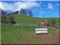
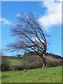
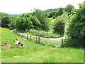
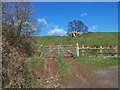
Nearby Images from Geograph Britain and Ireland:
©2008(licence)
©2008(licence)
©2006(licence)
©2008(licence)
©2008(licence)
The above images may not be of the site on this page, they are loaded from Geograph.
Please Submit an Image of this site or go out and take one for us!
Click here to see more info for this site
Nearby sites
Key: Red: member's photo, Blue: 3rd party photo, Yellow: other image, Green: no photo - please go there and take one, Grey: site destroyed
Download sites to:
KML (Google Earth)
GPX (GPS waypoints)
CSV (Garmin/Navman)
CSV (Excel)
To unlock full downloads you need to sign up as a Contributory Member. Otherwise downloads are limited to 50 sites.
Turn off the page maps and other distractions
Nearby sites listing. In the following links * = Image available
423m S 186° Chapel field Hillfort (SO32404425)
1.0km E 99° Bredwardine Church* Carving (SO33484450)
1.6km SSW 199° Arthur's Stone* Chambered Tomb (SO3188843124)
1.7km SSE 156° Pentre House Standing Stone* Standing Stone (Menhir) (SO33154307)
2.4km S 176° Dorstone Hill* Ancient Village or Settlement (SO32604230)
2.9km SW 214° The Golden Well (Dorstone) Holy Well or Sacred Spring (SO30804228)
3.1km SSE 165° Great Llanavon Farm* Long Barrow (SO3322441689)
5.2km SE 133° Blakemere Church Stone* Marker Stone (SO362411)
5.9km SE 125° Holy Well (Blakemere)* Holy Well or Sacred Spring (SO37254128)
6.3km WNW 296° St Peter's Well, Whitney on Wye* Holy Well or Sacred Spring (SO268475)
6.5km SSE 153° Peterchurch St Peter's Well* Holy Well or Sacred Spring (SO35333880)
7.7km SSW 195° Wern Derys* Standing Stone (Menhir) (SO30363726)
7.9km SSE 153° Poston Camp Hillfort (SO3598937647)
10.0km W 261° The Monk's Well* Holy Well or Sacred Spring (SO225432)
10.1km SE 141° Timberline Camp Hillfort (SO387367)
10.2km WSW 255° The Walk Well* Holy Well or Sacred Spring (SO225422)
10.3km SW 233° Twyn-Y-Beddau* Round Barrow(s) (SO2414838610)
10.6km W 275° Crossfoot Farm Standing Stone* Standing Stone (Menhir) (SO21874573)
10.9km SW 230° Maes-Coch Chambered Cairn (SO239378)
11.0km WSW 243° Pen-y-Wyrlod* Chambered Tomb (SO22483987)
11.2km SW 228° Pen Y Beacon* Stone Circle (SO23933735)
11.3km W 261° Clyro Court* Chambered Tomb (SO21234315)
11.6km ESE 104° Holy Well (Swainshill)* Holy Well or Sacred Spring (SO43724177)
12.4km NNE 19° Tank Cottage Standing Stone (Menhir) (SO36615640)
12.6km E 90° Credenhill Camp* Hillfort (SO451445)
View more nearby sites and additional images


 We would like to know more about this location. Please feel free to add a brief description and any relevant information in your own language.
 Wir möchten mehr über diese Stätte erfahren. Bitte zögern Sie nicht, eine kurze Beschreibung und relevante Informationen in Deutsch hinzuzufügen.
 Nous aimerions en savoir encore un peu sur les lieux. S'il vous plaît n'hesitez pas à ajouter une courte description et tous les renseignements pertinents dans votre propre langue.
 Quisieramos informarnos un poco más de las lugares. No dude en añadir una breve descripción y otros datos relevantes en su propio idioma.