

<< Our Photo Pages >> Rusland - Standing Stone (Menhir) in England in Cumbria
Submitted by Postman on Tuesday, 01 December 2015 Page Views: 4925
Neolithic and Bronze AgeSite Name: RuslandCountry: England
NOTE: This site is 2.611 km away from the location you searched for.
County: Cumbria Type: Standing Stone (Menhir)
Nearest Town: Newby Bridge Nearest Village: Rusland
Map Ref: SD33098867
Latitude: 54.289256N Longitude: 3.029383W
Condition:
| 5 | Perfect |
| 4 | Almost Perfect |
| 3 | Reasonable but with some damage |
| 2 | Ruined but still recognisable as an ancient site |
| 1 | Pretty much destroyed, possibly visible as crop marks |
| 0 | No data. |
| -1 | Completely destroyed |
| 5 | Superb |
| 4 | Good |
| 3 | Ordinary |
| 2 | Not Good |
| 1 | Awful |
| 0 | No data. |
| 5 | Can be driven to, probably with disabled access |
| 4 | Short walk on a footpath |
| 3 | Requiring a bit more of a walk |
| 2 | A long walk |
| 1 | In the middle of nowhere, a nightmare to find |
| 0 | No data. |
| 5 | co-ordinates taken by GPS or official recorded co-ordinates |
| 4 | co-ordinates scaled from a detailed map |
| 3 | co-ordinates scaled from a bad map |
| 2 | co-ordinates of the nearest village |
| 1 | co-ordinates of the nearest town |
| 0 | no data |
Internal Links:
External Links:
I have visited· I would like to visit
SumDoood would like to visit
")
Good stone, no tourists.
I parked in a small gateway with a no parking sign, well someone else was already there so I parked next to them and walked briskly across the field.
For more information see Pastscape Monument No. 39772, which says " "In a field right opposite Whitestock Hall, in Colton, stands an upright glaciated boulder, about four feet high, planted on its end on a footing of stones, on a hillock ... A glacially-worn quartzite boulder ... embedded into the ground upon the top of a glacial mound in a pasture field. The boulder is supported by some small stones around the base; it is 1.4m in height, 1.0m wide and 0.6m deep. It has every appearance of having been erected to its present position by human agency."
You may be viewing yesterday's version of this page. To see the most up to date information please register for a free account.
")
")
")
")
Do not use the above information on other web sites or publications without permission of the contributor.
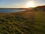
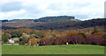
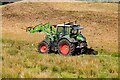
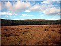
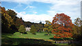
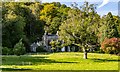
Nearby Images from Geograph Britain and Ireland:
©2010(licence)
©2023(licence)
©2010(licence)
©2010(licence)
©2023(licence)
The above images may not be of the site on this page, they are loaded from Geograph.
Please Submit an Image of this site or go out and take one for us!
Click here to see more info for this site
Nearby sites
Key: Red: member's photo, Blue: 3rd party photo, Yellow: other image, Green: no photo - please go there and take one, Grey: site destroyed
Download sites to:
KML (Google Earth)
GPX (GPS waypoints)
CSV (Garmin/Navman)
CSV (Excel)
To unlock full downloads you need to sign up as a Contributory Member. Otherwise downloads are limited to 50 sites.
Turn off the page maps and other distractions
Nearby sites listing. In the following links * = Image available
2.2km NW 311° Bethecar Moor Round Cairn* Round Cairn (SD3142090164)
3.9km NNE 20° Stone Forest by Kimio Tsuchiya* Modern Stone Circle etc (SD34509230)
6.1km WNW 286° Blawith Fells and Tarn Riggs (near Beacon Tarn) Cairn (SD2725490383)
6.1km SSW 195° Greenodd Holy Well (Egton with Newland) Holy Well or Sacred Spring (SD3144082770)
6.4km W 272° White Borran Cairn, Woodland Fell* Ring Cairn (SD2668788943)
6.7km SSW 193° Sheriff's Well (Greenodd) Holy Well or Sacred Spring (SD3150082130)
6.7km SW 228° The Beacon (Cumbria)* Stone Circle (SD28008423)
6.8km SW 229° Lowick Ring Cairn (SD279843)
6.9km WSW 252° Heathwaite Settlement* Ancient Village or Settlement (SD265867)
7.3km WSW 245° Great Burney* Cairn (SD26458565)
7.4km WSW 244° Great Burney* Ring Cairn (SD2640185541)
7.4km W 263° Giants Grave (Woodland)* Cairn (SD257879)
7.5km W 264° Giants Grave (Cumbria)* Ring Cairn (SD256880)
8.0km W 264° Heathwaite Fell Ancient Village or Settlement (SD251880)
8.2km NW 320° Hare Crags and Tranearth Beck* Artificial Mound (SD2792395001)
8.3km NNE 27° St Helen's Well (Thorpe Hesley) Holy Well or Sacred Spring (SD370960)
8.9km NW 311° Bleaberry Haws* Stone Circle (SD26449466)
9.0km NW 314° Bleaberry Enclosure* Ancient Village or Settlement (SD267950)
9.1km NNW 331° Heathwaite How* Stone Circle (SD2876396672)
9.2km NW 324° Little Arrow* Stone Circle (SD278962)
9.3km NNW 329° Banishead Stone Circle* Stone Circle (SD2846796700)
9.5km NW 320° Torver Beck Homestead* Ancient Village or Settlement (SD271961)
9.7km WNW 291° The Hawk Settlement* Ancient Village or Settlement (SD241923)
9.7km SW 234° Kirkby Moor Ringcairn* Round Cairn (SD25148299)
9.9km SW 233° The Kirk Stone Row* Multiple Stone Rows / Avenue (SD2509182770)
View more nearby sites and additional images


 We would like to know more about this location. Please feel free to add a brief description and any relevant information in your own language.
 Wir möchten mehr über diese Stätte erfahren. Bitte zögern Sie nicht, eine kurze Beschreibung und relevante Informationen in Deutsch hinzuzufügen.
 Nous aimerions en savoir encore un peu sur les lieux. S'il vous plaît n'hesitez pas à ajouter une courte description et tous les renseignements pertinents dans votre propre langue.
 Quisieramos informarnos un poco más de las lugares. No dude en añadir una breve descripción y otros datos relevantes en su propio idioma.