


<< Our Photo Pages >> Ffynnon Angaeron - Holy Well or Sacred Spring in Wales in Monmouthshire
Submitted by Sunny100 on Saturday, 26 June 2010 Page Views: 8160
Springs and Holy WellsSite Name: Ffynnon Angaeron Alternative Name: Cold Well, Aeron's Well, Pin Well,Country: Wales
NOTE: This site is 2.525 km away from the location you searched for.
County: Monmouthshire Type: Holy Well or Sacred Spring
Nearest Town: Abergavenny Nearest Village: Goytre
Map Ref: SO298051
Latitude: 51.740189N Longitude: 3.018078W
Condition:
| 5 | Perfect |
| 4 | Almost Perfect |
| 3 | Reasonable but with some damage |
| 2 | Ruined but still recognisable as an ancient site |
| 1 | Pretty much destroyed, possibly visible as crop marks |
| 0 | No data. |
| -1 | Completely destroyed |
| 5 | Superb |
| 4 | Good |
| 3 | Ordinary |
| 2 | Not Good |
| 1 | Awful |
| 0 | No data. |
| 5 | Can be driven to, probably with disabled access |
| 4 | Short walk on a footpath |
| 3 | Requiring a bit more of a walk |
| 2 | A long walk |
| 1 | In the middle of nowhere, a nightmare to find |
| 0 | No data. |
| 5 | co-ordinates taken by GPS or official recorded co-ordinates |
| 4 | co-ordinates scaled from a detailed map |
| 3 | co-ordinates scaled from a bad map |
| 2 | co-ordinates of the nearest village |
| 1 | co-ordinates of the nearest town |
| 0 | no data |
Internal Links:
External Links:
I have visited· I would like to visit
MicheleW PAB would like to visit
")
It has been described as a Medieval wishing well. A Thomas Thomas of Cardiff visited the well in 1890. He referred to it as that and said that pins, pencil stubs and buttons were tossed in. Apparently, when making a wish one had to do so in silence for it to come true. However, the well/spring was there long before that. It probably did have some religious significance in pre-Christian times, and the Roman legions who came to this area would have been aware of it.
Today pilgrims still visit the well and a few coins are sometimes deposited in the water - in the hope of a wish coming true. The name of the well is uncertain; it could be named for someone called Aeron or Aaron - some mythical personage lost in the mists of time, probably not a local saint.
You may be viewing yesterday's version of this page. To see the most up to date information please register for a free account.
Do not use the above information on other web sites or publications without permission of the contributor.
Nearby Images from Geograph Britain and Ireland:
©2012(licence)
©2012(licence)
©2012(licence)
©2012(licence)
©2012(licence)
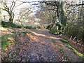
The above images may not be of the site on this page, they are loaded from Geograph.
Please Submit an Image of this site or go out and take one for us!
Click here to see more info for this site
Nearby sites
Key: Red: member's photo, Blue: 3rd party photo, Yellow: other image, Green: no photo - please go there and take one, Grey: site destroyed
Download sites to:
KML (Google Earth)
GPX (GPS waypoints)
CSV (Garmin/Navman)
CSV (Excel)
To unlock full downloads you need to sign up as a Contributory Member. Otherwise downloads are limited to 50 sites.
Turn off the page maps and other distractions
Nearby sites listing. In the following links * = Image available
2.8km NW 314° Carn-y-Garnclochdy Ring Cairn (SO27780708)
3.0km W 262° Garnteg Menhir* Standing Stone (Menhir) (SO268047)
3.1km W 262° Garnteg Barrows* Barrow Cemetery (SO267047)
3.8km NW 312° Capel Newydd* Carving (SO27020763)
3.9km NNE 22° Ffynnon Gofer (Llanover)* Holy Well or Sacred Spring (SO313087)
4.1km SSW 194° Pontypool Gorsedd Circle Modern Stone Circle etc (SO2875001181)
4.3km NNW 331° Carn-y-Big Fach Cist (SO27790885)
5.3km NW 322° Mynydd Garn Fawr* Ancient Trackway (SO2655609300)
5.6km NNW 330° Carn y Defaid (S)* Cairn (SO27040997)
5.6km NNW 330° Carn y Defaid (N)* Cairn (SO27081004)
6.0km ENE 60° Llanover Fawr Round Barrow(s) (SO351080)
6.2km E 96° Trostrey Stone Circle (SO35950435)
6.3km ESE 112° Llancayo Barrow Cemetery* Barrow Cemetery (SO356027)
6.9km ENE 75° Coed y Bwynydd Camp* Hillfort (SO36500680)
7.3km NNW 328° Blorenge West Flank - Y Blorens* Not Known (by us) (SO260113)
7.3km NNW 337° Blorenge Cairn* Round Cairn (SO270119)
7.4km NW 317° Careg Croes-Ifor Round Cairn (SO248106)
8.1km E 98° Llancayo Camp* Hillfort (SO37830383)
8.6km NW 316° Carreg Maen-Taro* Standing Stone (Menhir) (SO23831134)
8.7km WSW 248° St Illtyd's Castle Mound Artificial Mound (SO2172601919)
8.7km N 353° Llanfoist Standing Stone* Standing Stone (Menhir) (SO28781379)
8.8km N 2° Priory Well (Abergavenny)* Holy Well or Sacred Spring (SO30231387)
8.8km N 0° Abergavenny Museum* Museum (SO2995913943)
9.2km ESE 123° Twyn Bell Camp Ancient Village or Settlement (SO375000)
9.3km NW 320° Gilwern Hill* Standing Stone (Menhir) (SO2395512301)
View more nearby sites and additional images
<< Wadi Paran ancient agriculture terraces, matseboth and Rock art


 We would like to know more about this location. Please feel free to add a brief description and any relevant information in your own language.
 Wir möchten mehr über diese Stätte erfahren. Bitte zögern Sie nicht, eine kurze Beschreibung und relevante Informationen in Deutsch hinzuzufügen.
 Nous aimerions en savoir encore un peu sur les lieux. S'il vous plaît n'hesitez pas à ajouter une courte description et tous les renseignements pertinents dans votre propre langue.
 Quisieramos informarnos un poco más de las lugares. No dude en añadir una breve descripción y otros datos relevantes en su propio idioma.