


<< Text Pages >> Shapwick Hill Bowl Barrows - Barrow Cemetery in England in Devon
Submitted by SolarMegalith on Friday, 02 March 2012 Page Views: 3302
Neolithic and Bronze AgeSite Name: Shapwick Hill Bowl Barrows Alternative Name: Five BarrowsCountry: England
NOTE: This site is 1.646 km away from the location you searched for.
County: Devon Type: Barrow Cemetery
Nearest Town: Lyme Regis
Map Ref: SY303930
Latitude: 50.732416N Longitude: 2.988983W
Condition:
| 5 | Perfect |
| 4 | Almost Perfect |
| 3 | Reasonable but with some damage |
| 2 | Ruined but still recognisable as an ancient site |
| 1 | Pretty much destroyed, possibly visible as crop marks |
| 0 | No data. |
| -1 | Completely destroyed |
| 5 | Superb |
| 4 | Good |
| 3 | Ordinary |
| 2 | Not Good |
| 1 | Awful |
| 0 | No data. |
| 5 | Can be driven to, probably with disabled access |
| 4 | Short walk on a footpath |
| 3 | Requiring a bit more of a walk |
| 2 | A long walk |
| 1 | In the middle of nowhere, a nightmare to find |
| 0 | No data. |
| 5 | co-ordinates taken by GPS or official recorded co-ordinates |
| 4 | co-ordinates scaled from a detailed map |
| 3 | co-ordinates scaled from a bad map |
| 2 | co-ordinates of the nearest village |
| 1 | co-ordinates of the nearest town |
| 0 | no data |
Internal Links:
External Links:
Barrow Cemetery in Devon
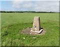
Six Bronze Age bowl barrows located on Shapwick Hill. The largest one has 21.3 m in diameter and 0.9 m height. One of the barrows in completely destroyed.
Read More at Pastscape.
You may be viewing yesterday's version of this page. To see the most up to date information please register for a free account.
Do not use the above information on other web sites or publications without permission of the contributor.
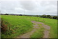
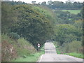
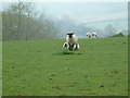
Nearby Images from Geograph Britain and Ireland:
©2017(licence)
©2020(licence)
©2010(licence)
©2006(licence)
©2017(licence)
The above images may not be of the site on this page, they are loaded from Geograph.
Please Submit an Image of this site or go out and take one for us!
Click here to see more info for this site
Nearby sites
Key: Red: member's photo, Blue: 3rd party photo, Yellow: other image, Green: no photo - please go there and take one, Grey: site destroyed
Download sites to:
KML (Google Earth)
GPX (GPS waypoints)
CSV (Garmin/Navman)
CSV (Excel)
To unlock full downloads you need to sign up as a Contributory Member. Otherwise downloads are limited to 50 sites.
Turn off the page maps and other distractions
Nearby sites listing. In the following links * = Image available
2.4km WNW 297° Musbury Castle* Hillfort (SY282941)
3.9km E 101° Leper's Well (Lyme Regis)* Holy Well or Sacred Spring (SY3411292224)
4.3km WSW 248° Hawksdown Camp Hillfort (SY26299143)
5.6km N 352° Axminster Castle* Hillfort (SY296986)
5.8km W 280° Colyton Church Cross* Ancient Cross (SY24599409)
6.9km W 260° Seaton Down Camp* Hillfort (SY23449185)
8.2km NE 56° Coney's Castle* Hillfort (SY372975)
9.2km NE 48° Lambert's Castle* Hillfort (SY372991)
9.7km E 85° St Candida's Well* Holy Well or Sacred Spring (SY3995193753)
9.7km ENE 75° St Candida & Holy Cross (Whitchurch Canonicorum)* Early Christian Sculptured Stone (SY3967895432)
10.0km NNW 347° Membury Castle Hillfort (ST282028)
10.3km E 94° Golden Cap Barrows* Barrow Cemetery (SY40569211)
11.6km W 266° Blackbury Camp* Hillfort (SY187924)
12.3km NW 321° Stockland Great Castle* Hillfort (ST22620262)
12.6km NE 52° Bettiscombe Stone Natural Stone / Erratic / Other Natural Feature (ST4036800561)
12.8km E 96° Doghouse Hill* Ancient Village or Settlement (SY430915)
12.9km NW 325° Stockland Little Castle Hillfort (ST22980362)
13.0km W 274° Broad Down* Barrow Cemetery (SY173940)
13.1km W 271° Broad Down Stone Circle (SY172933)
13.8km NE 52° Pilsdon Pen* Hillfort (ST413013)
14.4km W 279° Farway Castle Henge (SY1606395499)
15.1km W 280° Ring-in-the-Mire* Misc. Earthwork (SY1548695932)
15.7km ENE 58° Lewesdon Hillfort Hillfort (ST437012)
16.0km W 281° Farway & Gittisham Hill Cemetery* Barrow Cemetery (SY146962)
16.3km NE 52° St Dunstan's Well* Holy Well or Sacred Spring (ST433028)
View more nearby sites and additional images


 We would like to know more about this location. Please feel free to add a brief description and any relevant information in your own language.
 Wir möchten mehr über diese Stätte erfahren. Bitte zögern Sie nicht, eine kurze Beschreibung und relevante Informationen in Deutsch hinzuzufügen.
 Nous aimerions en savoir encore un peu sur les lieux. S'il vous plaît n'hesitez pas à ajouter une courte description et tous les renseignements pertinents dans votre propre langue.
 Quisieramos informarnos un poco más de las lugares. No dude en añadir una breve descripción y otros datos relevantes en su propio idioma.