 with our Megalithic Portal iPhone app")

<< Our Photo Pages >> Cerau - Hillfort in Wales in Monmouthshire
Submitted by vicky on Wednesday, 25 February 2004 Page Views: 5111
Iron Age and Later PrehistorySite Name: CerauCountry: Wales County: Monmouthshire Type: Hillfort
Nearest Town: Newport Nearest Village: Llanfrechfa Lower
Map Ref: ST330934 Landranger Map Number: 171
Latitude: 51.635400N Longitude: 2.969491W
Condition:
| 5 | Perfect |
| 4 | Almost Perfect |
| 3 | Reasonable but with some damage |
| 2 | Ruined but still recognisable as an ancient site |
| 1 | Pretty much destroyed, possibly visible as crop marks |
| 0 | No data. |
| -1 | Completely destroyed |
| 5 | Superb |
| 4 | Good |
| 3 | Ordinary |
| 2 | Not Good |
| 1 | Awful |
| 0 | No data. |
| 5 | Can be driven to, probably with disabled access |
| 4 | Short walk on a footpath |
| 3 | Requiring a bit more of a walk |
| 2 | A long walk |
| 1 | In the middle of nowhere, a nightmare to find |
| 0 | No data. |
| 5 | co-ordinates taken by GPS or official recorded co-ordinates |
| 4 | co-ordinates scaled from a detailed map |
| 3 | co-ordinates scaled from a bad map |
| 2 | co-ordinates of the nearest village |
| 1 | co-ordinates of the nearest town |
| 0 | no data |
Be the first person to rate this site - see the 'Contribute!' box in the right hand menu.
Internal Links:
External Links:
")
In March 2021 (see comment below): Who587Illustrator posted: "Cerrau is a small easy to find Hill Fort. On top of a small hill, nestled on the very edge of the progressively larger rolling hills that become the Vale of Usk to the North.
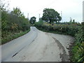
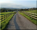
If visiting, park in or near the Ponthir House Inn car park. Walk up the lane heading North through farmland. A clear view can be had from the fork in the road, across a sloping sheep field leading up to the rounded top (detour sharp right towards the reservoir 50 metres and you can see a good side profile of the hill. Further up, just below the reservoir you can look down onto its clearly visible levelled out top).
Staying on the left fork, you draw level with the earthworks after 500 metres, the road cuts into the Eastern edge of what would have been part of the fort. At the turn off for Candwr Farm cross the stile into a (horse) field. The Northern edge is mostly overgrown with bramble and fern, but visible. After 20 metres the berm becomes prominent, another 20 metres, cross over into the next field. Here the drop and sharp rise is obvious, stretching along the whole Western edge at 2 - 3 metres high. A winter visit is best, while the hedgerow is not too thick with growth.
At the SW field corner the fence is down and the hedgerow has thinned out enough to get in amongst where people have had a peek over the years. Nothing of real immediate interest, but you get a really good feel of the fortification. At the top of the bank is another small fence circling round the perimeter.
Looking West from here the hill sweeps down into two large flat fields, sheltered by wooded hills and Candwr Brook. You can see how the fort's inhabitants would have used the land, the brook in relation to the hill top and the gentle land that stretches away. With what from a distance of 100 metres looks to be a circle of large oak trees there is a spiritual feel to the place, stillnes. Looking South there is a clear view across to Lodge Hill Fort in Caerleon, less then a mile away, a site steeped in history, grand in scale and very interesting to walk around. They were likely around at the same time. Perhaps this small fortification served Lodge hill in some way.
To the West the prominent and well known Twmbarlwm looks over the M4 corridor, in equal distance to the East is Caer Licyn (age undetermined, has the appearance of an iron age fort) atop the ridge where Wentwood forest begins. Between that and Cerau are the remains of Cae Camp. A network of hilltop sites, varying in size and dotted around the landscape.
Go for a drive or hilly cycle and you get a real sense of the layout of these interlinking sites placed atop the fertile green hills of the Usk Vale.
In August 2021, Who587Illustrator adds: " Update ... according to the lady who lives in the house below the hill Cerau sits on this site is a Roman burial ground, not a hillfort, as is marked on O/S mapping."
With thanks to vicky, who was the original author of this site page in 2004.
You may be viewing yesterday's version of this page. To see the most up to date information please register for a free account.
Do not use the above information on other web sites or publications without permission of the contributor.
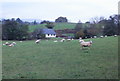
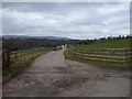
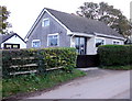
Nearby Images from Geograph Britain and Ireland:
©2010(licence)
©2010(licence)
©2010(licence)
©2010(licence)
©2013(licence)
The above images may not be of the site on this page, they are loaded from Geograph.
Please Submit an Image of this site or go out and take one for us!
Click here to see more info for this site
Nearby sites
Key: Red: member's photo, Blue: 3rd party photo, Yellow: other image, Green: no photo - please go there and take one, Grey: site destroyed
Download sites to:
KML (Google Earth)
GPX (GPS waypoints)
CSV (Garmin/Navman)
CSV (Excel)
To unlock full downloads you need to sign up as a Contributory Member. Otherwise downloads are limited to 50 sites.
Turn off the page maps and other distractions
Nearby sites listing. In the following links * = Image available
1.4km SW 230° Malthouse Lane Motte* Artificial Mound (ST31899249)
2.2km SSW 198° Lodge Wood* Hillfort (ST323913)
2.9km ENE 61° Llwyn-celyn Defended Enclosure Hillfort (ST3556294790)
2.9km E 79° Cae Camp Hillfort* Hillfort (ST359939)
3.1km SSE 160° Caerleon Roman Fortress and Baths* Ancient Village or Settlement (ST34039050)
3.2km E 95° Glen Usk Hillfort Hillfort (ST362931)
3.6km ENE 76° Cae Camp standing stone* Modern Stone Circle etc (ST36489422)
3.6km NE 55° Cefn-Carnau* Stone Circle (ST360954)
3.6km E 80° Cefn-Henllan Stone Circle* Modern Stone Circle etc (ST36589400)
4.3km SSE 166° St Julian's Wood Hillfort (ST340892)
4.8km S 179° Maindy Hill Camp Misc. Earthwork (ST3304588604)
4.8km S 179° Maindee Camp Ancient Village or Settlement (ST3304588604)
5.1km ESE 111° Coed y Caerau* Ancient Village or Settlement (ST378915)
5.3km WNW 285° Green Meadow Woods Holy Well or Sacred Spring (ST27859489)
5.5km NE 53° St Cybi's Well (Llangybi)* Holy Well or Sacred Spring (ST3744796662)
5.5km ESE 103° Kemeys Graig Earthworks Misc. Earthwork (ST384921)
5.6km E 80° Bwllfa Cottages Henge Henge (ST38509431)
5.8km SSW 197° Newport Museum and Art Gallery* Museum (ST31278791)
5.8km ENE 59° Llangybi Bottom Stone* Standing Stone (Menhir) (ST38049638)
6.0km SE 128° Lang Stone (Newport)* Standing Stone (Menhir) (ST37698961)
6.1km ESE 117° Tre-Garn Round Cairn (ST384906)
6.7km SE 129° Langstone (Bishton)* Round Barrow(s) (ST382891)
7.7km SSW 210° Tredegar Hillfort* Hillfort (ST290868)
7.8km WSW 248° Risca Round Cairn (ST257906)
7.8km WSW 252° Rogerstone 1 Round Barrow(s) (ST255911)
View more nearby sites and additional images


 We would like to know more about this location. Please feel free to add a brief description and any relevant information in your own language.
 Wir möchten mehr über diese Stätte erfahren. Bitte zögern Sie nicht, eine kurze Beschreibung und relevante Informationen in Deutsch hinzuzufügen.
 Nous aimerions en savoir encore un peu sur les lieux. S'il vous plaît n'hesitez pas à ajouter une courte description et tous les renseignements pertinents dans votre propre langue.
 Quisieramos informarnos un poco más de las lugares. No dude en añadir una breve descripción y otros datos relevantes en su propio idioma.