 with our Megalithic Portal iPhone app")


<< Text Pages >> Gairsay - Cairn in Scotland in Orkney
Submitted by AKFisher on Friday, 12 April 2024 Page Views: 7
Neolithic and Bronze AgeSite Name: Gairsay Alternative Name: Skelbust, Sweyn's Watch TowerCountry: Scotland
NOTE: This site is 0.313 km away from the location you searched for.
County: Orkney Type: Cairn
Map Ref: HY44942237
Latitude: 59.084675N Longitude: 2.962454W
Condition:
| 5 | Perfect |
| 4 | Almost Perfect |
| 3 | Reasonable but with some damage |
| 2 | Ruined but still recognisable as an ancient site |
| 1 | Pretty much destroyed, possibly visible as crop marks |
| 0 | No data. |
| -1 | Completely destroyed |
| 5 | Superb |
| 4 | Good |
| 3 | Ordinary |
| 2 | Not Good |
| 1 | Awful |
| 0 | No data. |
| 5 | Can be driven to, probably with disabled access |
| 4 | Short walk on a footpath |
| 3 | Requiring a bit more of a walk |
| 2 | A long walk |
| 1 | In the middle of nowhere, a nightmare to find |
| 0 | No data. |
| 5 | co-ordinates taken by GPS or official recorded co-ordinates |
| 4 | co-ordinates scaled from a detailed map |
| 3 | co-ordinates scaled from a bad map |
| 2 | co-ordinates of the nearest village |
| 1 | co-ordinates of the nearest town |
| 0 | no data |
Internal Links:
External Links:
Cairn in Orkney
Chambered mound/cairn site; 40' in diameter, 4' in height; unrecorded excavation exposed an oblong chamber 6'7" long. Slabs or lintels have long been removed. First recorded RCAHMS 1946.
Information links:
1. canmore.org.uk/site/2681/gairsay
2. archaeologyorkney.com/tombs-of-the-isles/gairsay/skelbust-gairsay/
You may be viewing yesterday's version of this page. To see the most up to date information please register for a free account.
Do not use the above information on other web sites or publications without permission of the contributor.
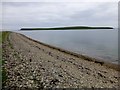
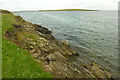
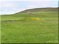
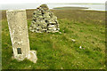
Nearby Images from Geograph Britain and Ireland:
©2014(licence)
©2008(licence)
©2011(licence)
©2008(licence)
©2007(licence)
The above images may not be of the site on this page, they are loaded from Geograph.
Please Submit an Image of this site or go out and take one for us!
Click here to see more info for this site
Nearby sites
Key: Red: member's photo, Blue: 3rd party photo, Yellow: other image, Green: no photo - please go there and take one, Grey: site destroyed
Download sites to:
KML (Google Earth)
GPX (GPS waypoints)
CSV (Garmin/Navman)
CSV (Excel)
To unlock full downloads you need to sign up as a Contributory Member. Otherwise downloads are limited to 50 sites.
Turn off the page maps and other distractions
Nearby sites listing. In the following links * = Image available
2.7km SW 231° Holm of Rendall* Cairn (HY4283220735)
3.4km SW 224° Knowe of Dishero* Broch or Nuraghe (HY42561998)
3.8km N 353° Braes of Ha’Breck, Wyre. Ancient Village or Settlement (HY445262)
4.8km W 274° Tingwall Broch* Broch or Nuraghe (HY401228)
5.3km WNW 283° Knowe of Midgarth* Ancient Village or Settlement (HY39812361)
5.5km WNW 296° Ness of Woodwick* Broch or Nuraghe (HY40072487)
5.7km N 349° Cubbie Roo's Burden* Chambered Cairn (HY43932800)
5.7km NNW 335° Taversoe Tuick* Chambered Cairn (HY42572761)
5.8km WSW 239° Sandyhall* Barrow Cemetery (HY399194)
5.9km WSW 253° Seven Knowes* Barrow Cemetery (HY39282072)
6.0km NNE 24° Onziebist* Chambered Cairn (HY4741827807)
6.0km NW 323° Knowe of Hunclett* Broch or Nuraghe (HY41442722)
6.2km SW 233° St Mary's Kirk, Isbister* Broch or Nuraghe (HY39971872)
6.3km NW 325° Blackhammer* Chambered Tomb (HY41422761)
6.4km SSE 163° Twi Ness* Cairn (HY46761625)
6.5km ESE 119° Odin Stone* Standing Stone (Menhir) (HY506191)
6.6km SSE 158° Setter Noost* Ancient Village or Settlement (HY47301621)
6.8km NW 318° Langstane (Orkney)* Standing Stone (Menhir) (HY404275)
7.0km NW 315° Knowe of Burrian (Frotoft)* Broch or Nuraghe (HY40062745)
7.1km NNW 339° Tammaskirk* Ancient Village or Settlement (HY42502907)
7.1km NW 321° Knowe of Yarso* Chambered Cairn (HY40482795)
7.3km SW 233° Oyce of Isbister* Round Barrow(s) (HY39021802)
7.3km WNW 289° Redland South* Chambered Cairn (HY38002484)
7.4km NW 318° Knowe of Ramsay* Chambered Cairn (HY40042800)
7.5km NW 317° Knowe of Lairo* Chambered Cairn (HY39922796)
View more nearby sites and additional images


 We would like to know more about this location. Please feel free to add a brief description and any relevant information in your own language.
 Wir möchten mehr über diese Stätte erfahren. Bitte zögern Sie nicht, eine kurze Beschreibung und relevante Informationen in Deutsch hinzuzufügen.
 Nous aimerions en savoir encore un peu sur les lieux. S'il vous plaît n'hesitez pas à ajouter une courte description et tous les renseignements pertinents dans votre propre langue.
 Quisieramos informarnos un poco más de las lugares. No dude en añadir una breve descripción y otros datos relevantes en su propio idioma.