


<< Text Pages >> Berrier Hill Earthworks - Misc. Earthwork in England in Cumbria
Submitted by Andy B on Wednesday, 09 January 2008 Page Views: 7189
Multi-periodSite Name: Berrier Hill EarthworksCountry: England County: Cumbria Type: Misc. Earthwork
Map Ref: NY416313
Latitude: 54.673366N Longitude: 2.907111W
Condition:
| 5 | Perfect |
| 4 | Almost Perfect |
| 3 | Reasonable but with some damage |
| 2 | Ruined but still recognisable as an ancient site |
| 1 | Pretty much destroyed, possibly visible as crop marks |
| 0 | No data. |
| -1 | Completely destroyed |
| 5 | Superb |
| 4 | Good |
| 3 | Ordinary |
| 2 | Not Good |
| 1 | Awful |
| 0 | No data. |
| 5 | Can be driven to, probably with disabled access |
| 4 | Short walk on a footpath |
| 3 | Requiring a bit more of a walk |
| 2 | A long walk |
| 1 | In the middle of nowhere, a nightmare to find |
| 0 | No data. |
| 5 | co-ordinates taken by GPS or official recorded co-ordinates |
| 4 | co-ordinates scaled from a detailed map |
| 3 | co-ordinates scaled from a bad map |
| 2 | co-ordinates of the nearest village |
| 1 | co-ordinates of the nearest town |
| 0 | no data |
Internal Links:
External Links:
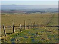
Misc. Earthwork in Cumbria. The area is of high archaeological significance, there are earthwork remains surviving at three locations in the area that are likely to relate to prehistoric or Romano-British settlement. The site also has the potential to contain important archaeological features that are currently unknown with a previously unidentified Bronze Age cremation burial revealed nearby in 1990.
The prehistoric/Romano-British earthwork remains are of particular significance. Their origins are poorly understood and the Environmental Statement indicates that the full extent of these features within the application area has not been defined.
Source: Letter from Jeremy Parsons, Assistant Archaeologist, Cumbria CC
Note: Controversial windfarm plans could be shelved due to the area's archaeology, see comment
You may be viewing yesterday's version of this page. To see the most up to date information please register for a free account.
Do not use the above information on other web sites or publications without permission of the contributor.
Nearby Images from Geograph Britain and Ireland:
©2006(licence)
©2006(licence)
©2013(licence)
©2013(licence)
©2007(licence)
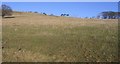
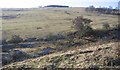
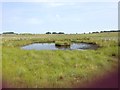
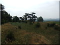
The above images may not be of the site on this page, they are loaded from Geograph.
Please Submit an Image of this site or go out and take one for us!
Click here to see more info for this site
Nearby sites
Key: Red: member's photo, Blue: 3rd party photo, Yellow: other image, Green: no photo - please go there and take one, Grey: site destroyed
Download sites to:
KML (Google Earth)
GPX (GPS waypoints)
CSV (Garmin/Navman)
CSV (Excel)
To unlock full downloads you need to sign up as a Contributory Member. Otherwise downloads are limited to 50 sites.
Turn off the page maps and other distractions
Nearby sites listing. In the following links * = Image available
2.4km E 99° Greystoke Village Cross* Ancient Cross (NY4401230870)
2.6km ESE 107° Eye Keld Well* Holy Well or Sacred Spring (NY441305)
2.8km E 100° Sanctuary Stone (Greystoke)* Early Christian Sculptured Stone (NY4433530785)
3.1km S 174° Penruddock Stone Circle (NY419282)
3.1km S 174° Motherby Stone Circle (NY419282)
3.4km SSE 156° Motherby (Cumbria)* Holy Well or Sacred Spring (NY4293428212)
5.0km E 96° Kells Well (Newbeggin)* Holy Well or Sacred Spring (NY4654330728)
5.8km ESE 114° Newbeggin Stone Row (Stone 5)* Standing Stone (Menhir) (NY4684928893)
5.8km ESE 109° Newbeggin Stone Row (Stone 3)* Standing Stone (Menhir) (NY4703929314)
5.8km ESE 113° Newbeggin Stone Row (Stone 4)* Standing Stone (Menhir) (NY4692428953)
5.8km ESE 110° Newbeggin Stone Row (Stone 2)* Standing Stone (Menhir) (NY4705629248)
5.9km ESE 109° Newbeggin Stone Row* Stone Row / Alignment (NY47122929)
5.9km ESE 109° Newbeggin Stone Row (Stone 1)* Standing Stone (Menhir) (NY4712629292)
5.9km E 87° Newton Reigny Stone Row / Alignment (NY475315)
6.0km ESE 112° Newbeggin Wells* Holy Well or Sacred Spring (NY47122902)
6.0km ESE 112° Newbeggin Stone Row (Blue Stone)* Natural Stone / Erratic / Other Natural Feature (NY4713029010)
6.2km SSW 197° Great Mell Fell Tumulus* Round Cairn (NY3967825366)
6.4km SE 136° Dacre Church* Ancient Cross (NY46002664)
6.5km E 87° Newton Reigny Enclosure* Misc. Earthwork (NY4814031590)
6.7km E 95° Mossthorn Long Cairn 1* Cairn (NY4825830606)
6.7km ESE 105° Newbeggin Stone Row (Possible)* Standing Stone (Menhir) (NY4805829531)
6.7km WNW 290° Mungrisedale* Cairn (NY353337)
6.7km E 97° Mossthorn Long Cairn 2* Cairn (NY4828930440)
7.3km E 100° Sewborrans Stone* Standing Stone (Menhir) (NY48842999)
7.7km WNW 287° Carrock Fell* Hillfort (NY342336)
View more nearby sites and additional images
Group of Ethiopian Scientists Discover Ancient Antiquities >>


 We would like to know more about this location. Please feel free to add a brief description and any relevant information in your own language.
 Wir möchten mehr über diese Stätte erfahren. Bitte zögern Sie nicht, eine kurze Beschreibung und relevante Informationen in Deutsch hinzuzufügen.
 Nous aimerions en savoir encore un peu sur les lieux. S'il vous plaît n'hesitez pas à ajouter une courte description et tous les renseignements pertinents dans votre propre langue.
 Quisieramos informarnos un poco más de las lugares. No dude en añadir una breve descripción y otros datos relevantes en su propio idioma.