


<< Text Pages >> Lochmaloney Farmm (Kilmany) - Rock Art in Scotland in Fife
Submitted by Anne T on Friday, 01 December 2017 Page Views: 1004
Rock ArtSite Name: Lochmaloney Farmm (Kilmany) Alternative Name: LochmaloneyCountry: Scotland County: Fife Type: Rock Art
Nearest Town: Leuchars Nearest Village: Kilmany
Map Ref: NO37902049
Latitude: 56.372615N Longitude: 3.006988W
Condition:
| 5 | Perfect |
| 4 | Almost Perfect |
| 3 | Reasonable but with some damage |
| 2 | Ruined but still recognisable as an ancient site |
| 1 | Pretty much destroyed, possibly visible as crop marks |
| 0 | No data. |
| -1 | Completely destroyed |
| 5 | Superb |
| 4 | Good |
| 3 | Ordinary |
| 2 | Not Good |
| 1 | Awful |
| 0 | No data. |
| 5 | Can be driven to, probably with disabled access |
| 4 | Short walk on a footpath |
| 3 | Requiring a bit more of a walk |
| 2 | A long walk |
| 1 | In the middle of nowhere, a nightmare to find |
| 0 | No data. |
| 5 | co-ordinates taken by GPS or official recorded co-ordinates |
| 4 | co-ordinates scaled from a detailed map |
| 3 | co-ordinates scaled from a bad map |
| 2 | co-ordinates of the nearest village |
| 1 | co-ordinates of the nearest town |
| 0 | no data |
Internal Links:
External Links:
Rock Art in Fife
Canmore ID 31752 tells us that this stone was "blown up in 1965, leaving no trace"! Previous entries told us: "A cup-marked boulder is located in a heavy growth of whin bushes in a covert c. 3/4 mile (1.8 km) NE of Lochmalony House. It is somewhat hog-backed, measuring 8'9" (2.1m) by 6' (1.83m) and 3' (0.9m) high, bearing 28 cup-marks between 1 1/2 and 3" in diameter, two of the cup-marks having single rings round them. Visited 1925." By 1956: "This erratic boulder is as described except that weathering has obliterated the rings around the cups. The covert in which it was formerly situated has been removed."
The Northern Antiquarian (TNA) also features a page for this cup and ring stone - see their page for Lochmaloney, Kilmany, Fife, which also includes a drawing of this now long-gone carving.
Note: Do you have any historical information, drawings or images you can add, please?
You may be viewing yesterday's version of this page. To see the most up to date information please register for a free account.
Do not use the above information on other web sites or publications without permission of the contributor.
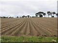
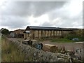
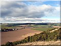
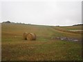
Nearby Images from Geograph Britain and Ireland:
©2018(licence)
©2013(licence)
©2008(licence)
©2013(licence)
©2013(licence)
The above images may not be of the site on this page, they are loaded from Geograph.
Please Submit an Image of this site or go out and take one for us!
Click here to see more info for this site
Nearby sites
Key: Red: member's photo, Blue: 3rd party photo, Yellow: other image, Green: no photo - please go there and take one, Grey: site destroyed
Download sites to:
KML (Google Earth)
GPX (GPS waypoints)
CSV (Garmin/Navman)
CSV (Excel)
To unlock full downloads you need to sign up as a Contributory Member. Otherwise downloads are limited to 50 sites.
Turn off the page maps and other distractions
Nearby sites listing. In the following links * = Image available
2.8km NE 40° Kilmany Cursus Cursus (NO39742263)
4.7km NNW 333° Monk's Well (Balmerino)* Holy Well or Sacred Spring (NO358247)
6.0km W 274° Creich Manse* Class I Pictish Symbol Stone (NO319210)
7.4km E 81° St Bunyan's Well (Leuchars) Holy Well or Sacred Spring (NO4525221483)
7.7km E 81° Lady's Well (Leuchars) Holy Well or Sacred Spring (NO4557321645)
9.3km SSE 166° Spout Well* Holy Well or Sacred Spring (NO400114)
9.7km SSW 199° Walton Symbol Stone Class I Pictish Symbol Stone (NO34651135)
10.0km NNW 341° St Peter's Church (Invergowrie)* Early Christian Sculptured Stone (NO348300)
10.2km NNE 12° McManus Galleries* Museum (NO40253047)
10.6km NNW 334° Mylnefield Stone Circle (NO334301)
10.6km N 350° Dark Stane Roundie* Round Barrow(s) (NO362310)
10.8km SE 132° Drumcarrow Craig* Broch or Nuraghe (NO459132)
11.0km NNW 342° Devil's Stone (Perth & Kinross)* Standing Stone (Menhir) (NO3458131019)
11.1km NNW 339° Longforgan Cursus Cursus (NO34123090)
11.1km NNW 340° Longforgan Cursus Cursus (NO34163094)
11.2km SW 229° Collessie* Standing Stone (Menhir) (NO293132)
11.3km SW 229° Newton of Collessie Class I Pictish Symbol Stone (NO292132)
11.4km NNW 346° Balgarthno* Stone Circle (NO35333161)
12.6km WSW 250° Lindores* Class I Pictish Symbol Stone (NO25951634)
12.6km NNW 348° Camperdown Standing Stone* Standing Stone (Menhir) (NO3549632905)
12.9km ESE 110° St. Andrews Museum* Museum (NO5016)
12.9km NW 324° Longforgan Cursus Cursus (NO30353100)
13.1km NW 313° Moncur Castle* Standing Stone (Menhir) (NO2836929520)
13.2km NNW 338° Hurly Hawkins* Broch or Nuraghe (NO332328)
13.2km ESE 106° The Blue Stane (St Andrews)* Standing Stone (Menhir) (NO5055216707)
View more nearby sites and additional images


 We would like to know more about this location. Please feel free to add a brief description and any relevant information in your own language.
 Wir möchten mehr über diese Stätte erfahren. Bitte zögern Sie nicht, eine kurze Beschreibung und relevante Informationen in Deutsch hinzuzufügen.
 Nous aimerions en savoir encore un peu sur les lieux. S'il vous plaît n'hesitez pas à ajouter une courte description et tous les renseignements pertinents dans votre propre langue.
 Quisieramos informarnos un poco más de las lugares. No dude en añadir una breve descripción y otros datos relevantes en su propio idioma.