


<< Our Photo Pages >> Holy Well (Humphrey Head) - Holy Well or Sacred Spring in England in Cumbria
Submitted by Anne T on Wednesday, 15 November 2017 Page Views: 3679
Springs and Holy WellsSite Name: Holy Well (Humphrey Head)Country: England County: Cumbria Type: Holy Well or Sacred Spring
Nearest Town: Grange-over-Sands Nearest Village: Allithwaite
Map Ref: SD39017391
Latitude: 54.157363N Longitude: 2.935449W
Condition:
| 5 | Perfect |
| 4 | Almost Perfect |
| 3 | Reasonable but with some damage |
| 2 | Ruined but still recognisable as an ancient site |
| 1 | Pretty much destroyed, possibly visible as crop marks |
| 0 | No data. |
| -1 | Completely destroyed |
| 5 | Superb |
| 4 | Good |
| 3 | Ordinary |
| 2 | Not Good |
| 1 | Awful |
| 0 | No data. |
| 5 | Can be driven to, probably with disabled access |
| 4 | Short walk on a footpath |
| 3 | Requiring a bit more of a walk |
| 2 | A long walk |
| 1 | In the middle of nowhere, a nightmare to find |
| 0 | No data. |
| 5 | co-ordinates taken by GPS or official recorded co-ordinates |
| 4 | co-ordinates scaled from a detailed map |
| 3 | co-ordinates scaled from a bad map |
| 2 | co-ordinates of the nearest village |
| 1 | co-ordinates of the nearest town |
| 0 | no data |
Be the first person to rate this site - see the 'Contribute!' box in the right hand menu.
Internal Links:
External Links:
 (PID:257971)")
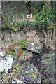
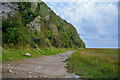
This medicinal spring, sited near a natural rock arch, is recorded as Pastscape Monument No. 39689, which tells us: "Holy Well Humphrey Head - This medieval well is situated three and a half miles due south from Cartmel, at Humphrey Head. The water which flows from the hillside into an artificial basin or grotto, is said to have been used by lead miners from the time of the Romans. On a map of 1828 the well is called 'Spa Holy Well'. The Holy Well was 'celebrated as a remedy for stone, gout and cutaneous diseases'. The water is now enclosed by an ugly iron hut, piped into a concrete basin, and to taste the water one must scoop up that which trickles into a hollow in the sand. Reference to the well occur in SARAH FELL'S Account Book for 1674. Of the building which formerly enclosed the well only a fragment of walling, containing a recess, remains. Nearby is a broken cistern of modern earthenware. The spring is still visible as a trickle of water from the face of the cliff."
The Northern Antiquarian (TNA) also features a page for this well - see their entry for Holy Well, Humphrey Head, Allithwaite, Cumbria, which gives directions for finding this site, together with a 1906 photograph, and a detailed archaeology & history quoting from a number of references.
Note: Have you visited this site? Do you have any photographs or information to add?
You may be viewing yesterday's version of this page. To see the most up to date information please register for a free account.
Do not use the above information on other web sites or publications without permission of the contributor.
Nearby Images from Geograph Britain and Ireland:
©2013(licence)
©2023(licence)
©2020(licence)
©2023(licence)
©2016(licence)
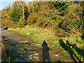
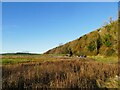
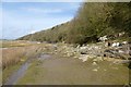
The above images may not be of the site on this page, they are loaded from Geograph.
Please Submit an Image of this site or go out and take one for us!
Click here to see more info for this site
Nearby sites
Key: Red: member's photo, Blue: 3rd party photo, Yellow: other image, Green: no photo - please go there and take one, Grey: site destroyed
Download sites to:
KML (Google Earth)
GPX (GPS waypoints)
CSV (Garmin/Navman)
CSV (Excel)
To unlock full downloads you need to sign up as a Contributory Member. Otherwise downloads are limited to 50 sites.
Turn off the page maps and other distractions
Nearby sites listing. In the following links * = Image available
490m SSE 163° Fairy Stone (Humphrey Head)* Natural Stone / Erratic / Other Natural Feature (SD39157344)
1.9km N 2° Kirkhead Cave Cave or Rock Shelter (SD391758)
4.6km NW 317° Holker Labyrinth and Standing Stones Modern Stone Circle etc (SD3590677373)
6.6km NNE 27° Castle-Head (Lindale) Promontory Fort / Cliff Castle (SD421797)
6.9km NE 53° Grubbins Wood Stone Natural Stone / Erratic / Other Natural Feature (SD446780)
7.0km E 89° Woodwell* Holy Well or Sacred Spring (SD4674)
8.9km E 95° Ings Point Natural Stone / Erratic / Other Natural Feature (SD479730)
8.9km ENE 71° Bowk Stone Natural Stone / Erratic / Other Natural Feature (SD475767)
9.2km E 96° Badger Hole (Lancashire)* Cave or Rock Shelter (SD48187285)
9.3km ENE 70° Haweswater Stones* Misc. Earthwork (SD478770)
9.3km E 95° Dog Holes* Cave or Rock Shelter (SD48337303)
9.4km ENE 71° Haweswater Cairns and Propped Stone Cairn (SD479769)
9.4km ENE 61° Hazelslack Stone* Standing Stone (Menhir) (SD473783)
9.4km ESE 102° Cote Stones Cairn (SD482719)
9.8km W 270° Druids Temple (Cumbria)* Stone Circle (SD29237396)
10.1km W 271° Birkrigg Common Round Cairn 2 Round Cairn (SD289743)
10.1km SSE 151° Fartle Barrow* Cairn (SD4380364966)
10.2km W 273° Birkrigg Common Settlement* Ancient Village or Settlement (SD28837453)
10.2km W 273° Birkrigg Common Enclosures and Appleby Hill and Stone Circle Ancient Village or Settlement (SD288745)
10.2km W 273° Birkrigg Common Round Cairn 3 Round Cairn (SD288746)
10.2km E 96° Warton Crag* Hillfort (SD492727)
10.4km W 271° Birkrigg Common Cemetery* Barrow Cemetery (SD28627421)
10.5km E 91° The Three brothers* Natural Stone / Erratic / Other Natural Feature (SD495735)
10.5km W 272° Birkrigg Common Round Cairn 1 Round Cairn (SD285744)
10.5km ESE 107° Hunting Hill* Round Barrow(s) (SD49037065)
View more nearby sites and additional images


 We would like to know more about this location. Please feel free to add a brief description and any relevant information in your own language.
 Wir möchten mehr über diese Stätte erfahren. Bitte zögern Sie nicht, eine kurze Beschreibung und relevante Informationen in Deutsch hinzuzufügen.
 Nous aimerions en savoir encore un peu sur les lieux. S'il vous plaît n'hesitez pas à ajouter une courte description et tous les renseignements pertinents dans votre propre langue.
 Quisieramos informarnos un poco más de las lugares. No dude en añadir una breve descripción y otros datos relevantes en su propio idioma.