


<< Text Pages >> Goldcliff Earthwork - Misc. Earthwork in Wales in Monmouthshire
Submitted by coldrum on Friday, 13 July 2007 Page Views: 3795
Multi-periodSite Name: Goldcliff EarthworkCountry: Wales
NOTE: This site is 1.165 km away from the location you searched for.
County: Monmouthshire Type: Misc. Earthwork
Nearest Village: Goldcliff
Map Ref: ST361835
Latitude: 51.546758N Longitude: 2.922899W
Condition:
| 5 | Perfect |
| 4 | Almost Perfect |
| 3 | Reasonable but with some damage |
| 2 | Ruined but still recognisable as an ancient site |
| 1 | Pretty much destroyed, possibly visible as crop marks |
| 0 | No data. |
| -1 | Completely destroyed |
| 5 | Superb |
| 4 | Good |
| 3 | Ordinary |
| 2 | Not Good |
| 1 | Awful |
| 0 | No data. |
| 5 | Can be driven to, probably with disabled access |
| 4 | Short walk on a footpath |
| 3 | Requiring a bit more of a walk |
| 2 | A long walk |
| 1 | In the middle of nowhere, a nightmare to find |
| 0 | No data. |
| 5 | co-ordinates taken by GPS or official recorded co-ordinates |
| 4 | co-ordinates scaled from a detailed map |
| 3 | co-ordinates scaled from a bad map |
| 2 | co-ordinates of the nearest village |
| 1 | co-ordinates of the nearest town |
| 0 | no data |
Be the first person to rate this site - see the 'Contribute!' box in the right hand menu.
Internal Links:
External Links:
Misc. Earthwork in Monmouthshire (Sir Fynwy)
Earthwork.
You may be viewing yesterday's version of this page. To see the most up to date information please register for a free account.
Do not use the above information on other web sites or publications without permission of the contributor.
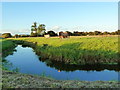
Nearby Images from Geograph Britain and Ireland:
©2007(licence)
©2010(licence)
©2010(licence)
©2010(licence)
©2010(licence)
The above images may not be of the site on this page, they are loaded from Geograph.
Please Submit an Image of this site or go out and take one for us!
Click here to see more info for this site
Nearby sites
Key: Red: member's photo, Blue: 3rd party photo, Yellow: other image, Green: no photo - please go there and take one, Grey: site destroyed
Download sites to:
KML (Google Earth)
GPX (GPS waypoints)
CSV (Garmin/Navman)
CSV (Excel)
To unlock full downloads you need to sign up as a Contributory Member. Otherwise downloads are limited to 50 sites.
Turn off the page maps and other distractions
Nearby sites listing. In the following links * = Image available
2.2km SE 131° Goldcliff East Mesolithic Site* Ancient Trackway (ST3771582063)
3.4km WSW 254° Mesolithic Human Footprints at Uskmouth* Natural Stone / Erratic / Other Natural Feature (ST32808260)
5.9km NNW 328° Maindee Camp Ancient Village or Settlement (ST3304588604)
5.9km NNW 328° Maindy Hill Camp Misc. Earthwork (ST3304588604)
6.0km NNE 20° Langstone (Bishton)* Round Barrow(s) (ST382891)
6.1km NNW 339° St Julian's Wood Hillfort (ST340892)
6.3km NNE 14° Lang Stone (Newport)* Standing Stone (Menhir) (ST37698961)
6.5km NE 49° Wilcrick Hill Fort* Hillfort (ST411877)
6.5km NW 312° Newport Museum and Art Gallery* Museum (ST31278791)
6.7km NE 46° Wilcrick Wishing Well* Holy Well or Sacred Spring (ST4097088044)
7.0km E 84° Caldicot Level Ancient Trackway (ST431841)
7.3km NNW 343° Caerleon Roman Fortress and Baths* Ancient Village or Settlement (ST34039050)
7.5km NNE 17° Tre-Garn Round Cairn (ST384906)
7.8km WNW 294° Tredegar Hillfort* Hillfort (ST290868)
8.2km N 11° Coed y Caerau* Ancient Village or Settlement (ST378915)
8.6km W 280° Gwern y Cleppa* Chambered Tomb (ST27648505)
8.6km E 79° Upton Ancient Trackway Ancient Trackway (ST446850)
8.7km NNW 333° Lodge Wood* Hillfort (ST323913)
8.7km ENE 79° Chapel Tump Ancient Village or Settlement (ST447851)
8.8km ENE 64° Undy Earthwork Misc. Earthwork (ST441873)
8.9km NNE 14° Kemeys Graig Earthworks Misc. Earthwork (ST384921)
9.2km WNW 286° Coed Ffynnon-Oer Hillfort (ST273861)
9.4km ENE 62° Llanfihangel Rogiet* Standing Stone (Menhir) (ST44518775)
9.6km N 360° Glen Usk Hillfort Hillfort (ST362931)
9.7km NE 45° Carrow Hill Round Barrow Pair Round Barrow(s) (ST42999029)
View more nearby sites and additional images


 We would like to know more about this location. Please feel free to add a brief description and any relevant information in your own language.
 Wir möchten mehr über diese Stätte erfahren. Bitte zögern Sie nicht, eine kurze Beschreibung und relevante Informationen in Deutsch hinzuzufügen.
 Nous aimerions en savoir encore un peu sur les lieux. S'il vous plaît n'hesitez pas à ajouter une courte description et tous les renseignements pertinents dans votre propre langue.
 Quisieramos informarnos un poco más de las lugares. No dude en añadir una breve descripción y otros datos relevantes en su propio idioma.