


<< Our Photo Pages >> St Noyale Well - Holy Well or Sacred Spring in France in Bretagne:Morbihan (56)
Submitted by JohnGinny on Thursday, 17 March 2011 Page Views: 3664
Springs and Holy WellsSite Name: St Noyale WellCountry: France Département: Bretagne:Morbihan (56) Type: Holy Well or Sacred Spring
Nearest Town: Pontivy Nearest Village: Sainte Noyal
Latitude: 48.082900N Longitude: 2.9011W
Condition:
| 5 | Perfect |
| 4 | Almost Perfect |
| 3 | Reasonable but with some damage |
| 2 | Ruined but still recognisable as an ancient site |
| 1 | Pretty much destroyed, possibly visible as crop marks |
| 0 | No data. |
| -1 | Completely destroyed |
| 5 | Superb |
| 4 | Good |
| 3 | Ordinary |
| 2 | Not Good |
| 1 | Awful |
| 0 | No data. |
| 5 | Can be driven to, probably with disabled access |
| 4 | Short walk on a footpath |
| 3 | Requiring a bit more of a walk |
| 2 | A long walk |
| 1 | In the middle of nowhere, a nightmare to find |
| 0 | No data. |
| 5 | co-ordinates taken by GPS or official recorded co-ordinates |
| 4 | co-ordinates scaled from a detailed map |
| 3 | co-ordinates scaled from a bad map |
| 2 | co-ordinates of the nearest village |
| 1 | co-ordinates of the nearest town |
| 0 | no data |
Internal Links:
External Links:
I have visited· I would like to visit
negus would like to visit
")
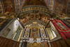
A simple, fairly rustic structure that houses a rather gruesome statue of Noyale, holding her severed head.
Well worth a visit.
You may be viewing yesterday's version of this page. To see the most up to date information please register for a free account.
")
Do not use the above information on other web sites or publications without permission of the contributor.
Nearby Images from Flickr
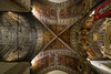
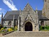
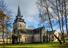


The above images may not be of the site on this page, but were taken nearby. They are loaded from Flickr so please click on them for image credits.
Click here to see more info for this site
Nearby sites
Click here to view sites on an interactive map of the areaKey: Red: member's photo, Blue: 3rd party photo, Yellow: other image, Green: no photo - please go there and take one, Grey: site destroyed
Download sites to:
KML (Google Earth)
GPX (GPS waypoints)
CSV (Garmin/Navman)
CSV (Excel)
To unlock full downloads you need to sign up as a Contributory Member. Otherwise downloads are limited to 50 sites.
Turn off the page maps and other distractions
Nearby sites listing. In the following links * = Image available
1.2km ESE 119° Les Trois Fontaine Noyal-Pontivy* Holy Well or Sacred Spring
4.9km SW 234° Menhir de la Chapelle de la Houssaie* Standing Stone (Menhir)
5.5km WSW 246° Sépulture circulaire de Pontivy* Cairn
7.1km W 271° Fontaine Ste-Meriadoc (Stival) Holy Well or Sacred Spring
9.7km SW 226° Kerhoret menhirs* Standing Stones
9.8km SW 223° Menhir de Kerhoret* Standing Stone (Menhir)
12.5km NNW 336° Menhir de Botconnaire Standing Stone (Menhir)
13.8km W 267° Saint Nizon allée couverte* Burial Chamber or Dolmen
14.2km NNW 347° Menhir de Botrain Standing Stone (Menhir)
14.4km SW 228° Kermabon Dolmen* Burial Chamber or Dolmen
14.8km NW 306° Bod er Mohet Allée Couverte* Passage Grave
14.9km NW 304° Bugul-er-Hoet* Standing Stone (Menhir)
15.1km W 265° Les Trois Menhirs de Saint-Etienne* Standing Stones
15.1km NW 307° Alignement de la Lande du Cerf Stone Row / Alignment
15.4km NW 323° Camp dit du Castel-Finans Ancient Village or Settlement
15.7km NW 306° Bugul er Hoët Menhir* Standing Stone (Menhir)
15.8km WNW 302° Menhir du Breuil-du-Chêne 3 Standing Stone (Menhir)
16.0km SW 224° Fontaine Saint-Gildas* Holy Well or Sacred Spring
16.1km WNW 298° Allée Couverte de Park-er-Bé Passage Grave
16.1km WNW 303° Menhir du Breuil-du-Chêne 1 Standing Stone (Menhir)
16.2km W 259° Menhir dit la Pierre du Diable (Guern) Standing Stone (Menhir)
16.2km WNW 303° Menhir du Breuil-du-Chêne 2 Standing Stone (Menhir)
16.4km NW 304° Menhir du Breuil-du-Chêne 4 Standing Stone (Menhir)
16.4km NW 308° Pierre de Guergadic* Standing Stone (Menhir)
16.5km SE 136° Stèle de Reguiny* Standing Stone (Menhir)
View more nearby sites and additional images


 We would like to know more about this location. Please feel free to add a brief description and any relevant information in your own language.
 Wir möchten mehr über diese Stätte erfahren. Bitte zögern Sie nicht, eine kurze Beschreibung und relevante Informationen in Deutsch hinzuzufügen.
 Nous aimerions en savoir encore un peu sur les lieux. S'il vous plaît n'hesitez pas à ajouter une courte description et tous les renseignements pertinents dans votre propre langue.
 Quisieramos informarnos un poco más de las lugares. No dude en añadir una breve descripción y otros datos relevantes en su propio idioma.