 with our Megalithic Portal iPhone app")


<< Our Photo Pages >> St John the Baptist Church, Chester - Ancient Cross in England in Cheshire
Submitted by TimPrevett on Tuesday, 11 January 2005 Page Views: 13596
Early Medieval (Dark Age)Site Name: St John the Baptist Church, ChesterCountry: England County: Cheshire Type: Ancient Cross
Nearest Town: Chester
Map Ref: SJ40916613
Latitude: 53.188962N Longitude: 2.885796W
Condition:
| 5 | Perfect |
| 4 | Almost Perfect |
| 3 | Reasonable but with some damage |
| 2 | Ruined but still recognisable as an ancient site |
| 1 | Pretty much destroyed, possibly visible as crop marks |
| 0 | No data. |
| -1 | Completely destroyed |
| 5 | Superb |
| 4 | Good |
| 3 | Ordinary |
| 2 | Not Good |
| 1 | Awful |
| 0 | No data. |
| 5 | Can be driven to, probably with disabled access |
| 4 | Short walk on a footpath |
| 3 | Requiring a bit more of a walk |
| 2 | A long walk |
| 1 | In the middle of nowhere, a nightmare to find |
| 0 | No data. |
| 5 | co-ordinates taken by GPS or official recorded co-ordinates |
| 4 | co-ordinates scaled from a detailed map |
| 3 | co-ordinates scaled from a bad map |
| 2 | co-ordinates of the nearest village |
| 1 | co-ordinates of the nearest town |
| 0 | no data |
Internal Links:
External Links:
I have visited· I would like to visit
kthdsn visited on 11th Oct 2014 - their rating: Access: 4
")
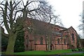
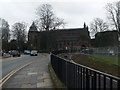
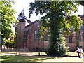
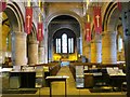
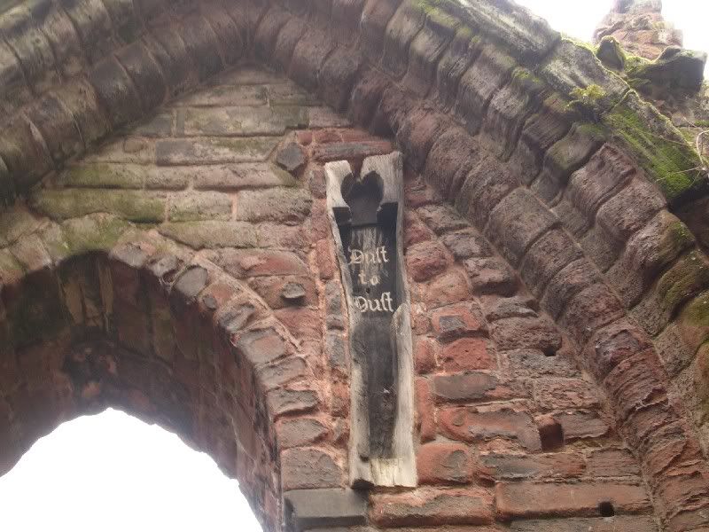
A church has stood on this location for at least 1,300 years, and therefore the place has a long history. There are ruins of different phases of the church at the west and east ends of the exterior.
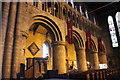
Concerning the cross heads, a printed sign says :
"These stone crosses are reputedly from the workshop established in the quarry of St Johns by Irish - Norse traders who settled in Chester during the 10th Century. Similar crosses thought to have been from the same workshop have been found over a wide area as shown on the map."
but a hand written note, very faded also says:
"Remains of Saxon crosses; these were unearthed from the eastern area of St Johns 1870 restoration. Their circular head design and squared shafts suggest Celtic origin, early Mercian AD750-900..."
I have given the ambience 5 here; it is wonderfully still and peaceful, even if the immediate decor is not impressive. Access is 4 - subject to church opening, and services / events happening.
The finding of these cross was an unexpected joy; I must have taken over 5,000 people past this church from June - December 2004, and kept telling myself I must have peep in one day. I had 50 minutes to kill before work, so made a minor detour, and the first thing that hit was the stillness of the place. Wonderful. The I noticed the cross heads - a bonus!
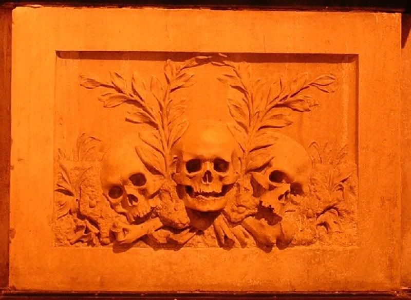
If visiting, be sure to take in the skeletal figure and skulls carved in the Lady Chapel, the mediaeval painting on a column at the front, as well as the coffin set high in the ruins at the east end outside the current building.
You may be viewing yesterday's version of this page. To see the most up to date information please register for a free account.
")
")
")
")
Do not use the above information on other web sites or publications without permission of the contributor.
Nearby Images from Geograph Britain and Ireland:
©2007(licence)
©2010(licence)
©2012(licence)
©2012(licence)
©2013(licence)
The above images may not be of the site on this page, they are loaded from Geograph.
Please Submit an Image of this site or go out and take one for us!
Click here to see more info for this site
Nearby sites
Key: Red: member's photo, Blue: 3rd party photo, Yellow: other image, Green: no photo - please go there and take one, Grey: site destroyed
Download sites to:
KML (Google Earth)
GPX (GPS waypoints)
CSV (Garmin/Navman)
CSV (Excel)
To unlock full downloads you need to sign up as a Contributory Member. Otherwise downloads are limited to 50 sites.
Turn off the page maps and other distractions
Nearby sites listing. In the following links * = Image available
85m WNW 290° Roman Amphitheatre (Chester)* Ancient Temple (SJ40836616)
143m WSW 244° Roman Garden & Hypocaust (Chester)* Ancient Village or Settlement (SJ40786607)
373m ENE 78° Billy Hobby's Well* Holy Well or Sacred Spring (SJ4127766202)
443m WNW 292° Dewa Roman Experience* Museum (SJ405663)
483m WSW 247° Grosvenor Museum* Museum (SJ40466595)
572m SSW 204° Chester Minerva shrine* Ancient Temple (SJ40676561)
2.2km S 177° Heronbridge Roman Strip Settlement Ancient Village or Settlement (SJ410639)
6.2km NE 50° St Plegmund's Well* Holy Well or Sacred Spring (SJ457701)
7.7km S 184° Poulton Timber Circle* Ancient Village or Settlement (SJ4033558472)
9.0km NNE 20° St Mary (Thornton Le Moors)* Ancient Cross (SJ44157455)
9.0km ESE 104° Brookhouse Farm Ancient Village or Settlement (SJ497639)
9.3km SSW 206° St Peter's Well (Denbighshire) Holy Well or Sacred Spring (SJ36735784)
9.3km WNW 301° Modern Stones at Deeside Industrial Area* Modern Stone Circle etc (SJ330711)
10.0km S 179° Knowl Plantation Barrow Cemetery (SJ410561)
10.3km S 178° Churton* Long Barrow (SJ411558)
12.3km E 83° Kelsborrow Castle* Hillfort (SJ5315567509)
12.5km NE 41° Helsby Hill* Hillfort (SJ493754)
12.5km SW 231° Hope Church Early Medieval Stones* Ancient Cross (SJ310584)
12.7km SSE 149° St Winefride's (Clutton)* Holy Well or Sacred Spring (SJ47395524)
12.8km SSW 209° The Atropos Altar Stone* Sculptured Stone (SJ34645497)
12.8km NW 309° Hampston's Well* Holy Well or Sacred Spring (SJ3099074309)
12.9km SW 227° Caer Estyn* Hillfort (SJ314574)
12.9km ENE 77° Delamere Stone Circle (SJ536688)
13.0km NW 304° Burton Point* Promontory Fort / Cliff Castle (SJ302736)
13.0km SW 235° Park in the Past* Museum (SJ301588)
View more nearby sites and additional images


 We would like to know more about this location. Please feel free to add a brief description and any relevant information in your own language.
 Wir möchten mehr über diese Stätte erfahren. Bitte zögern Sie nicht, eine kurze Beschreibung und relevante Informationen in Deutsch hinzuzufügen.
 Nous aimerions en savoir encore un peu sur les lieux. S'il vous plaît n'hesitez pas à ajouter une courte description et tous les renseignements pertinents dans votre propre langue.
 Quisieramos informarnos un poco más de las lugares. No dude en añadir una breve descripción y otros datos relevantes en su propio idioma.
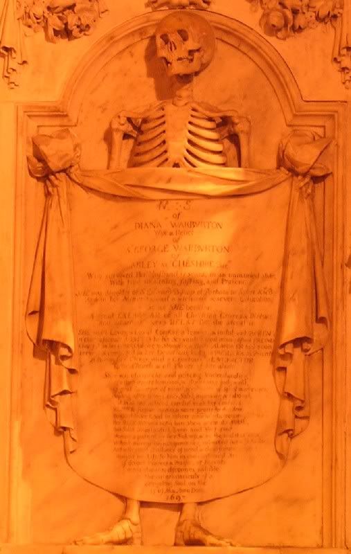