


<< Our Photo Pages >> Llangybi Bottom Stone - Standing Stone (Menhir) in Wales in Monmouthshire
Submitted by WelshRockGoddess on Monday, 09 June 2014 Page Views: 9947
Neolithic and Bronze AgeSite Name: Llangybi Bottom Stone Alternative Name: Waen-Y-'FfeiradCountry: Wales
NOTE: This site is 1.207 km away from the location you searched for.
County: Monmouthshire Type: Standing Stone (Menhir)
Nearest Town: Usk Nearest Village: Llangybi Fawr
Map Ref: ST38049638 Landranger Map Number: 171
Latitude: 51.662769N Longitude: 2.897206W
Condition:
| 5 | Perfect |
| 4 | Almost Perfect |
| 3 | Reasonable but with some damage |
| 2 | Ruined but still recognisable as an ancient site |
| 1 | Pretty much destroyed, possibly visible as crop marks |
| 0 | No data. |
| -1 | Completely destroyed |
| 5 | Superb |
| 4 | Good |
| 3 | Ordinary |
| 2 | Not Good |
| 1 | Awful |
| 0 | No data. |
| 5 | Can be driven to, probably with disabled access |
| 4 | Short walk on a footpath |
| 3 | Requiring a bit more of a walk |
| 2 | A long walk |
| 1 | In the middle of nowhere, a nightmare to find |
| 0 | No data. |
| 5 | co-ordinates taken by GPS or official recorded co-ordinates |
| 4 | co-ordinates scaled from a detailed map |
| 3 | co-ordinates scaled from a bad map |
| 2 | co-ordinates of the nearest village |
| 1 | co-ordinates of the nearest town |
| 0 | no data |
Internal Links:
External Links:
")
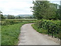
The reddish stone, although broken up, was, I felt, well worth the walk .
Note: Just in case you think we have everywhere covered, there are still thousands of ancient sites we don't yet have photos of. This beautifully coloured stone was one of them - until today.
You may be viewing yesterday's version of this page. To see the most up to date information please register for a free account.
")
")
")
Do not use the above information on other web sites or publications without permission of the contributor.
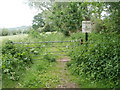
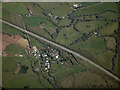
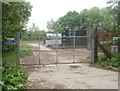
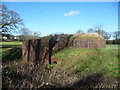
Nearby Images from Geograph Britain and Ireland:
©2011(licence)
©2023(licence)
©2011(licence)
©2012(licence)
©2011(licence)
The above images may not be of the site on this page, they are loaded from Geograph.
Please Submit an Image of this site or go out and take one for us!
Click here to see more info for this site
Nearby sites
Key: Red: member's photo, Blue: 3rd party photo, Yellow: other image, Green: no photo - please go there and take one, Grey: site destroyed
Download sites to:
KML (Google Earth)
GPX (GPS waypoints)
CSV (Garmin/Navman)
CSV (Excel)
To unlock full downloads you need to sign up as a Contributory Member. Otherwise downloads are limited to 50 sites.
Turn off the page maps and other distractions
Nearby sites listing. In the following links * = Image available
655m WNW 295° St Cybi's Well (Llangybi)* Holy Well or Sacred Spring (ST3744796662)
2.1km SSE 167° Bwllfa Cottages Henge Henge (ST38509431)
2.3km WSW 244° Cefn-Carnau* Stone Circle (ST360954)
2.7km SW 215° Cae Camp standing stone* Modern Stone Circle etc (ST36489422)
2.8km SSW 211° Cefn-Henllan Stone Circle* Modern Stone Circle etc (ST36589400)
2.9km WSW 237° Llwyn-celyn Defended Enclosure Hillfort (ST3556294790)
3.3km SW 220° Cae Camp Hillfort* Hillfort (ST359939)
3.7km N 351° Twyn Bell Camp Ancient Village or Settlement (SO375000)
3.8km SSW 209° Glen Usk Hillfort Hillfort (ST362931)
4.0km ESE 116° Llanvaches 2* Round Barrow(s) (ST41669455)
4.1km ESE 116° Llanvaches 1* Round Barrow(s) (ST41699455)
4.3km S 175° Kemeys Graig Earthworks Misc. Earthwork (ST384921)
4.7km ENE 75° Golden Hill Earthwork Hillfort (ST42579753)
4.9km S 182° Coed y Caerau* Ancient Village or Settlement (ST378915)
5.0km SE 143° NOT SET
5.0km SE 143° Castell Prin* Hillfort (ST410924)
5.4km ESE 114° Forresters' Oaks Round Barrow* Round Barrow(s) (ST42929410)
5.7km NE 54° Camp Farm* Misc. Earthwork (ST427997)
5.8km S 176° Tre-Garn Round Cairn (ST384906)
5.8km WSW 239° Cerau* Hillfort (ST330934)
6.0km ESE 117° Gray Hill summit cairn* Round Cairn (ST43399355)
6.3km NNE 14° Gwehelog Fawr Ancient Village or Settlement (SO397025)
6.4km ESE 116° Gray Hill stone row* Standing Stone (Menhir) (ST43769357)
6.4km ESE 116° Gray Hill circle* Stone Circle (ST43809353)
6.4km NE 42° Earthwork Misc. Earthwork (SO424011)
View more nearby sites and additional images


 We would like to know more about this location. Please feel free to add a brief description and any relevant information in your own language.
 Wir möchten mehr über diese Stätte erfahren. Bitte zögern Sie nicht, eine kurze Beschreibung und relevante Informationen in Deutsch hinzuzufügen.
 Nous aimerions en savoir encore un peu sur les lieux. S'il vous plaît n'hesitez pas à ajouter une courte description et tous les renseignements pertinents dans votre propre langue.
 Quisieramos informarnos un poco más de las lugares. No dude en añadir una breve descripción y otros datos relevantes en su propio idioma.