

<< Our Photo Pages >> Leasowes Barrow - Round Barrow(s) in England in Shropshire
Submitted by TimPrevett on Monday, 11 July 2005 Page Views: 4334
Neolithic and Bronze AgeSite Name: Leasowes BarrowCountry: England
NOTE: This site is 1.824 km away from the location you searched for.
County: Shropshire Type: Round Barrow(s)
Map Ref: SO408997
Latitude: 52.591859N Longitude: 2.875326W
Condition:
| 5 | Perfect |
| 4 | Almost Perfect |
| 3 | Reasonable but with some damage |
| 2 | Ruined but still recognisable as an ancient site |
| 1 | Pretty much destroyed, possibly visible as crop marks |
| 0 | No data. |
| -1 | Completely destroyed |
| 5 | Superb |
| 4 | Good |
| 3 | Ordinary |
| 2 | Not Good |
| 1 | Awful |
| 0 | No data. |
| 5 | Can be driven to, probably with disabled access |
| 4 | Short walk on a footpath |
| 3 | Requiring a bit more of a walk |
| 2 | A long walk |
| 1 | In the middle of nowhere, a nightmare to find |
| 0 | No data. |
| 5 | co-ordinates taken by GPS or official recorded co-ordinates |
| 4 | co-ordinates scaled from a detailed map |
| 3 | co-ordinates scaled from a bad map |
| 2 | co-ordinates of the nearest village |
| 1 | co-ordinates of the nearest town |
| 0 | no data |
Internal Links:
External Links:
I have visited· I would like to visit
TimPrevett has visited here
")
You may be viewing yesterday's version of this page. To see the most up to date information please register for a free account.
Do not use the above information on other web sites or publications without permission of the contributor.
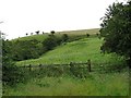
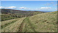
Nearby Images from Geograph Britain and Ireland:
©2007(licence)
©2010(licence)
©2022(licence)
©2007(licence)
©2019(licence)
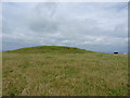
The above images may not be of the site on this page, they are loaded from Geograph.
Please Submit an Image of this site or go out and take one for us!
Click here to see more info for this site
Nearby sites
Key: Red: member's photo, Blue: 3rd party photo, Yellow: other image, Green: no photo - please go there and take one, Grey: site destroyed
Download sites to:
KML (Google Earth)
GPX (GPS waypoints)
CSV (Garmin/Navman)
CSV (Excel)
To unlock full downloads you need to sign up as a Contributory Member. Otherwise downloads are limited to 50 sites.
Turn off the page maps and other distractions
Nearby sites listing. In the following links * = Image available
1.6km SSE 166° Ratlinghope Hill Bowl Barrow* Round Barrow(s) (SO41179817)
1.9km S 188° Castle Ring (Stitt Hill)* Hillfort (SO405978)
2.4km S 182° Ratlinghope Hill Camp* Hillfort (SO407973)
3.0km WNW 296° The Paddocks Stone Row / Alignment (SJ38100107)
3.4km SSE 151° Wildmoor Bowl Barrow* Round Barrow(s) (SO42409672)
3.5km SE 144° Henley Knap Bowl Barrow* Round Barrow(s) (SO42799685)
3.8km WNW 289° Castle Ring (Stiperstones)* Hillfort (SJ372010)
3.8km SE 144° Robin Hood's Butts (Shropshire)* Round Barrow(s) (SO43029655)
4.1km WSW 257° The Stiperstones* Cairn (SO36799880)
4.5km SSE 160° Long Mynd C* Round Barrow(s) (SO423955)
4.5km SSE 163° Shooting Box Disc Barrow* Round Barrow(s) (SO421954)
4.6km SE 130° High Park Cross Dyke* Ancient Village or Settlement (SO443967)
5.0km N 359° Earls Hill Camp* Hillfort (SJ408047)
5.2km W 270° Pennerley Circle* Stone Circle (SO356998)
5.3km SSE 163° Boiling Well (Long Mynd)* Round Barrow(s) (SO423946)
5.5km SSE 160° Long Mynd A* Round Barrow(s) (SO426945)
5.6km NNW 334° Callow Hill Camp* Hillfort (SJ38430480)
5.8km S 176° Pole Cottage* Round Barrow(s) (SO411939)
5.9km W 265° Pennerley Barrows* Round Barrow(s) (SO349993)
5.9km N 0° Pontesford Hill* Hillfort (SJ409056)
6.1km SSW 200° Norton Stones* Misc. Earthwork (SO386940)
6.2km SE 143° Bodbury Ring* Hillfort (SO445947)
6.3km SW 226° Linley Hill Camp* Misc. Earthwork (SO362954)
6.3km SSE 149° The Devil's Mouth Cross Dyke* Misc. Earthwork (SO43959425)
6.4km S 173° Long Mynd B* Round Barrow(s) (SO41539330)
View more nearby sites and additional images


 We would like to know more about this location. Please feel free to add a brief description and any relevant information in your own language.
 Wir möchten mehr über diese Stätte erfahren. Bitte zögern Sie nicht, eine kurze Beschreibung und relevante Informationen in Deutsch hinzuzufügen.
 Nous aimerions en savoir encore un peu sur les lieux. S'il vous plaît n'hesitez pas à ajouter une courte description et tous les renseignements pertinents dans votre propre langue.
 Quisieramos informarnos un poco más de las lugares. No dude en añadir una breve descripción y otros datos relevantes en su propio idioma.