


<< Our Photo Pages >> Balmossie Den (Broughty Ferry) - Holy Well or Sacred Spring in Scotland in Angus
Submitted by Anne T on Thursday, 23 November 2017 Page Views: 2437
Springs and Holy WellsSite Name: Balmossie Den (Broughty Ferry) Alternative Name: Cat Craig Well; Cauld Water Wellie; Wishing WellCountry: Scotland
NOTE: This site is 4.188 km away from the location you searched for.
County: Angus Type: Holy Well or Sacred Spring
Nearest Town: Broughty Ferry
Map Ref: NO4721732714
Latitude: 56.483558N Longitude: 2.858639W
Condition:
| 5 | Perfect |
| 4 | Almost Perfect |
| 3 | Reasonable but with some damage |
| 2 | Ruined but still recognisable as an ancient site |
| 1 | Pretty much destroyed, possibly visible as crop marks |
| 0 | No data. |
| -1 | Completely destroyed |
| 5 | Superb |
| 4 | Good |
| 3 | Ordinary |
| 2 | Not Good |
| 1 | Awful |
| 0 | No data. |
| 5 | Can be driven to, probably with disabled access |
| 4 | Short walk on a footpath |
| 3 | Requiring a bit more of a walk |
| 2 | A long walk |
| 1 | In the middle of nowhere, a nightmare to find |
| 0 | No data. |
| 5 | co-ordinates taken by GPS or official recorded co-ordinates |
| 4 | co-ordinates scaled from a detailed map |
| 3 | co-ordinates scaled from a bad map |
| 2 | co-ordinates of the nearest village |
| 1 | co-ordinates of the nearest town |
| 0 | no data |
Be the first person to rate this site - see the 'Contribute!' box in the right hand menu.
Internal Links:
External Links:
I have visited· I would like to visit
ivrig visited on 21st Mar 2024 - their rating: Cond: 3 Amb: 3 Access: 1 Difficult to find and access
 (PID:270813)")
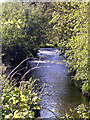
Sitting right next to Dighty Burn in Broughty Ferry, on the north side of the A92 at Balmossie Bridge, this little known site is recorded on The Northern Antiquarian (TNA) - see their entry for Holy Well, Balmossie Den, Broughty Ferry, Angus, which gives directions for finding this well, together with an image of the site from 1900.
TNA adds the well is still marked on modern OS maps and: "the area is much overgrown now, but the well still exists. It is inscribed, ‘Whosoever drinketh of this water shall thirst again T.E. 1847.’ These initials are of Thomas Erskine of Linlathen who had the stone erected on the supposed site of a medieval holy well ... Just below (this well) used to be the remains of an ancient chapel, which Tom Erskine thought gave this well holy sanctity. In the late 19th and early 20th century, the site gained repute as a wishing well, where people left offerings for the spirit of the waters in exchange for health and other good deeds. The area of Broughty Ferry and Monifieth was a seat of the Culdees, with ancient trees and land hereby dedicated to St Bridget and Our Lady, although there remain no extant traditions indicating that this site had any direct associations with such mythic figures."
Note: Have you visited this site? Do you have any photographs or information to add?
You may be viewing yesterday's version of this page. To see the most up to date information please register for a free account.
 (PID:270817)")
 (PID:270816)")
 (PID:270815)")
 (PID:270814)")
Do not use the above information on other web sites or publications without permission of the contributor.
Nearby Images from Geograph Britain and Ireland:
©2022(licence)
©2014(licence)
©2014(licence)
©2005(licence)
©2005(licence)
The above images may not be of the site on this page, they are loaded from Geograph.
Please Submit an Image of this site or go out and take one for us!
Click here to see more info for this site
Nearby sites
Key: Red: member's photo, Blue: 3rd party photo, Yellow: other image, Green: no photo - please go there and take one, Grey: site destroyed
Download sites to:
KML (Google Earth)
GPX (GPS waypoints)
CSV (Garmin/Navman)
CSV (Excel)
To unlock full downloads you need to sign up as a Contributory Member. Otherwise downloads are limited to 50 sites.
Turn off the page maps and other distractions
Nearby sites listing. In the following links * = Image available
1.2km NNW 330° Linlathen Class I Pictish Symbol Stone (NO46623376)
2.9km NE 41° Drumsturdy Hill* Broch or Nuraghe (NO492349)
3.4km ENE 59° Ardestie* Souterrain (Fogou, Earth House) (NO5019434441)
4.8km ENE 65° Barry Cursus Cursus (NO51603465)
5.0km ENE 71° Woodhill House* Rock Art (NO520343)
5.1km NE 49° Carlungie* Souterrain (Fogou, Earth House) (NO51123597)
7.0km NE 41° Camus Cross (Angus)* Ancient Cross (NO519379)
7.3km WSW 251° McManus Galleries* Museum (NO40253047)
7.5km NNW 346° Carrot Hill* Rock Art (NO45454000)
8.1km NW 311° Tealing* Souterrain (Fogou, Earth House) (NO412381)
8.7km ENE 72° Carnoustie Neolithic Halls, Bronze Age roundhouses and Hoard* Ancient Village or Settlement (NO5553135246)
9.0km NW 321° Tealing Stones* Standing Stones (NO4165139785)
9.2km NW 319° Huntingfaulds* Rock Art (NO41303974)
9.3km E 79° The Singing Stone (Summstein) Modern Stone Circle etc
9.7km WNW 284° Strathmartine 3 Class II Pictish Symbol Stone (NO378352)
10.6km WNW 302° Balkemback* Stone Circle (NO382384)
10.7km NW 309° Prieston* Rock Art (NO39023960)
10.9km WNW 296° Balluderon* Class II Pictish Symbol Stone (NO37483758)
11.0km NW 315° Gallow Hill B* Rock Art (NO39584066)
11.1km W 260° Dark Stane Roundie* Round Barrow(s) (NO362310)
11.1km NW 312° Gallow Hill A* Rock Art (NO39054033)
11.2km S 188° Lady's Well (Leuchars) Holy Well or Sacred Spring (NO4557321645)
11.4km S 189° St Bunyan's Well (Leuchars) Holy Well or Sacred Spring (NO4525221483)
11.7km W 270° Camperdown Standing Stone* Standing Stone (Menhir) (NO3549632905)
11.9km W 264° Balgarthno* Stone Circle (NO35333161)
View more nearby sites and additional images


 We would like to know more about this location. Please feel free to add a brief description and any relevant information in your own language.
 Wir möchten mehr über diese Stätte erfahren. Bitte zögern Sie nicht, eine kurze Beschreibung und relevante Informationen in Deutsch hinzuzufügen.
 Nous aimerions en savoir encore un peu sur les lieux. S'il vous plaît n'hesitez pas à ajouter une courte description et tous les renseignements pertinents dans votre propre langue.
 Quisieramos informarnos un poco más de las lugares. No dude en añadir una breve descripción y otros datos relevantes en su propio idioma.