


<< Our Photo Pages >> Skipperhams Well - Holy Well or Sacred Spring in England in Somerset
Submitted by KiwiBetsy on Sunday, 08 October 2006 Page Views: 5351
Springs and Holy WellsSite Name: Skipperhams Well Alternative Name: St Cyprian's WellCountry: England
NOTE: This site is 6.504 km away from the location you searched for.
County: Somerset Type: Holy Well or Sacred Spring
Nearest Town: Taunton Nearest Village: Beercrocombe
Map Ref: ST329188
Latitude: 50.964696N Longitude: 2.956884W
Condition:
| 5 | Perfect |
| 4 | Almost Perfect |
| 3 | Reasonable but with some damage |
| 2 | Ruined but still recognisable as an ancient site |
| 1 | Pretty much destroyed, possibly visible as crop marks |
| 0 | No data. |
| -1 | Completely destroyed |
| 5 | Superb |
| 4 | Good |
| 3 | Ordinary |
| 2 | Not Good |
| 1 | Awful |
| 0 | No data. |
| 5 | Can be driven to, probably with disabled access |
| 4 | Short walk on a footpath |
| 3 | Requiring a bit more of a walk |
| 2 | A long walk |
| 1 | In the middle of nowhere, a nightmare to find |
| 0 | No data. |
| 5 | co-ordinates taken by GPS or official recorded co-ordinates |
| 4 | co-ordinates scaled from a detailed map |
| 3 | co-ordinates scaled from a bad map |
| 2 | co-ordinates of the nearest village |
| 1 | co-ordinates of the nearest town |
| 0 | no data |
Internal Links:
External Links:
")
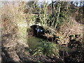
Skipperhams Well lies on private land at the edge of a field. We were shown the well by it’s very proud owner and found that it consists of a stone basin which is stained by the iron rich water that bubbles up into it and drains away into an adjacent wood.
You may be viewing yesterday's version of this page. To see the most up to date information please register for a free account.
")
Do not use the above information on other web sites or publications without permission of the contributor.
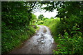
Nearby Images from Geograph Britain and Ireland:
©2007(licence)
©2015(licence)
©2015(licence)
©2015(licence)
©2017(licence)
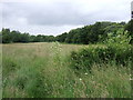
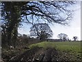
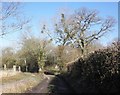
The above images may not be of the site on this page, they are loaded from Geograph.
Please Submit an Image of this site or go out and take one for us!
Click here to see more info for this site
Nearby sites
Key: Red: member's photo, Blue: 3rd party photo, Yellow: other image, Green: no photo - please go there and take one, Grey: site destroyed
Download sites to:
KML (Google Earth)
GPX (GPS waypoints)
CSV (Garmin/Navman)
CSV (Excel)
To unlock full downloads you need to sign up as a Contributory Member. Otherwise downloads are limited to 50 sites.
Turn off the page maps and other distractions
Nearby sites listing. In the following links * = Image available
5.3km NE 35° St. Catherine's Well (Swell)* Holy Well or Sacred Spring (ST360231)
6.4km WSW 241° Castle Neroche* Hillfort (ST272158)
6.5km W 265° The Devilstones* Natural Stone / Erratic / Other Natural Feature (ST264183)
7.4km SSW 206° Combe Beacon Tumulus* Long Barrow (ST295122)
8.7km SSW 213° Northay Barrow* Long Barrow (ST281115)
9.2km NW 308° Cambria Farm Ancient Village or Settlement (ST257246)
10.5km WSW 252° Robin Hoods Butt 2 (Somerset) Round Barrow(s) (ST22801575)
10.6km N 7° Athelney* Hillfort (ST344293)
10.8km WSW 245° Robin Hood's Butts North* Barrow Cemetery (ST230143)
11.0km SW 236° Robin Hood's Butts South* Barrow Cemetery (ST237128)
11.9km WNW 298° Museum of Somerset* Museum (ST225246)
14.1km SE 128° Pople's Well* Holy Well or Sacred Spring (ST4387909886)
15.0km E 96° Ham Hill stone circle* Modern Stone Circle etc (ST478171)
15.2km E 97° Ham Hill (Somerset)* Hillfort (ST480168)
15.2km WNW 299° Norton Fitzwarren* Hillfort (ST196263)
16.0km NNE 23° Greylake Mesolithic open-air cemetery Natural Stone / Erratic / Other Natural Feature (ST393335)
16.1km NNE 11° Westonzoyland Cursus Cursus (ST36263450)
16.7km SSW 196° Membury Castle Hillfort (ST282028)
16.8km NE 45° High Ham Cursus Cursus (ST45013048)
18.1km SSW 212° Stockland Little Castle Hillfort (ST22980362)
18.4km N 1° Chedzoy Cursus Cursus (ST33503721)
19.1km SSE 146° St Dunstan's Well* Holy Well or Sacred Spring (ST433028)
19.2km SSW 212° Stockland Great Castle* Hillfort (ST22620262)
19.4km SSE 154° Pilsdon Pen* Hillfort (ST413013)
19.5km NW 311° St. Agnes Well* Holy Well or Sacred Spring (ST18423186)
View more nearby sites and additional images


 We would like to know more about this location. Please feel free to add a brief description and any relevant information in your own language.
 Wir möchten mehr über diese Stätte erfahren. Bitte zögern Sie nicht, eine kurze Beschreibung und relevante Informationen in Deutsch hinzuzufügen.
 Nous aimerions en savoir encore un peu sur les lieux. S'il vous plaît n'hesitez pas à ajouter une courte description et tous les renseignements pertinents dans votre propre langue.
 Quisieramos informarnos un poco más de las lugares. No dude en añadir una breve descripción y otros datos relevantes en su propio idioma.