


<< Text Pages >> Aberlady Bay - Standing Stone (Menhir) in Scotland in East Lothian
Submitted by Anne T on Monday, 22 October 2018 Page Views: 1392
Neolithic and Bronze AgeSite Name: Aberlady BayCountry: Scotland
NOTE: This site is 3.332 km away from the location you searched for.
County: East Lothian Type: Standing Stone (Menhir)
Nearest Town: Gullane Nearest Village: Aberlady
Map Ref: NT46768022
Latitude: 56.011937N Longitude: 2.855475W
Condition:
| 5 | Perfect |
| 4 | Almost Perfect |
| 3 | Reasonable but with some damage |
| 2 | Ruined but still recognisable as an ancient site |
| 1 | Pretty much destroyed, possibly visible as crop marks |
| 0 | No data. |
| -1 | Completely destroyed |
| 5 | Superb |
| 4 | Good |
| 3 | Ordinary |
| 2 | Not Good |
| 1 | Awful |
| 0 | No data. |
| 5 | Can be driven to, probably with disabled access |
| 4 | Short walk on a footpath |
| 3 | Requiring a bit more of a walk |
| 2 | A long walk |
| 1 | In the middle of nowhere, a nightmare to find |
| 0 | No data. |
| 5 | co-ordinates taken by GPS or official recorded co-ordinates |
| 4 | co-ordinates scaled from a detailed map |
| 3 | co-ordinates scaled from a bad map |
| 2 | co-ordinates of the nearest village |
| 1 | co-ordinates of the nearest town |
| 0 | no data |
Be the first person to rate this site - see the 'Contribute!' box in the right hand menu.
Internal Links:
External Links:
Although not recorded on Canmore, this now fallen standing stone is featured on the Ancient Stones: A Guide to Standing Stones and Stone Circles in the South of Scotland - see their entry for Stone, Aberlady Bay, Aberlady, which includes a description, directions for finding the stone with nearby parking, folklore and fieldnotes.
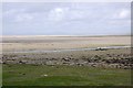
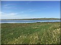
The Ancient Stones tells us: "This large recumbent stone caught my eye one Sunday evening when returning from North Berwick. It lies on the foreshore just a few metres west of Aberlady village and measures 2.35m long x 1.20m wide x 0.75m thick. The stone is well rounded, most likely by the tides, as it presently lies between high and low tide marks. One end is pointed and the stone is of a type local to the area. There is no known prehistoric associations with this stone and whether it stood upright is unlikely ever to be known, unless time travel is developed. I'm working on that!" They add that "one possibility is that the stone is a fallen boundary stone."
Does anyone have any more information about this stone, please?
Note: Has anyone seen this stone? Do you have any photographs, information or comments to add? Do you know anything about its history?
You may be viewing yesterday's version of this page. To see the most up to date information please register for a free account.
Do not use the above information on other web sites or publications without permission of the contributor.
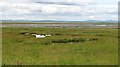
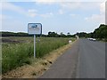
Nearby Images from Geograph Britain and Ireland:
©2008(licence)
©2013(licence)
©2015(licence)
©2020(licence)
©2008(licence)
The above images may not be of the site on this page, they are loaded from Geograph.
Please Submit an Image of this site or go out and take one for us!
Click here to see more info for this site
Nearby sites
Key: Red: member's photo, Blue: 3rd party photo, Yellow: other image, Green: no photo - please go there and take one, Grey: site destroyed
Download sites to:
KML (Google Earth)
GPX (GPS waypoints)
CSV (Garmin/Navman)
CSV (Excel)
To unlock full downloads you need to sign up as a Contributory Member. Otherwise downloads are limited to 50 sites.
Turn off the page maps and other distractions
Nearby sites listing. In the following links * = Image available
1.7km NNE 28° Brand's Well* Holy Well or Sacred Spring (NT47588171)
2.8km N 10° King's Chair (Gullane Hill) Natural Stone / Erratic / Other Natural Feature (NT47308299)
4.4km ESE 115° The Chesters* Hillfort (NT50767826)
5.7km E 94° Boar Stone (Drem)* Ancient Cross (NT52427975)
5.9km NE 51° Piper's Stone (Dirleton) Standing Stone (Menhir) (NT51438392)
6.4km SE 127° Kaeheughs Hillfort (NT51837627)
6.7km NNE 31° Eldbotle Wood (Dirleton) Cairn (NT50258593)
8.0km SE 141° Custom Stone (Haddington) Marker Stone (NT51697388)
9.5km ENE 66° North Berwick Law* Ancient Village or Settlement (NT555839)
10.0km ENE 59° St. Andrew's Well Holy Well or Sacred Spring (NT55438520)
10.0km SW 235° Johnnie Moat Stone (Prestonpans) Natural Stone / Erratic / Other Natural Feature (NT38507455)
11.8km ESE 106° Pencraig Brae* Standing Stone (Menhir) (NT58087681)
12.3km E 100° Prestonkirk Cursus Cursus (NT58927790)
12.5km ESE 115° Traprain Law* Hillfort (NT5805674696)
12.6km ESE 118° Loth Stone* Standing Stone (Menhir) (NT5782374146)
12.7km E 99° Prestonkirk Cursus Cursus (NT59257798)
12.7km E 100° St Baldred's Well* Holy Well or Sacred Spring (NT59317780)
12.7km ESE 115° Maiden Stone (East Lothian)* Standing Stone (Menhir) (NT5830774748)
12.8km ESE 120° Standingstone (East Lothian)* Standing Stone (Menhir) (NT57737363)
13.0km E 99° Prestonkirk Cursus Cursus (NT59657799)
13.1km E 83° Our Lady's Well (Whitekirk) Holy Well or Sacred Spring (NT598816)
13.1km ENE 70° St. Baldred's Well (Auldhame)* Holy Well or Sacred Spring (NT59168450)
13.4km E 98° Prestonkirk Cursus Cursus (NT60007809)
14.6km SW 232° Inveresk B Cursus Cursus (NT35177128)
14.8km SW 232° Inveresk A Cursus Cursus (NT35017118)
View more nearby sites and additional images


 We would like to know more about this location. Please feel free to add a brief description and any relevant information in your own language.
 Wir möchten mehr über diese Stätte erfahren. Bitte zögern Sie nicht, eine kurze Beschreibung und relevante Informationen in Deutsch hinzuzufügen.
 Nous aimerions en savoir encore un peu sur les lieux. S'il vous plaît n'hesitez pas à ajouter une courte description et tous les renseignements pertinents dans votre propre langue.
 Quisieramos informarnos un poco más de las lugares. No dude en añadir una breve descripción y otros datos relevantes en su propio idioma.