

<< Text Pages >> St Bunyan's Well (Leuchars) - Holy Well or Sacred Spring in Scotland in Fife
Submitted by Anne T on Monday, 08 January 2018 Page Views: 1385
Springs and Holy WellsSite Name: St Bunyan''s Well (Leuchars)Country: Scotland
NOTE: This site is 2.889 km away from the location you searched for.
County: Fife Type: Holy Well or Sacred Spring
Nearest Town: Leuchars
Map Ref: NO4525221483
Latitude: 56.382445N Longitude: 2.888185W
Condition:
| 5 | Perfect |
| 4 | Almost Perfect |
| 3 | Reasonable but with some damage |
| 2 | Ruined but still recognisable as an ancient site |
| 1 | Pretty much destroyed, possibly visible as crop marks |
| 0 | No data. |
| -1 | Completely destroyed |
| 5 | Superb |
| 4 | Good |
| 3 | Ordinary |
| 2 | Not Good |
| 1 | Awful |
| 0 | No data. |
| 5 | Can be driven to, probably with disabled access |
| 4 | Short walk on a footpath |
| 3 | Requiring a bit more of a walk |
| 2 | A long walk |
| 1 | In the middle of nowhere, a nightmare to find |
| 0 | No data. |
| 5 | co-ordinates taken by GPS or official recorded co-ordinates |
| 4 | co-ordinates scaled from a detailed map |
| 3 | co-ordinates scaled from a bad map |
| 2 | co-ordinates of the nearest village |
| 1 | co-ordinates of the nearest town |
| 0 | no data |
Be the first person to rate this site - see the 'Contribute!' box in the right hand menu.
Internal Links:
External Links:
Holy Well or Sacred Spring in Fife
The Northern Antiquarian (TNA) features a page for this holy well - see their entry for St Bunyan’s Well, Leuchars, Fife, which gives directions for finding this site, together with photographs, a brief archaeology & history and references.
TNA quotes from the Ordnance Survey Name Book: "In the village of Leuchars. A excellent Spring Well in the village of Leuchars it is built round with cut stones, and is Kept in good repair by the inhabitants. the date when it was first Constructed is not known but it said to have been before the reformation, dedicated to St. Bunyan hence its name."
TNA adds: "An elderly couple whom I met remembered a small well-house, but I didn’t ask them when it was demolished. The Saint is remembered in Leuchars by the road name of a modern development in St Bunyan’s Place. St Bunyan’s Well probably dried up as a result of the increased water demand following the establishment of RAF Leuchars in 1920. The Saint now has his waters extracted by Scottish Water’s Meadow Road Pumping Station."
Note: Have you visited this site? Do you have any photographs, illustrations or information to add?
You may be viewing yesterday's version of this page. To see the most up to date information please register for a free account.
Do not use the above information on other web sites or publications without permission of the contributor.
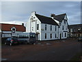
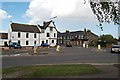
Nearby Images from Geograph Britain and Ireland:
©2013(licence)
©2021(licence)
©2021(licence)
©2013(licence)
©2006(licence)
The above images may not be of the site on this page, they are loaded from Geograph.
Please Submit an Image of this site or go out and take one for us!
Click here to see more info for this site
Nearby sites
Key: Red: member's photo, Blue: 3rd party photo, Yellow: other image, Green: no photo - please go there and take one, Grey: site destroyed
Download sites to:
KML (Google Earth)
GPX (GPS waypoints)
CSV (Garmin/Navman)
CSV (Excel)
To unlock full downloads you need to sign up as a Contributory Member. Otherwise downloads are limited to 50 sites.
Turn off the page maps and other distractions
Nearby sites listing. In the following links * = Image available
359m ENE 62° Lady's Well (Leuchars) Holy Well or Sacred Spring (NO4557321645)
5.6km W 281° Kilmany Cursus Cursus (NO39742263)
7.1km SE 131° The Blue Stane (St Andrews)* Standing Stone (Menhir) (NO5055216707)
7.2km SE 138° St. Andrews Museum* Museum (NO5016)
7.4km W 262° Lochmaloney Farmm (Kilmany) Rock Art (NO37902049)
7.8km SE 128° Monk's Well, St Andrews* Holy Well or Sacred Spring (NO514166)
8.3km S 175° Drumcarrow Craig* Broch or Nuraghe (NO459132)
10.0km WNW 288° Monk's Well (Balmerino)* Holy Well or Sacred Spring (NO358247)
10.3km NNW 330° McManus Galleries* Museum (NO40253047)
11.4km SSW 207° Spout Well* Holy Well or Sacred Spring (NO400114)
11.4km N 9° Balmossie Den (Broughty Ferry)* Holy Well or Sacred Spring (NO4721732714)
12.3km N 6° Linlathen Class I Pictish Symbol Stone (NO46623376)
12.9km SE 128° Boarhills* Standing Stone (Menhir) (NO5525413356)
13.0km SE 143° Dunino Stone Circle (NO530110)
13.1km NW 316° Dark Stane Roundie* Round Barrow(s) (NO362310)
13.3km W 267° Creich Manse* Class I Pictish Symbol Stone (NO319210)
13.5km NW 308° St Peter's Church (Invergowrie)* Early Christian Sculptured Stone (NO348300)
13.7km SE 140° Dunino Den* Stone Row / Alignment (NO540109)
13.8km SE 140° Druid's Well (Dunino)* Holy Well or Sacred Spring (NO540108)
13.9km NNE 20° Ardestie* Souterrain (Fogou, Earth House) (NO5019434441)
14.0km NNE 16° Drumsturdy Hill* Broch or Nuraghe (NO492349)
14.1km NW 315° Balgarthno* Stone Circle (NO35333161)
14.3km NW 311° Devil's Stone (Perth & Kinross)* Standing Stone (Menhir) (NO3458131019)
14.5km NNE 27° Woodhill House* Rock Art (NO520343)
14.5km NW 310° Longforgan Cursus Cursus (NO34163094)
View more nearby sites and additional images


 We would like to know more about this location. Please feel free to add a brief description and any relevant information in your own language.
 Wir möchten mehr über diese Stätte erfahren. Bitte zögern Sie nicht, eine kurze Beschreibung und relevante Informationen in Deutsch hinzuzufügen.
 Nous aimerions en savoir encore un peu sur les lieux. S'il vous plaît n'hesitez pas à ajouter une courte description et tous les renseignements pertinents dans votre propre langue.
 Quisieramos informarnos un poco más de las lugares. No dude en añadir una breve descripción y otros datos relevantes en su propio idioma.