


<< Text Pages >> Leintwardine Cursus - Cursus in England in Worcestershire
Submitted by EssexMan on Wednesday, 07 April 2010 Page Views: 5175
Neolithic and Bronze AgeSite Name: Leintwardine CursusCountry: England
NOTE: This site is 1.84 km away from the location you searched for.
County: Worcestershire Type: Cursus
Nearest Town: Ludlow Nearest Village: Leintwardine
Map Ref: SO39577534 Landranger Map Number: 137
Latitude: 52.372755N Longitude: 2.889054W
Condition:
| 5 | Perfect |
| 4 | Almost Perfect |
| 3 | Reasonable but with some damage |
| 2 | Ruined but still recognisable as an ancient site |
| 1 | Pretty much destroyed, possibly visible as crop marks |
| 0 | No data. |
| -1 | Completely destroyed |
| 5 | Superb |
| 4 | Good |
| 3 | Ordinary |
| 2 | Not Good |
| 1 | Awful |
| 0 | No data. |
| 5 | Can be driven to, probably with disabled access |
| 4 | Short walk on a footpath |
| 3 | Requiring a bit more of a walk |
| 2 | A long walk |
| 1 | In the middle of nowhere, a nightmare to find |
| 0 | No data. |
| 5 | co-ordinates taken by GPS or official recorded co-ordinates |
| 4 | co-ordinates scaled from a detailed map |
| 3 | co-ordinates scaled from a bad map |
| 2 | co-ordinates of the nearest village |
| 1 | co-ordinates of the nearest town |
| 0 | no data |
Internal Links:
External Links:
Cursus in Worcestershire
Status: Possible
NMR No. SO 37 NE 82
You may be viewing yesterday's version of this page. To see the most up to date information please register for a free account.
Do not use the above information on other web sites or publications without permission of the contributor.
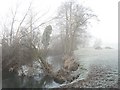
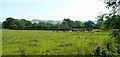
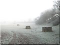
Nearby Images from Geograph Britain and Ireland:
![SO3975 : Wanderings around the Welsh/English border [261] by Michael Dibb](https://s1.geograph.org.uk/geophotos/07/55/88/7558849_5c8f8d5c_120x120.jpg)
©2023(licence)
![SO3975 : Wanderings around the Welsh/English border [259] by Michael Dibb](https://s3.geograph.org.uk/geophotos/07/55/88/7558839_eeb8c63c_120x120.jpg)
©2023(licence)
©2007(licence)
©2008(licence)
©2007(licence)
The above images may not be of the site on this page, they are loaded from Geograph.
Please Submit an Image of this site or go out and take one for us!
Click here to see more info for this site
Nearby sites
Key: Red: member's photo, Blue: 3rd party photo, Yellow: other image, Green: no photo - please go there and take one, Grey: site destroyed
Download sites to:
KML (Google Earth)
GPX (GPS waypoints)
CSV (Garmin/Navman)
CSV (Excel)
To unlock full downloads you need to sign up as a Contributory Member. Otherwise downloads are limited to 50 sites.
Turn off the page maps and other distractions
Nearby sites listing. In the following links * = Image available
3.0km S 169° Brandon Camp* Hillfort (SO401724)
3.5km SW 236° Coxall Knoll* Hillfort (SO366734)
4.3km W 277° Castle Ditches (Shropshire)* Ancient Village or Settlement (SO35357594)
4.8km NW 316° Hopton Castle Standing Stone (Menhir) (SO36297883)
4.8km NNW 330° Fairy Stone* Natural Stone / Erratic / Other Natural Feature (SO37237958)
5.1km SW 224° Brampton Bryan Lady Well* Holy Well or Sacred Spring (SO36007172)
5.4km WNW 284° Great Hagley* Standing Stone (Menhir) (SO343767)
7.8km N 349° Burrow Hill Camp (Shropshire)* Hillfort (SO38218305)
8.0km NNE 24° Tumpy Hill Round Barrow(s) (SO429826)
8.2km NNE 28° Secret Hills Discovery Centre* Museum (SO435825)
8.2km WNW 293° Fiddler's Elbow Standing Stone (Menhir) (SO32007865)
8.4km NE 37° Norton Camp (Shropshire)* Hillfort (SO44728193)
8.6km W 272° Caer Caradoc (Chapel Lawn)* Hillfort (SO310758)
8.8km WNW 292° Pen-Y-Wern Outlier Standing Stone (Menhir) (SO31447880)
8.8km WNW 292° Pen-Y-Wern Conglomerate* Standing Stone (Menhir) (SO31407871)
8.9km WNW 292° Pen-Y-Wern Hill* Stone Circle (SO313788)
9.3km NNE 21° Belair Bowl Barrow* Round Barrow(s) (SO430840)
9.4km N 2° Wart Hill Camp* Hillfort (SO400847)
9.4km SSE 162° Pyon Wood* Hillfort (SO424664)
9.7km ENE 74° Robin Hoods Butt 1 (Shropshire) Round Barrow(s) (SO48977787)
9.8km SSE 150° Croft Ambrey* Hillfort (SO444668)
9.9km NW 309° Radnor Wood Camp* Hillfort (SO320817)
10.0km ESE 107° Haye Park Wood Enclosure* Ancient Village or Settlement (SO49167229)
10.2km ENE 76° Bromfield Barrows* Barrow Cemetery (SO495776)
10.2km WNW 289° Clun Hill Stones* Standing Stones (SO29897873)
View more nearby sites and additional images


 We would like to know more about this location. Please feel free to add a brief description and any relevant information in your own language.
 Wir möchten mehr über diese Stätte erfahren. Bitte zögern Sie nicht, eine kurze Beschreibung und relevante Informationen in Deutsch hinzuzufügen.
 Nous aimerions en savoir encore un peu sur les lieux. S'il vous plaît n'hesitez pas à ajouter une courte description et tous les renseignements pertinents dans votre propre langue.
 Quisieramos informarnos un poco más de las lugares. No dude en añadir una breve descripción y otros datos relevantes en su propio idioma.