


<< Our Photo Pages >> Fartle Barrow - Cairn in England in Lancashire
Submitted by SumDoood on Friday, 24 February 2017 Page Views: 1931
Neolithic and Bronze AgeSite Name: Fartle BarrowCountry: England County: Lancashire Type: Cairn
Nearest Town: Morecambe
Map Ref: SD4380364966
Latitude: 54.077536N Longitude: 2.860395W
Condition:
| 5 | Perfect |
| 4 | Almost Perfect |
| 3 | Reasonable but with some damage |
| 2 | Ruined but still recognisable as an ancient site |
| 1 | Pretty much destroyed, possibly visible as crop marks |
| 0 | No data. |
| -1 | Completely destroyed |
| 5 | Superb |
| 4 | Good |
| 3 | Ordinary |
| 2 | Not Good |
| 1 | Awful |
| 0 | No data. |
| 5 | Can be driven to, probably with disabled access |
| 4 | Short walk on a footpath |
| 3 | Requiring a bit more of a walk |
| 2 | A long walk |
| 1 | In the middle of nowhere, a nightmare to find |
| 0 | No data. |
| 5 | co-ordinates taken by GPS or official recorded co-ordinates |
| 4 | co-ordinates scaled from a detailed map |
| 3 | co-ordinates scaled from a bad map |
| 2 | co-ordinates of the nearest village |
| 1 | co-ordinates of the nearest town |
| 0 | no data |
Internal Links:
External Links:
I have visited· I would like to visit
AmyBlahBlahBlah would like to visit
")
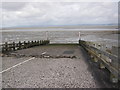
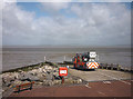
To simplify the named location, walk north from the Town Hall, cross the promenade, and stop at the beach. There are very few references to this site on the www, and probably very few elsewhere. Visually there seems to be nothing more than a stonier area in the mud and sand just below the HWM. Had it not been for an article on The Northern Antiquarian about the nearby Torrisholme Barrow, I would have assumed Fartle Barrow to be no more than an illogical place name.
You may be viewing yesterday's version of this page. To see the most up to date information please register for a free account.
")
Do not use the above information on other web sites or publications without permission of the contributor.
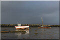
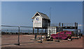
Nearby Images from Geograph Britain and Ireland:
©2023(licence)
©2013(licence)
©2017(licence)
©2012(licence)
©2010(licence)
The above images may not be of the site on this page, they are loaded from Geograph.
Please Submit an Image of this site or go out and take one for us!
Click here to see more info for this site
Nearby sites
Key: Red: member's photo, Blue: 3rd party photo, Yellow: other image, Green: no photo - please go there and take one, Grey: site destroyed
Download sites to:
KML (Google Earth)
GPX (GPS waypoints)
CSV (Garmin/Navman)
CSV (Excel)
To unlock full downloads you need to sign up as a Contributory Member. Otherwise downloads are limited to 50 sites.
Turn off the page maps and other distractions
Nearby sites listing. In the following links * = Image available
2.3km ESE 108° Torrisholme* Round Barrow(s) (SD45966425)
4.3km SW 218° St Patrick's Well (Heysham)* Holy Well or Sacred Spring (SD4108961591)
4.3km SW 218° Heysham St Peter's Churchyard* Ancient Cross (SD41066161)
4.3km SW 220° Heysham Rock-Cut tombs* Rock Cut Tomb (SD4098461655)
4.6km SW 222° Heysham Labyrinth* Carving (SD407616)
4.6km SSW 208° Church Well (Heysham) Holy Well or Sacred Spring (SD416609)
4.7km SE 130° Lancaster Priory Cross* Ancient Cross (SD474619)
5.0km SE 130° Lancaster City Museum* Museum (SD4761161729)
5.3km ENE 59° Bolton Le Sands Early Christian Sculptured Stone (SD48336765)
5.3km ENE 57° St Michael's Well (Lancashire) Holy Well or Sacred Spring (SD4828567831)
5.8km ENE 62° Bolton-le-Sands Barrow* Ring Cairn (SD4901467624)
6.1km E 92° Halton St Wilfrid's Churchyard* Ancient Cross (SD49916469)
6.1km SE 127° Golgotha Lodge (Williamson Park) Cairn (SD48666121)
6.6km E 90° The Lancaster Cross* Ancient Cross (SD504649)
7.7km NE 42° Hunting Hill* Round Barrow(s) (SD49037065)
8.2km NNE 32° Cote Stones Cairn (SD482719)
9.0km NNE 28° Badger Hole (Lancashire)* Cave or Rock Shelter (SD48187285)
9.0km NNE 26° Ings Point Natural Stone / Erratic / Other Natural Feature (SD479730)
9.2km NNE 29° Dog Holes* Cave or Rock Shelter (SD48337303)
9.3km ESE 105° Askew Heights* Ancient Village or Settlement (SD52726239)
9.3km NNE 13° Woodwell* Holy Well or Sacred Spring (SD4674)
9.4km NE 34° Warton Crag* Hillfort (SD492727)
9.7km NNW 331° Fairy Stone (Humphrey Head)* Natural Stone / Erratic / Other Natural Feature (SD39157344)
10.1km NNW 331° Holy Well (Humphrey Head)* Holy Well or Sacred Spring (SD39017391)
10.2km NE 36° Warton Crag giant wall Misc. Earthwork (SD499731)
View more nearby sites and additional images


 We would like to know more about this location. Please feel free to add a brief description and any relevant information in your own language.
 Wir möchten mehr über diese Stätte erfahren. Bitte zögern Sie nicht, eine kurze Beschreibung und relevante Informationen in Deutsch hinzuzufügen.
 Nous aimerions en savoir encore un peu sur les lieux. S'il vous plaît n'hesitez pas à ajouter une courte description et tous les renseignements pertinents dans votre propre langue.
 Quisieramos informarnos un poco más de las lugares. No dude en añadir una breve descripción y otros datos relevantes en su propio idioma.