

<< Other Photo Pages >> Priest's Well (Catlowdy) - Holy Well or Sacred Spring in England in Cumbria
Submitted by Anne T on Friday, 02 September 2022 Page Views: 373
Springs and Holy WellsSite Name: Priest's Well (Catlowdy) Alternative Name: Priest's Well (Nicholforest)Country: England
NOTE: This site is 0.454 km away from the location you searched for.
County: Cumbria Type: Holy Well or Sacred Spring
Nearest Town: Carlisle Nearest Village: Catlowdy
Map Ref: NY4573976887
Latitude: 55.083445N Longitude: 2.851532W
Condition:
| 5 | Perfect |
| 4 | Almost Perfect |
| 3 | Reasonable but with some damage |
| 2 | Ruined but still recognisable as an ancient site |
| 1 | Pretty much destroyed, possibly visible as crop marks |
| 0 | No data. |
| -1 | Completely destroyed |
| 5 | Superb |
| 4 | Good |
| 3 | Ordinary |
| 2 | Not Good |
| 1 | Awful |
| 0 | No data. |
| 5 | Can be driven to, probably with disabled access |
| 4 | Short walk on a footpath |
| 3 | Requiring a bit more of a walk |
| 2 | A long walk |
| 1 | In the middle of nowhere, a nightmare to find |
| 0 | No data. |
| 5 | co-ordinates taken by GPS or official recorded co-ordinates |
| 4 | co-ordinates scaled from a detailed map |
| 3 | co-ordinates scaled from a bad map |
| 2 | co-ordinates of the nearest village |
| 1 | co-ordinates of the nearest town |
| 0 | no data |
Be the first person to rate this site - see the 'Contribute!' box in the right hand menu.
Internal Links:
External Links:
I have visited· I would like to visit
Anne T couldn't find on 30th Aug 2022 Priest's Well, Catlowdy: Tried to find, but the footpath appears block by recently constructed areas for horses. Not wanting to disturb these beautiful animals, we gave up on our search, and will try and seek permission to enter from another direction at a future date.
 (PID:246887)")
Recorded in Jim Taylor Page's 1990 publication "Cumbrian Holy Wells" (page 27), this well is also shown on modern OS maps, and also comes up on the Historic England map search for this location.
Page describes this well as being "on the north side (of) Chapel Hill. Site of ancient chapel. Little evidence". [Note that the site of the old chapel is approximately at NY 46673 76779 , to the east of this well, location taken from the old OS maps from the National Library of Scotland - see the 1864 25 inch OS map (shared under the terms of their Creative Commons license)].
The Old Cumbria Gazetteer describes the water from this well running into Priest's Syke.
We tried to find this well, and found the sturdy, well-maintained stile to the footpath leading to the well from the B6318, but very quickly found our way blocked by (electrified?) grass enclosures recently built for some horses. Not wanting to disturb these beautiful animals, we discontinued our search.
So, this well remains on my list of sites to visit, but if anyone has any information, or photographs of this well, I'd be really pleased if you could leave a comment here. Thank you.
You may be viewing yesterday's version of this page. To see the most up to date information please register for a free account.
Do not use the above information on other web sites or publications without permission of the contributor.
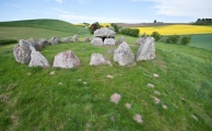
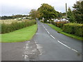
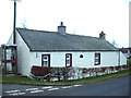
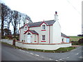
Nearby Images from Geograph Britain and Ireland:
©2017(licence)
©2007(licence)
©2007(licence)
©2011(licence)
©2007(licence)
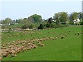
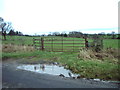
The above images may not be of the site on this page, they are loaded from Geograph.
Please Submit an Image of this site or go out and take one for us!
Click here to see more info for this site
Nearby sites
Key: Red: member's photo, Blue: 3rd party photo, Yellow: other image, Green: no photo - please go there and take one, Grey: site destroyed
Download sites to:
KML (Google Earth)
GPX (GPS waypoints)
CSV (Garmin/Navman)
CSV (Excel)
To unlock full downloads you need to sign up as a Contributory Member. Otherwise downloads are limited to 50 sites.
Turn off the page maps and other distractions
Nearby sites listing. In the following links * = Image available
1.5km SSE 150° Holywell (Catlowdy)* Holy Well or Sacred Spring (NY4649175570)
1.5km SSE 155° Solport Holy Well (Catlowdy) Holy Well or Sacred Spring (NY4637075490)
6.4km NNE 16° Will O'Greena's Stane* Standing Stone (Menhir) (NY47578303)
7.3km SE 140° Bride's Well (Stapleton)* Holy Well or Sacred Spring (NY50397119)
7.5km NNW 338° Windy Edge Stone Stone Circle (NY43048389)
7.5km NNW 338° Windy Edge* Chambered Cairn (NY42958391)
7.6km NNW 337° Windy Edge* Chambered Cairn (NY429839)
7.7km WNW 282° Gilnochie Tower rock art* Rock Art (NY3823178559)
8.1km WSW 243° Scots' Dike* Misc. Earthwork (NY38507325)
8.1km SW 229° Castra Exploratorum Ancient Village or Settlement (NY39607160)
8.2km NNE 23° Carby Hill* Ancient Village or Settlement (NY4906084360)
8.2km SW 233° St Andrew's Well (Kirkandrews-on-Esk) Holy Well or Sacred Spring (NY3913071970)
8.7km NNW 342° Tinnis Well* Holy Well or Sacred Spring (NY431852)
9.0km NNW 342° Tinnis Hill* Cairn (NY43098545)
9.4km N 11° Milnholm (Newcastleton)* Ancient Cross (NY4763986111)
10.5km E 93° Hobbie Nobles Well (Bewcastle) Holy Well or Sacred Spring (NY5624076200)
11.0km ESE 102° Bewcastle Cross* Ancient Cross (NY5653574550)
11.1km ESE 102° Priest's Well (Bewcastle)* Holy Well or Sacred Spring (NY56607454)
11.6km E 92° Grey Hill Settlement Ancient Village or Settlement (NY57317626)
11.7km ESE 122° Askerton Park* Ancient Village or Settlement (NY55567053)
11.8km ESE 109° Towerbrae Cairn* Cairn (NY56867282)
12.0km SW 220° St Michael's Holy Well* Holy Well or Sacred Spring (NY3789967755)
12.1km SW 219° Arthuret Church cross* Ancient Cross (NY37936766)
12.9km ESE 118° Gillalees Ring Cairn (NY571708)
13.0km ESE 113° Robin Hood's Well (Askerton) Holy Well or Sacred Spring (NY57677161)
View more nearby sites and additional images


 We would like to know more about this location. Please feel free to add a brief description and any relevant information in your own language.
 Wir möchten mehr über diese Stätte erfahren. Bitte zögern Sie nicht, eine kurze Beschreibung und relevante Informationen in Deutsch hinzuzufügen.
 Nous aimerions en savoir encore un peu sur les lieux. S'il vous plaît n'hesitez pas à ajouter une courte description et tous les renseignements pertinents dans votre propre langue.
 Quisieramos informarnos un poco más de las lugares. No dude en añadir una breve descripción y otros datos relevantes en su propio idioma.