


<< Text Pages >> Cairn de Lost-er-Lenn - Cairn in France in Bretagne:Morbihan (56)
Submitted by TheCaptain on Monday, 03 January 2005 Page Views: 2654
Neolithic and Bronze AgeSite Name: Cairn de Lost-er-LennCountry: France
NOTE: This site is 3.482 km away from the location you searched for.
Département: Bretagne:Morbihan (56) Type: Cairn
Nearest Town: Vannes Nearest Village: Grand-Champ
Latitude: 47.790386N Longitude: 2.819574W
Condition:
| 5 | Perfect |
| 4 | Almost Perfect |
| 3 | Reasonable but with some damage |
| 2 | Ruined but still recognisable as an ancient site |
| 1 | Pretty much destroyed, possibly visible as crop marks |
| 0 | No data. |
| -1 | Completely destroyed |
| 5 | Superb |
| 4 | Good |
| 3 | Ordinary |
| 2 | Not Good |
| 1 | Awful |
| 0 | No data. |
| 5 | Can be driven to, probably with disabled access |
| 4 | Short walk on a footpath |
| 3 | Requiring a bit more of a walk |
| 2 | A long walk |
| 1 | In the middle of nowhere, a nightmare to find |
| 0 | No data. |
| 5 | co-ordinates taken by GPS or official recorded co-ordinates |
| 4 | co-ordinates scaled from a detailed map |
| 3 | co-ordinates scaled from a bad map |
| 2 | co-ordinates of the nearest village |
| 1 | co-ordinates of the nearest town |
| 0 | no data |
Be the first person to rate this site - see the 'Contribute!' box in the right hand menu.
Internal Links:
External Links:
Cairn in Morbihan
Location Source: T4T35.fr
You may be viewing yesterday's version of this page. To see the most up to date information please register for a free account.
Do not use the above information on other web sites or publications without permission of the contributor.
Nearby Images from Flickr
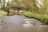

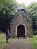
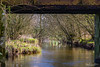
The above images may not be of the site on this page, but were taken nearby. They are loaded from Flickr so please click on them for image credits.
Click here to see more info for this site
Nearby sites
Click here to view sites on an interactive map of the areaKey: Red: member's photo, Blue: 3rd party photo, Yellow: other image, Green: no photo - please go there and take one, Grey: site destroyed
Download sites to:
KML (Google Earth)
GPX (GPS waypoints)
CSV (Garmin/Navman)
CSV (Excel)
To unlock full downloads you need to sign up as a Contributory Member. Otherwise downloads are limited to 50 sites.
Turn off the page maps and other distractions
Nearby sites listing. In the following links * = Image available
1.3km SE 141° Ty Neüé menhir couché* Standing Stone (Menhir)
2.6km NE 51° Larcuste cairns 3* Chambered Cairn
2.6km NE 50° Larcuste cairns 2* Chambered Cairn
2.6km NE 50° Larcuste Cairns* Chambered Cairn
2.6km NE 50° Larcuste cairns 1* Chambered Cairn
4.6km NW 323° Kerara Menhir* Standing Stone (Menhir)
4.8km NW 323° Kermarquer menhir* Standing Stone (Menhir)
4.9km NW 322° Men-Brasi-de-Kermar-Ker* Standing Stone (Menhir)
5.3km E 79° Colého Menhir* Standing Stone (Menhir)
5.5km ENE 65° Goh Menhir menhir* Standing Stone (Menhir)
5.7km E 91° Camp Romain de Kertloc'h Ancient Village or Settlement
5.7km NNW 336° Menhir du Mené* Standing Stone (Menhir)
5.7km NE 40° Kerjagu allée couverte* Passage Grave
5.8km NE 40° Kerjagu Menhirs* Standing Stones
6.1km NNW 333° Mégalithe-siège, Kerhero* Natural Stone / Erratic / Other Natural Feature
6.2km NW 305° Menhir de Kerigo Standing Stone (Menhir)
6.2km NNW 329° Pierres de Kerguéris* Natural Stone / Erratic / Other Natural Feature
6.2km E 84° Dolmen de Men-Gouarec* Passage Grave
6.3km NW 310° Cosquéro Menhir* Standing Stone (Menhir)
6.3km ENE 63° Kerherne-Bodunan dolmen* Passage Grave
6.8km E 98° Dolmen de Cadio Burial Chamber or Dolmen
7.0km ENE 66° La Moustoir stèle* Standing Stone (Menhir)
7.0km NE 55° Lann Doaur menhir* Standing Stone (Menhir)
7.1km NNW 336° Kermorvan Dolmen* Burial Chamber or Dolmen
7.1km NNE 19° Bézo menhir* Standing Stone (Menhir)
View more nearby sites and additional images


 We would like to know more about this location. Please feel free to add a brief description and any relevant information in your own language.
 Wir möchten mehr über diese Stätte erfahren. Bitte zögern Sie nicht, eine kurze Beschreibung und relevante Informationen in Deutsch hinzuzufügen.
 Nous aimerions en savoir encore un peu sur les lieux. S'il vous plaît n'hesitez pas à ajouter une courte description et tous les renseignements pertinents dans votre propre langue.
 Quisieramos informarnos un poco más de las lugares. No dude en añadir una breve descripción y otros datos relevantes en su propio idioma.