


<< Text Pages >> Grubbins Wood Stone - Natural Stone / Erratic / Other Natural Feature in England in Cumbria
Submitted by cumbrianlad on Monday, 26 April 2021 Page Views: 526
Natural PlacesSite Name: Grubbins Wood StoneCountry: England
NOTE: This site is 0.872 km away from the location you searched for.
County: Cumbria Type: Natural Stone / Erratic / Other Natural Feature
Map Ref: SD446780
Latitude: 54.194752N Longitude: 2.850613W
Condition:
| 5 | Perfect |
| 4 | Almost Perfect |
| 3 | Reasonable but with some damage |
| 2 | Ruined but still recognisable as an ancient site |
| 1 | Pretty much destroyed, possibly visible as crop marks |
| 0 | No data. |
| -1 | Completely destroyed |
| 5 | Superb |
| 4 | Good |
| 3 | Ordinary |
| 2 | Not Good |
| 1 | Awful |
| 0 | No data. |
| 5 | Can be driven to, probably with disabled access |
| 4 | Short walk on a footpath |
| 3 | Requiring a bit more of a walk |
| 2 | A long walk |
| 1 | In the middle of nowhere, a nightmare to find |
| 0 | No data. |
| 5 | co-ordinates taken by GPS or official recorded co-ordinates |
| 4 | co-ordinates scaled from a detailed map |
| 3 | co-ordinates scaled from a bad map |
| 2 | co-ordinates of the nearest village |
| 1 | co-ordinates of the nearest town |
| 0 | no data |
Internal Links:
External Links:
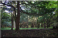
Probably an erratic, present in Grubbins Wood. We visited here in 2019, found a long line of small stones going through the wood, a bit like an embankment but we can't be sure.
This embankment runs between several things that look like cairns, and upon the embankment is this eratic. The eratic or stone seems to have high iron content.
You may be viewing yesterday's version of this page. To see the most up to date information please register for a free account.
Do not use the above information on other web sites or publications without permission of the contributor.
Nearby Images from Geograph Britain and Ireland:
©2012(licence)
©2006(licence)
©2008(licence)
©2013(licence)
©2007(licence)
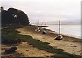
The above images may not be of the site on this page, they are loaded from Geograph.
Please Submit an Image of this site or go out and take one for us!
Click here to see more info for this site
Nearby sites
Key: Red: member's photo, Blue: 3rd party photo, Yellow: other image, Green: no photo - please go there and take one, Grey: site destroyed
Download sites to:
KML (Google Earth)
GPX (GPS waypoints)
CSV (Garmin/Navman)
CSV (Excel)
To unlock full downloads you need to sign up as a Contributory Member. Otherwise downloads are limited to 50 sites.
Turn off the page maps and other distractions
Nearby sites listing. In the following links * = Image available
2.7km E 83° Hazelslack Stone* Standing Stone (Menhir) (SD473783)
3.0km WNW 304° Castle-Head (Lindale) Promontory Fort / Cliff Castle (SD421797)
3.2km ESE 114° Bowk Stone Natural Stone / Erratic / Other Natural Feature (SD475767)
3.3km ESE 107° Haweswater Stones* Misc. Earthwork (SD478770)
3.5km ESE 108° Haweswater Cairns and Propped Stone Cairn (SD479769)
4.0km ENE 56° Haverbrack Cairn Cairn (SD480802)
4.1km ENE 58° Dog Hole possible dolmen/propped stone* Natural Stone / Erratic / Other Natural Feature (SD481801)
4.2km ENE 59° The Dog Hole Cave or Rock Shelter (SD482801)
4.2km SSE 160° Woodwell* Holy Well or Sacred Spring (SD4674)
4.3km ENE 76° The Fairy Steps* Natural Stone / Erratic / Other Natural Feature (SD488790)
4.8km NE 55° Haverbrack Fell Misc. Earthwork (SD486807)
5.3km ENE 66° Bela Stone Row* Stone Row / Alignment (SD495801)
5.3km ENE 76° The Rent Stone* Natural Stone / Erratic / Other Natural Feature (SD498792)
5.9km WSW 247° Kirkhead Cave Cave or Rock Shelter (SD391758)
6.0km SE 146° Ings Point Natural Stone / Erratic / Other Natural Feature (SD479730)
6.2km SE 142° Dog Holes* Cave or Rock Shelter (SD48337303)
6.3km SE 145° Badger Hole (Lancashire)* Cave or Rock Shelter (SD48187285)
6.5km ESE 123° Summerhouse Hill* Modern Stone Circle etc (SD50037437)
6.6km SE 132° The Three brothers* Natural Stone / Erratic / Other Natural Feature (SD495735)
6.7km ESE 123° Summerhouse Hill Cairn* Cairn (SD50147428)
6.9km SW 233° Holy Well (Humphrey Head)* Holy Well or Sacred Spring (SD39017391)
7.0km SE 138° Warton Crag* Hillfort (SD492727)
7.1km SSE 149° Cote Stones Cairn (SD482719)
7.1km SW 229° Fairy Stone (Humphrey Head)* Natural Stone / Erratic / Other Natural Feature (SD39157344)
7.2km SE 132° Warton Crag giant wall Misc. Earthwork (SD499731)
View more nearby sites and additional images


 We would like to know more about this location. Please feel free to add a brief description and any relevant information in your own language.
 Wir möchten mehr über diese Stätte erfahren. Bitte zögern Sie nicht, eine kurze Beschreibung und relevante Informationen in Deutsch hinzuzufügen.
 Nous aimerions en savoir encore un peu sur les lieux. S'il vous plaît n'hesitez pas à ajouter une courte description et tous les renseignements pertinents dans votre propre langue.
 Quisieramos informarnos un poco más de las lugares. No dude en añadir una breve descripción y otros datos relevantes en su propio idioma.