


<< Our Photo Pages >> Dunmallard - Hillfort in England in Cumbria
Submitted by vicky on Tuesday, 17 September 2002 Page Views: 13063
Iron Age and Later PrehistorySite Name: DunmallardCountry: England County: Cumbria Type: Hillfort
Nearest Town: Penrith Nearest Village: Pooley Bridge
Map Ref: NY468246 Landranger Map Number: 90
Latitude: 54.613738N Longitude: 2.825265W
Condition:
| 5 | Perfect |
| 4 | Almost Perfect |
| 3 | Reasonable but with some damage |
| 2 | Ruined but still recognisable as an ancient site |
| 1 | Pretty much destroyed, possibly visible as crop marks |
| 0 | No data. |
| -1 | Completely destroyed |
| 5 | Superb |
| 4 | Good |
| 3 | Ordinary |
| 2 | Not Good |
| 1 | Awful |
| 0 | No data. |
| 5 | Can be driven to, probably with disabled access |
| 4 | Short walk on a footpath |
| 3 | Requiring a bit more of a walk |
| 2 | A long walk |
| 1 | In the middle of nowhere, a nightmare to find |
| 0 | No data. |
| 5 | co-ordinates taken by GPS or official recorded co-ordinates |
| 4 | co-ordinates scaled from a detailed map |
| 3 | co-ordinates scaled from a bad map |
| 2 | co-ordinates of the nearest village |
| 1 | co-ordinates of the nearest town |
| 0 | no data |
Internal Links:
External Links:
I have visited· I would like to visit
SumDoood would like to visit
nicoladidsbury has visited here
")
Dunmallard hillfort sit at the end of Ullswater lake, guarding access to it, and to the mountain passes beyond. The people of this hillfort would effectively have control of the lake and the valley. Moor Divock cairns and Cockpit stone circle lie on the moorside to the south. Have you visited this site? Please add a comment below.
You may be viewing yesterday's version of this page. To see the most up to date information please register for a free account.
")
")
")
")
Do not use the above information on other web sites or publications without permission of the contributor.
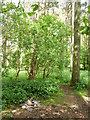
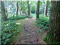
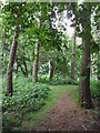
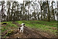
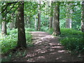
Nearby Images from Geograph Britain and Ireland:
©2009(licence)
©2014(licence)
©2015(licence)
©2017(licence)
©2011(licence)
The above images may not be of the site on this page, they are loaded from Geograph.
Please Submit an Image of this site or go out and take one for us!
Click here to see more info for this site
Nearby sites
Key: Red: member's photo, Blue: 3rd party photo, Yellow: other image, Green: no photo - please go there and take one, Grey: site destroyed
Download sites to:
KML (Google Earth)
GPX (GPS waypoints)
CSV (Garmin/Navman)
CSV (Excel)
To unlock full downloads you need to sign up as a Contributory Member. Otherwise downloads are limited to 50 sites.
Turn off the page maps and other distractions
Nearby sites listing. In the following links * = Image available
1.7km W 259° Maiden Castle (Cumbria) Hillfort (NY451243)
2.2km NNW 338° Dacre Church* Ancient Cross (NY46002664)
2.6km SE 139° Moor Divock Cairns G and H Cairn (NY4851622583)
2.7km SSE 147° Cockpit Cairns* Cairn (NY4826822280)
2.8km SSE 147° The Cockpit* Stone Circle (NY48282224)
2.9km SE 136° Moor Divock 11 Cairn (NY4878522498)
2.9km SE 134° Moor Divock Cairn F Cairn (NY4885422564)
2.9km SE 136° Moor Divock 12 Cairn (NY48782249)
3.0km SE 135° White Raise Cairn* Cairn (NY48882245)
3.0km SE 135° Moor Divock Cairn E Cairn (NY4892522460)
3.0km SE 145° Moor Divock Round Cairns K1, K2 and K3 Round Cairn (NY4853122092)
3.0km SSE 152° Threepow Raise Cairnfield Barrow Cemetery (NY4822221902)
3.0km ESE 123° Riddingleys Top* Cairn (NY49332289)
3.1km SE 125° Hag Stones (Moor Divock) Misc. Earthwork (NY493228)
3.2km SE 133° Askham Fell* Cairn (NY491224)
3.3km SE 134° Askham Fell Stone Row* Stone Row / Alignment (NY4914322307)
3.3km SE 134° Moor Divock 9 Cairn (NY4914122304)
3.3km SSE 149° Threepow Raise Ring Cairn Ring Cairn (NY4847721781)
3.3km SE 136° Moor Divock* Cairn (NY4907122166)
3.3km SE 134° Moor Divock 6, 7 and 8 Cairn (NY49192226)
3.4km ESE 113° Skirsgill Hill* Ancient Village or Settlement (NY4990923267)
3.5km SE 133° Moor Divock Round Cairn D* Cairn (NY4929822204)
3.5km SE 136° Moor Divock* Multiple Stone Rows / Avenue (NY492221)
3.5km SE 133° Moor Divock 5* Cairn (NY4930322183)
3.5km NE 36° Snuff Mill (Stainton)* Standing Stone (Menhir) (NY4890927405)
View more nearby sites and additional images


 We would like to know more about this location. Please feel free to add a brief description and any relevant information in your own language.
 Wir möchten mehr über diese Stätte erfahren. Bitte zögern Sie nicht, eine kurze Beschreibung und relevante Informationen in Deutsch hinzuzufügen.
 Nous aimerions en savoir encore un peu sur les lieux. S'il vous plaît n'hesitez pas à ajouter une courte description et tous les renseignements pertinents dans votre propre langue.
 Quisieramos informarnos un poco más de las lugares. No dude en añadir una breve descripción y otros datos relevantes en su propio idioma.