


<< Text Pages >> Dolmen de Kerarhoet - Burial Chamber or Dolmen in France in Bretagne:Morbihan (56)
Submitted by holger_rix on Friday, 26 February 2016 Page Views: 871
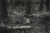
Neolithic and Bronze AgeSite Name: Dolmen de KerarhoetCountry: France
NOTE: This site is 1.828 km away from the location you searched for.
Département: Bretagne:Morbihan (56) Type: Burial Chamber or Dolmen
Nearest Town: Vannes Nearest Village: Arradon
Latitude: 47.637153N Longitude: 2.803776W
Condition:
| 5 | Perfect |
| 4 | Almost Perfect |
| 3 | Reasonable but with some damage |
| 2 | Ruined but still recognisable as an ancient site |
| 1 | Pretty much destroyed, possibly visible as crop marks |
| 0 | No data. |
| -1 | Completely destroyed |
| 5 | Superb |
| 4 | Good |
| 3 | Ordinary |
| 2 | Not Good |
| 1 | Awful |
| 0 | No data. |
| 5 | Can be driven to, probably with disabled access |
| 4 | Short walk on a footpath |
| 3 | Requiring a bit more of a walk |
| 2 | A long walk |
| 1 | In the middle of nowhere, a nightmare to find |
| 0 | No data. |
| 5 | co-ordinates taken by GPS or official recorded co-ordinates |
| 4 | co-ordinates scaled from a detailed map |
| 3 | co-ordinates scaled from a bad map |
| 2 | co-ordinates of the nearest village |
| 1 | co-ordinates of the nearest town |
| 0 | no data |
Be the first person to rate this site - see the 'Contribute!' box in the right hand menu.
Internal Links:
External Links:
Burial Chamber (Dolmen) in Bretagne:Morbihan (56)
Avenue du Ratz, Arradon, Vannes, Morbihan, Brittany
Source: T4T35.fr
You may be viewing yesterday's version of this page. To see the most up to date information please register for a free account.
Do not use the above information on other web sites or publications without permission of the contributor.
Nearby Images from Flickr

The above images may not be of the site on this page, but were taken nearby. They are loaded from Flickr so please click on them for image credits.
Click here to see more info for this site
Nearby sites
Click here to view sites on an interactive map of the areaKey: Red: member's photo, Blue: 3rd party photo, Yellow: other image, Green: no photo - please go there and take one, Grey: site destroyed
Download sites to:
KML (Google Earth)
GPX (GPS waypoints)
CSV (Garmin/Navman)
CSV (Excel)
To unlock full downloads you need to sign up as a Contributory Member. Otherwise downloads are limited to 50 sites.
Turn off the page maps and other distractions
Nearby sites listing. In the following links * = Image available
869m SE 144° Dolmen de Ker Henry* Burial Chamber or Dolmen
933m ENE 67° Dolmen dit Er-Roch Burial Chamber or Dolmen
4.1km ENE 58° Musée d'Archéologie du Morbihan* Museum
5.0km SE 135° Dolmen de l'île de Boëd 2 Burial Chamber or Dolmen
5.3km SE 135° Dolmen de l'île de Boëd 1 Burial Chamber or Dolmen
5.4km SE 126° Gornevez Dolmen* Burial Chamber or Dolmen
5.5km S 177° Dolmen de Pen Raz Burial Chamber or Dolmen
5.5km SSW 201° Menhirs de Brouel Standing Stone (Menhir)
6.3km SW 215° Kergonan Cromlech* Stone Circle
6.5km S 186° Dolmen de la Pointe de Liouse Burial Chamber or Dolmen
6.9km SW 214° Dolmen De Kerno II* Burial Chamber or Dolmen
7.2km SSW 212° Kerno Dolmen* Burial Chamber or Dolmen
7.3km SSW 212° Menhir de Kerno (B)* Standing Stone (Menhir)
7.6km SSW 209° Dolmen de Roh-Vras Burial Chamber or Dolmen
7.7km SSW 211° Menhir de Kerno (A) Standing Stone (Menhir)
8.0km NE 43° Lec'h de la Chapelle Notre-Dame-du-Loc* Standing Stone (Menhir)
8.2km NW 309° Dolmen De Pont-Tiret* Burial Chamber or Dolmen
8.3km NW 308° Megalithe de Tremodec* Standing Stones
8.4km SSW 209° Dolmen de Pen-Hap* Burial Chamber or Dolmen
8.4km NW 317° Allée Couverte dite de Coguer Neguinan* Passage Grave
8.6km NW 313° Allée Couverte de Coët-Sal Passage Grave
8.6km SW 225° Dolmen de la Pointe de Berder* Burial Chamber or Dolmen
9.0km SW 227° Tumulus d'Etal-Berder* Burial Chamber or Dolmen
9.3km SSW 207° Dolmens de Nioul Burial Chamber or Dolmen
9.3km WNW 290° Menhir de Keroyal* Standing Stone (Menhir)
View more nearby sites and additional images


 We would like to know more about this location. Please feel free to add a brief description and any relevant information in your own language.
 Wir möchten mehr über diese Stätte erfahren. Bitte zögern Sie nicht, eine kurze Beschreibung und relevante Informationen in Deutsch hinzuzufügen.
 Nous aimerions en savoir encore un peu sur les lieux. S'il vous plaît n'hesitez pas à ajouter une courte description et tous les renseignements pertinents dans votre propre langue.
 Quisieramos informarnos un poco más de las lugares. No dude en añadir una breve descripción y otros datos relevantes en su propio idioma.