


<< Image Pages >> Reswallie House rock art - Rock Art in Scotland in Angus
Submitted by durhamnature on Wednesday, 26 September 2012 Page Views: 2861
Rock ArtSite Name: Reswallie House rock artCountry: Scotland
NOTE: This site is 1.627 km away from the location you searched for.
County: Angus Type: Rock Art
Nearest Town: Forfar
Map Ref: NO50535154
Latitude: 56.653031N Longitude: 2.808453W
Condition:
| 5 | Perfect |
| 4 | Almost Perfect |
| 3 | Reasonable but with some damage |
| 2 | Ruined but still recognisable as an ancient site |
| 1 | Pretty much destroyed, possibly visible as crop marks |
| 0 | No data. |
| -1 | Completely destroyed |
| 5 | Superb |
| 4 | Good |
| 3 | Ordinary |
| 2 | Not Good |
| 1 | Awful |
| 0 | No data. |
| 5 | Can be driven to, probably with disabled access |
| 4 | Short walk on a footpath |
| 3 | Requiring a bit more of a walk |
| 2 | A long walk |
| 1 | In the middle of nowhere, a nightmare to find |
| 0 | No data. |
| 5 | co-ordinates taken by GPS or official recorded co-ordinates |
| 4 | co-ordinates scaled from a detailed map |
| 3 | co-ordinates scaled from a bad map |
| 2 | co-ordinates of the nearest village |
| 1 | co-ordinates of the nearest town |
| 0 | no data |
Be the first person to rate this site - see the 'Contribute!' box in the right hand menu.
Internal Links:
External Links:
")
Canmore site 34902
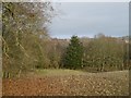
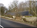
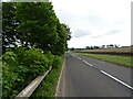
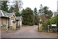
Five stones with rock art, in the grounds of Reswallie House.
You may be viewing yesterday's version of this page. To see the most up to date information please register for a free account.
")
")
")
Do not use the above information on other web sites or publications without permission of the contributor.
Nearby Images from Geograph Britain and Ireland:
©2016(licence)
©2016(licence)
©2021(licence)
©2009(licence)
©2021(licence)
The above images may not be of the site on this page, they are loaded from Geograph.
Please Submit an Image of this site or go out and take one for us!
Click here to see more info for this site
Nearby sites
Key: Red: member's photo, Blue: 3rd party photo, Yellow: other image, Green: no photo - please go there and take one, Grey: site destroyed
Download sites to:
KML (Google Earth)
GPX (GPS waypoints)
CSV (Garmin/Navman)
CSV (Excel)
To unlock full downloads you need to sign up as a Contributory Member. Otherwise downloads are limited to 50 sites.
Turn off the page maps and other distractions
Nearby sites listing. In the following links * = Image available
1.7km WNW 301° Rob's Reed Stone Fort or Dun (NO49065243)
2.2km SSE 150° Dunnichen* Class I Pictish Symbol Stone (NO516496)
2.5km WNW 300° Blackgate of Pitscandlie* Stone Circle (NO484528)
2.7km NE 36° West Mains 1 & 2 (Turin Hill) Rock Art (NO52145369)
2.8km NE 38° Doo'cot Woods (Turin Hill) Rock Art (NO5224953716)
2.9km SE 128° Girdle Stane of Dunnichen* Rock Art (NO5280849737)
2.9km N 360° Carsegownie Cairn* Cairn (NO50565449)
3.2km E 79° Westerton (Aberlemno)* Stone Circle (NO53645210)
4.1km N 0° Finavon* Vitrified Fort (NO506556)
4.2km WNW 300° Baggerton Class I Pictish Symbol Stone (NO469537)
4.6km NNE 21° Aberlemno* Standing Stones (NO52245586)
4.9km WNW 297° Carse Gray* Stone Circle (NO462538)
5.1km W 259° Meffan Institute* Museum (NO45525062)
5.9km SE 128° Dumbarrow Hill Stone Fort or Dun (NO55154791)
8.3km E 100° Guthrie Cursus Cursus (NO587500)
8.8km E 100° Guthrie Cursus Cursus (NO592499)
8.8km SW 228° Mill Of Invereighty Ancient Village or Settlement (NO439457)
8.9km W 274° Balinshoe Standing Stone (Menhir) (NO41645219)
9.0km SSE 153° Carmyllie Hill (Greystone) Cairn (NO545434)
9.5km NE 55° St Murdoch's Well (Brechin) Holy Well or Sacred Spring (NO58405682)
10.2km ESE 101° Kinnell Cursus Cursus (NO605494)
10.3km E 100° Kinnell Cursus Cursus (NO607497)
10.4km E 96° Kinnell Pictish Cross Slab Class III Pictish Cross Slab (NO60885028)
10.4km NNW 347° Ghaist Stone (Fern) Standing Stone (Menhir) (NO48326173)
10.4km W 275° Fletcherfield Standing Stones (NO401525)
View more nearby sites and additional images


 We would like to know more about this location. Please feel free to add a brief description and any relevant information in your own language.
 Wir möchten mehr über diese Stätte erfahren. Bitte zögern Sie nicht, eine kurze Beschreibung und relevante Informationen in Deutsch hinzuzufügen.
 Nous aimerions en savoir encore un peu sur les lieux. S'il vous plaît n'hesitez pas à ajouter une courte description et tous les renseignements pertinents dans votre propre langue.
 Quisieramos informarnos un poco más de las lugares. No dude en añadir una breve descripción y otros datos relevantes en su propio idioma.