

<< Our Photo Pages >> Bryn Rossett - Round Barrow(s) in England in Shropshire
Submitted by postman on Monday, 14 January 2013 Page Views: 2960
Neolithic and Bronze AgeSite Name: Bryn RossettCountry: England
NOTE: This site is 2.078 km away from the location you searched for.
County: Shropshire Type: Round Barrow(s)
Nearest Town: Whitchurch Nearest Village: Little Arowry
Map Ref: SJ46454095
Latitude: 52.963227N Longitude: 2.798693W
Condition:
| 5 | Perfect |
| 4 | Almost Perfect |
| 3 | Reasonable but with some damage |
| 2 | Ruined but still recognisable as an ancient site |
| 1 | Pretty much destroyed, possibly visible as crop marks |
| 0 | No data. |
| -1 | Completely destroyed |
| 5 | Superb |
| 4 | Good |
| 3 | Ordinary |
| 2 | Not Good |
| 1 | Awful |
| 0 | No data. |
| 5 | Can be driven to, probably with disabled access |
| 4 | Short walk on a footpath |
| 3 | Requiring a bit more of a walk |
| 2 | A long walk |
| 1 | In the middle of nowhere, a nightmare to find |
| 0 | No data. |
| 5 | co-ordinates taken by GPS or official recorded co-ordinates |
| 4 | co-ordinates scaled from a detailed map |
| 3 | co-ordinates scaled from a bad map |
| 2 | co-ordinates of the nearest village |
| 1 | co-ordinates of the nearest town |
| 0 | no data |
Internal Links:
External Links:
")
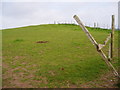
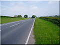
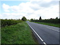
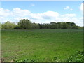
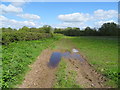
In the angle of two roads the A 525 and the A 539, a footpath goes just meters away from the barrow but it seems wanderers are not welcome. The entry from the road was very overgrown, I almost missed it, and several wooden fences bar progress along the path. I scaled these easily and made my way over to the barrow, whilst keeping low so as not to erk the land owner who apparently has a thing for horses.
You may be viewing yesterday's version of this page. To see the most up to date information please register for a free account.
")
")
")
")
Do not use the above information on other web sites or publications without permission of the contributor.
Nearby Images from Geograph Britain and Ireland:
©2006(licence)
©2006(licence)
©2019(licence)
©2019(licence)
©2019(licence)
The above images may not be of the site on this page, they are loaded from Geograph.
Please Submit an Image of this site or go out and take one for us!
Click here to see more info for this site
Nearby sites
Key: Red: member's photo, Blue: 3rd party photo, Yellow: other image, Green: no photo - please go there and take one, Grey: site destroyed
Download sites to:
KML (Google Earth)
GPX (GPS waypoints)
CSV (Garmin/Navman)
CSV (Excel)
To unlock full downloads you need to sign up as a Contributory Member. Otherwise downloads are limited to 50 sites.
Turn off the page maps and other distractions
Nearby sites listing. In the following links * = Image available
3.1km E 81° Whitewell (St Marys)* Holy Well or Sacred Spring (SJ49484137)
3.2km N 6° Oldcastle* Hillfort (SJ468441)
3.2km ENE 78° Whitewell 1* Round Barrow(s) (SJ49564160)
3.7km ENE 72° Warren Tump (Wrexham)* Round Barrow(s) (SJ49974206)
6.1km SSW 207° Hoar Stone (Welshampton)* Standing Stone (Menhir) (SJ43613550)
6.6km SSW 205° Welshampton Bowl Barrow* Round Barrow(s) (SJ43573499)
7.1km SSE 153° Lady Well (Whixall)* Holy Well or Sacred Spring (SJ496346)
7.5km N 352° Meadows Farm Barrow* Round Barrow(s) (SJ45454834)
10.7km WNW 296° Gerwyn Fechan Cursus (SJ36884584)
12.4km NNE 15° Maiden Castle (Cheshire)* Hillfort (SJ49805286)
12.6km N 359° Carden Park Barrow Round Barrow(s) (SJ46365352)
12.7km N 359° Carden Park* Cave or Rock Shelter (SJ463537)
12.8km SE 141° Soulton Long Barrow* Modern Stone Circle etc (SJ5441330922)
14.3km N 3° St Winefride's (Clutton)* Holy Well or Sacred Spring (SJ47395524)
15.5km WNW 302° Hillbury* Round Barrow(s) (SJ33424939)
15.6km NW 317° Borras Quarry Neolithic Village Ancient Village or Settlement (SJ35855243)
15.7km SSW 213° Gravelpits Wood Burnt Mounds Artificial Mound (SJ376279)
15.8km NNW 340° Churton* Long Barrow (SJ411558)
15.8km WNW 303° Fairy Oak* Round Barrow(s) (SJ33144962)
16.1km NNW 340° Knowl Plantation Barrow Cemetery (SJ410561)
16.3km NW 305° Wrexham County Borough Museum* Museum (SJ3318950455)
16.4km NW 312° Wrexham Gorsedd Circle Modern Stone Circle etc (SJ3436752064)
16.9km WNW 293° Hafod-y-bwch* Round Barrow(s) (SJ309477)
16.9km SW 235° Whittington Castle* Artificial Mound (SJ325313)
17.1km W 279° Offa's Dyke west of Ruabon Misc. Earthwork (SJ29564386)
View more nearby sites and additional images

")
 We would like to know more about this location. Please feel free to add a brief description and any relevant information in your own language.
 Wir möchten mehr über diese Stätte erfahren. Bitte zögern Sie nicht, eine kurze Beschreibung und relevante Informationen in Deutsch hinzuzufügen.
 Nous aimerions en savoir encore un peu sur les lieux. S'il vous plaît n'hesitez pas à ajouter une courte description et tous les renseignements pertinents dans votre propre langue.
 Quisieramos informarnos un poco más de las lugares. No dude en añadir una breve descripción y otros datos relevantes en su propio idioma.