


<< Our Photo Pages >> Great House Camp - Hillfort in Wales in Monmouthshire
Submitted by vicky on Sunday, 21 July 2002 Page Views: 8760
Iron Age and Later PrehistorySite Name: Great House CampCountry: Wales
NOTE: This site is 1.36 km away from the location you searched for.
County: Monmouthshire Type: Hillfort
Nearest Town: Usk Nearest Village: Llangwm
Map Ref: SO432033 Landranger Map Number: 171
Latitude: 51.725528N Longitude: 2.823742W
Condition:
| 5 | Perfect |
| 4 | Almost Perfect |
| 3 | Reasonable but with some damage |
| 2 | Ruined but still recognisable as an ancient site |
| 1 | Pretty much destroyed, possibly visible as crop marks |
| 0 | No data. |
| -1 | Completely destroyed |
| 5 | Superb |
| 4 | Good |
| 3 | Ordinary |
| 2 | Not Good |
| 1 | Awful |
| 0 | No data. |
| 5 | Can be driven to, probably with disabled access |
| 4 | Short walk on a footpath |
| 3 | Requiring a bit more of a walk |
| 2 | A long walk |
| 1 | In the middle of nowhere, a nightmare to find |
| 0 | No data. |
| 5 | co-ordinates taken by GPS or official recorded co-ordinates |
| 4 | co-ordinates scaled from a detailed map |
| 3 | co-ordinates scaled from a bad map |
| 2 | co-ordinates of the nearest village |
| 1 | co-ordinates of the nearest town |
| 0 | no data |
Be the first person to rate this site - see the 'Contribute!' box in the right hand menu.
Internal Links:
External Links:
I have visited· I would like to visit
oldman visited on 25th Apr 2019 - their rating: Cond: 3 Amb: 4 Access: 3 We thought at first that we would not be able to get to view the fort as there is no path indicated on the OS map and the Great House seems to be very private. However when we parked nearby we found that there is actually a marked (in Welsh) footpath which passes by two sides of the fort. There is a high hedge along most of the path but one access point into the area of the set of four ditches and mounds. The main area of the fort is not accessible and used for grazing cows. The rings are however quite impressive.
Andy B have visited here
")
Have you visited this site? Please add a comment below.
You may be viewing yesterday's version of this page. To see the most up to date information please register for a free account.
")
")
Do not use the above information on other web sites or publications without permission of the contributor.
coldrum has found this location on Google Street View:
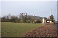
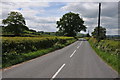
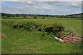
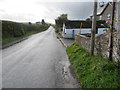
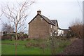
Nearby Images from Geograph Britain and Ireland:
©2006(licence)
©2011(licence)
©2011(licence)
©2016(licence)
©2006(licence)
The above images may not be of the site on this page, they are loaded from Geograph.
Please Submit an Image of this site or go out and take one for us!
Click here to see more info for this site
Nearby sites
Key: Red: member's photo, Blue: 3rd party photo, Yellow: other image, Green: no photo - please go there and take one, Grey: site destroyed
Download sites to:
KML (Google Earth)
GPX (GPS waypoints)
CSV (Garmin/Navman)
CSV (Excel)
To unlock full downloads you need to sign up as a Contributory Member. Otherwise downloads are limited to 50 sites.
Turn off the page maps and other distractions
Nearby sites listing. In the following links * = Image available
2.3km SSW 199° Earthwork Misc. Earthwork (SO424011)
3.6km WSW 256° Gwehelog Fawr Ancient Village or Settlement (SO397025)
3.6km S 187° Camp Farm* Misc. Earthwork (ST427997)
3.9km SSE 154° Cwrt-Y-Gaer Misc. Earthwork (ST449998)
4.7km NNW 336° Raglan Cross* Ancient Cross (SO4134007660)
4.8km SSE 169° Gaer Fawr (Monmouthshire) Hillfort (ST441986)
5.4km W 275° Llancayo Camp* Hillfort (SO37830383)
5.8km S 186° Golden Hill Earthwork Hillfort (ST42579753)
6.1km E 85° Gaer (Trellech)* Hillfort (SO493038)
6.2km NW 318° Camp Hill Bryngwyn Ancient Village or Settlement (SO391079)
6.6km WSW 239° Twyn Bell Camp Ancient Village or Settlement (SO375000)
6.7km SSE 166° y Garn Llwyd* Chambered Tomb (ST44769674)
7.0km ENE 74° Harolds Stones* Stone Row / Alignment (SO49930514)
7.0km ESE 106° Trellech United Standing Stone (Menhir) (SO499013)
7.2km ENE 72° Trelleck Churchyard Cross* Ancient Cross (SO5004605466)
7.3km ENE 75° Virtuous Well* Holy Well or Sacred Spring (SO50300509)
7.3km W 278° Trostrey Stone Circle (SO35950435)
7.5km WNW 297° Coed y Bwynydd Camp* Hillfort (SO36500680)
7.6km W 265° Llancayo Barrow Cemetery* Barrow Cemetery (SO356027)
8.3km SE 134° Chepstow Park Wood Cairn Cairn (ST491975)
8.6km SW 216° Llangybi Bottom Stone* Standing Stone (Menhir) (ST38049638)
8.8km SW 220° St Cybi's Well (Llangybi)* Holy Well or Sacred Spring (ST3744796662)
8.9km S 189° Llanvaches 1* Round Barrow(s) (ST41699455)
8.9km S 189° Llanvaches 2* Round Barrow(s) (ST41669455)
9.1km ESE 105° Tintern 2* Round Barrow(s) (SO5197000913)
View more nearby sites and additional images


 We would like to know more about this location. Please feel free to add a brief description and any relevant information in your own language.
 Wir möchten mehr über diese Stätte erfahren. Bitte zögern Sie nicht, eine kurze Beschreibung und relevante Informationen in Deutsch hinzuzufügen.
 Nous aimerions en savoir encore un peu sur les lieux. S'il vous plaît n'hesitez pas à ajouter une courte description et tous les renseignements pertinents dans votre propre langue.
 Quisieramos informarnos un poco más de las lugares. No dude en añadir una breve descripción y otros datos relevantes en su propio idioma.