

<< Our Photo Pages >> Bride's Well (Stapleton) - Holy Well or Sacred Spring in England in Cumbria
Submitted by Anne T on Friday, 25 August 2017 Page Views: 1918
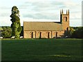
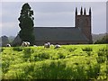
Springs and Holy WellsSite Name: Bride's Well (Stapleton) Alternative Name: St. Mary's Church (Stapleton)Country: England
NOTE: This site is 2.924 km away from the location you searched for.
County: Cumbria Type: Holy Well or Sacred Spring
Nearest Town: Brampton Nearest Village: Stapleton
Map Ref: NY50397119
Latitude: 55.032744N Longitude: 2.777689W
Condition:
| 5 | Perfect |
| 4 | Almost Perfect |
| 3 | Reasonable but with some damage |
| 2 | Ruined but still recognisable as an ancient site |
| 1 | Pretty much destroyed, possibly visible as crop marks |
| 0 | No data. |
| -1 | Completely destroyed |
| 5 | Superb |
| 4 | Good |
| 3 | Ordinary |
| 2 | Not Good |
| 1 | Awful |
| 0 | No data. |
| 5 | Can be driven to, probably with disabled access |
| 4 | Short walk on a footpath |
| 3 | Requiring a bit more of a walk |
| 2 | A long walk |
| 1 | In the middle of nowhere, a nightmare to find |
| 0 | No data. |
| 5 | co-ordinates taken by GPS or official recorded co-ordinates |
| 4 | co-ordinates scaled from a detailed map |
| 3 | co-ordinates scaled from a bad map |
| 2 | co-ordinates of the nearest village |
| 1 | co-ordinates of the nearest town |
| 0 | no data |
Internal Links:
External Links:
I have visited· I would like to visit
Anne T visited on 20th Aug 2017 - their rating: Cond: -1 Access: 4 Bride's Well, Stapleton: Now underneath a fallen tree? Having had to run away from this site to collect our cats from the vets after a very brief search for the well last Thursday, we went back armed with the GPS and OS map and found we’d been looking in the wrong direction.
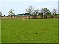
I’d seen a set of stile leading down to the meadow from the eastern side of the church yard so we found these. They led down to the meadow and the burn running north-south through the field, although they were completely overgrown by nettles. Whilst there were only two small steps on the church yard side, there were around 8 going down into the field below.
We walked round and round and the only feature we could see at the exact grid reference given by Pastscape was this fallen tree. Has the well been destroyed? We had a good look round all along the stream in this field.
I sent an email to the Rector when I got home, and received the reply below. She thinks the well might be in the field behind the rectory, which is above the church, and will check and send an update.
 (PID:169682)")
The holy well is described as a natural spring covered by a small stone well house in Pastscape Monument No. 13085, which goes onto add that "the well ... was confirmed by the Rector of Stapleton as the traditional 'Bride's Well'.
We'd tried to find this well the previous week but run out of time, so went back armed with a GPS and the OS Map.
At the position given by Pastscape (and as described in the church guide), we only found a large wind-fallen tree. We couldn't see any signs of a structure, although the ground above the grid reference was boggy and covered in marran grass, as if a spring was rising up out of the ground and running down into the beck below.
Just to confirm the actual location of the well, I sent an email to the Rector. He has just retired, but one of the church wardens replied and said she believes the well is in a field behind the vicarage, higher up the hill from the church. She is going to ask the rector and someone who has lived in the village all their lives and get back to me with an update.
You may be viewing yesterday's version of this page. To see the most up to date information please register for a free account.
Do not use the above information on other web sites or publications without permission of the contributor.
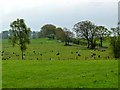
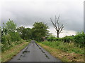
Nearby Images from Geograph Britain and Ireland:
©2007(licence)
©2007(licence)
©2011(licence)
©2011(licence)
©2010(licence)
The above images may not be of the site on this page, they are loaded from Geograph.
Please Submit an Image of this site or go out and take one for us!
Click here to see more info for this site
Nearby sites
Key: Red: member's photo, Blue: 3rd party photo, Yellow: other image, Green: no photo - please go there and take one, Grey: site destroyed
Download sites to:
KML (Google Earth)
GPX (GPS waypoints)
CSV (Garmin/Navman)
CSV (Excel)
To unlock full downloads you need to sign up as a Contributory Member. Otherwise downloads are limited to 50 sites.
Turn off the page maps and other distractions
Nearby sites listing. In the following links * = Image available
5.2km E 97° Askerton Park* Ancient Village or Settlement (NY55567053)
5.9km NW 318° Holywell (Catlowdy)* Holy Well or Sacred Spring (NY4649175570)
5.9km NW 316° Solport Holy Well (Catlowdy) Holy Well or Sacred Spring (NY4637075490)
6.7km ENE 75° Towerbrae Cairn* Cairn (NY56867282)
6.7km E 93° Gillalees Ring Cairn (NY571708)
6.9km SSE 164° St Mary's Church (Walton)* Ancient Cross (NY5220864492)
7.0km ENE 61° Bewcastle Cross* Ancient Cross (NY5653574550)
7.0km ENE 61° Priest's Well (Bewcastle)* Holy Well or Sacred Spring (NY56607454)
7.3km E 86° Robin Hood's Well (Askerton) Holy Well or Sacred Spring (NY57677161)
7.3km NW 320° Priest's Well (Catlowdy)* Holy Well or Sacred Spring (NY4573976887)
7.7km NE 49° Hobbie Nobles Well (Bewcastle) Holy Well or Sacred Spring (NY5624076200)
8.6km NE 53° Grey Hill Settlement Ancient Village or Settlement (NY57317626)
8.6km ENE 70° Woodhead Round Cairn* Round Cairn (NY58507402)
8.8km S 177° Irthington Mill* Misc. Earthwork (NY50776237)
9.2km SSW 195° Chapel Well (Irthington) Holy Well or Sacred Spring (NY4791062345)
9.5km ESE 107° Waterhead Holy Well (King Water)* Holy Well or Sacred Spring (NY5951068340)
9.5km SE 132° Banks East Ancient Village or Settlement (NY574647)
9.6km S 182° Hall Well (Irthington)* Holy Well or Sacred Spring (NY4992361627)
9.7km S 182° Irthington Motte* Misc. Earthwork (NY49936151)
10.3km SSE 163° Brampton Castle Mound and Well* Misc. Earthwork (NY5333261284)
10.8km W 272° Castra Exploratorum Ancient Village or Settlement (NY39607160)
11.3km W 273° St Andrew's Well (Kirkandrews-on-Esk) Holy Well or Sacred Spring (NY3913071970)
12.0km W 279° Scots' Dike* Misc. Earthwork (NY38507325)
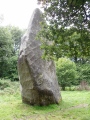
12.2km NNW 346° Will O'Greena's Stane* Standing Stone (Menhir) (NY47578303)
12.9km WSW 254° Arthuret Church cross* Ancient Cross (NY37936766)
View more nearby sites and additional images


 We would like to know more about this location. Please feel free to add a brief description and any relevant information in your own language.
 Wir möchten mehr über diese Stätte erfahren. Bitte zögern Sie nicht, eine kurze Beschreibung und relevante Informationen in Deutsch hinzuzufügen.
 Nous aimerions en savoir encore un peu sur les lieux. S'il vous plaît n'hesitez pas à ajouter une courte description et tous les renseignements pertinents dans votre propre langue.
 Quisieramos informarnos un poco más de las lugares. No dude en añadir una breve descripción y otros datos relevantes en su propio idioma.