


<< Our Photo Pages >> Stannin Steens O Strathbogie - Class I Pictish Symbol Stone in Scotland in Aberdeenshire
Submitted by thewonderer on Sunday, 25 April 2004 Page Views: 4761
Early Medieval (Dark Age)Site Name: Stannin Steens O StrathbogieCountry: Scotland
NOTE: This site is 0.385 km away from the location you searched for.
County: Aberdeenshire Type: Class I Pictish Symbol Stone
Nearest Town: Huntly
Map Ref: NJ529399 Landranger Map Number: 29
Latitude: 57.446954N Longitude: 2.786406W
Condition:
| 5 | Perfect |
| 4 | Almost Perfect |
| 3 | Reasonable but with some damage |
| 2 | Ruined but still recognisable as an ancient site |
| 1 | Pretty much destroyed, possibly visible as crop marks |
| 0 | No data. |
| -1 | Completely destroyed |
| 5 | Superb |
| 4 | Good |
| 3 | Ordinary |
| 2 | Not Good |
| 1 | Awful |
| 0 | No data. |
| 5 | Can be driven to, probably with disabled access |
| 4 | Short walk on a footpath |
| 3 | Requiring a bit more of a walk |
| 2 | A long walk |
| 1 | In the middle of nowhere, a nightmare to find |
| 0 | No data. |
| 5 | co-ordinates taken by GPS or official recorded co-ordinates |
| 4 | co-ordinates scaled from a detailed map |
| 3 | co-ordinates scaled from a bad map |
| 2 | co-ordinates of the nearest village |
| 1 | co-ordinates of the nearest town |
| 0 | no data |
Internal Links:
External Links:
")
The STANNIN STEENS O STRATHBOGIE comprise of two stones - one is a Pictish symbol stone though the horseshoe carving which once appeared upon it has disappeared. It is believed that the two stones were formerly part of a stone circle. So the Square was an important place even in Bronze Age times.
You may be viewing yesterday's version of this page. To see the most up to date information please register for a free account.
Do not use the above information on other web sites or publications without permission of the contributor.
coldrum has found this location on Google Street View:
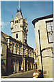
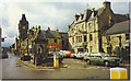
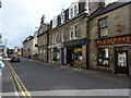
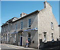
Nearby Images from Geograph Britain and Ireland:
©2005(licence)
©2006(licence)
©2011(licence)
©2017(licence)
©2015(licence)
The above images may not be of the site on this page, they are loaded from Geograph.
Please Submit an Image of this site or go out and take one for us!
Click here to see more info for this site
Nearby sites
Key: Red: member's photo, Blue: 3rd party photo, Yellow: other image, Green: no photo - please go there and take one, Grey: site destroyed
Download sites to:
KML (Google Earth)
GPX (GPS waypoints)
CSV (Garmin/Navman)
CSV (Excel)
To unlock full downloads you need to sign up as a Contributory Member. Otherwise downloads are limited to 50 sites.
Turn off the page maps and other distractions
Nearby sites listing. In the following links * = Image available
nankm 0° Huntly Stone Circle (NJ529399)
1.3km E 81° Battle Hill Dolmen Cairn (NJ542401)
4.0km SSW 195° Hill Of Bucharn Stone Circle (NJ518360)
4.6km E 86° Gerrieswells Long Barrow (NJ575402)
4.9km W 268° Bowman Hillock* Stone Circle (NJ480398)
5.7km N 1° Arnhill* Stone Circle (NJ531456)
6.4km ESE 110° Stonyfield* Stone Circle (NJ589376)
6.8km WNW 296° Gingomyres Stone Circle (NJ46794294)
7.1km N 360° Tillytarmont 2* Class I Pictish Symbol Stone (NJ52974705)
7.3km N 11° Kimmonity Stone Circle (NJ54394707)
7.4km NE 49° Westertown* Stone Circle (NJ58594467)
8.7km ENE 69° Frendraught* Stone Circle (NJ6110442869)
9.1km NNE 13° Rothiemay* Stone Circle (NJ55084872)
9.3km NE 50° Yonder Bognie* Stone Circle (NJ601458)
9.6km S 177° Candy* Stone Circle (NJ533303)
9.7km ENE 67° Raich Stone Circle* Stone Circle (NJ6187543655)
9.9km S 173° Leith Hall* Class I Pictish Symbol Stone (NJ540300)
10.0km S 173° Newbigging Leslie Class I Pictish Symbol Stone (NJ53992998)
10.3km SSE 158° Wardhouse Ancient Village or Settlement (NJ567303)
10.6km WSW 258° Nether Dumeath* Stone Circle (NJ425378)
11.0km ENE 61° Conwath Stone (Inverkeithny) Standing Stone (Menhir) (NJ62654507)
11.3km ESE 106° Hillhead (Forgue) Stone Circle (NJ638367)
11.5km SSW 202° Tap o'Noth* Hillfort (NJ484293)
12.1km SE 144° Candle Hill* Stone Circle (NJ59912997)
12.2km SW 220° Wormy Hillock* Henge (NJ449307)
View more nearby sites and additional images


 We would like to know more about this location. Please feel free to add a brief description and any relevant information in your own language.
 Wir möchten mehr über diese Stätte erfahren. Bitte zögern Sie nicht, eine kurze Beschreibung und relevante Informationen in Deutsch hinzuzufügen.
 Nous aimerions en savoir encore un peu sur les lieux. S'il vous plaît n'hesitez pas à ajouter une courte description et tous les renseignements pertinents dans votre propre langue.
 Quisieramos informarnos un poco más de las lugares. No dude en añadir una breve descripción y otros datos relevantes en su propio idioma.