<< Our Photo Pages >> Castleton (Newcastleton) - Ancient Cross in Scotland in Scottish Borders
Submitted by Anne T on Friday, 30 June 2017 Page Views: 3640
Early Medieval (Dark Age)Site Name: Castleton (Newcastleton) Alternative Name: Old CastletonCountry: Scotland County: Scottish Borders Type: Ancient Cross
Nearest Town: Newcastleton Nearest Village: Old Castleton
Map Ref: NY51108983
Latitude: 55.200298N Longitude: 2.769797W
Condition:
| 5 | Perfect |
| 4 | Almost Perfect |
| 3 | Reasonable but with some damage |
| 2 | Ruined but still recognisable as an ancient site |
| 1 | Pretty much destroyed, possibly visible as crop marks |
| 0 | No data. |
| -1 | Completely destroyed |
| 5 | Superb |
| 4 | Good |
| 3 | Ordinary |
| 2 | Not Good |
| 1 | Awful |
| 0 | No data. |
| 5 | Can be driven to, probably with disabled access |
| 4 | Short walk on a footpath |
| 3 | Requiring a bit more of a walk |
| 2 | A long walk |
| 1 | In the middle of nowhere, a nightmare to find |
| 0 | No data. |
| 5 | co-ordinates taken by GPS or official recorded co-ordinates |
| 4 | co-ordinates scaled from a detailed map |
| 3 | co-ordinates scaled from a bad map |
| 2 | co-ordinates of the nearest village |
| 1 | co-ordinates of the nearest town |
| 0 | no data |
Internal Links:
External Links:
I have visited· I would like to visit
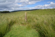
Anne T visited on 24th Jun 2017 - their rating: Cond: 1 Amb: 4 Access: 5 Castleton Cross, Near Newcastleton: Whilst this cross can be seen from the road, it is best viewed from the field (gate opposite the cemetery, otherwise its a clamber over a barbed wire fence in boggy ground). The shaft is a modern replacement, made of concrete. The field contains many lumps and bumps - the remains of the old village. This spot is virtually opposite Old Castleton earthworks (Liddel Castle) and with the enigmatic cemetery with its strange grave markers and brilliant views, it was well worth the stop. Shame the road was so busy at this time on night; cars whizzed by at 60 mph at regular intervals. Not the safest place to walk.
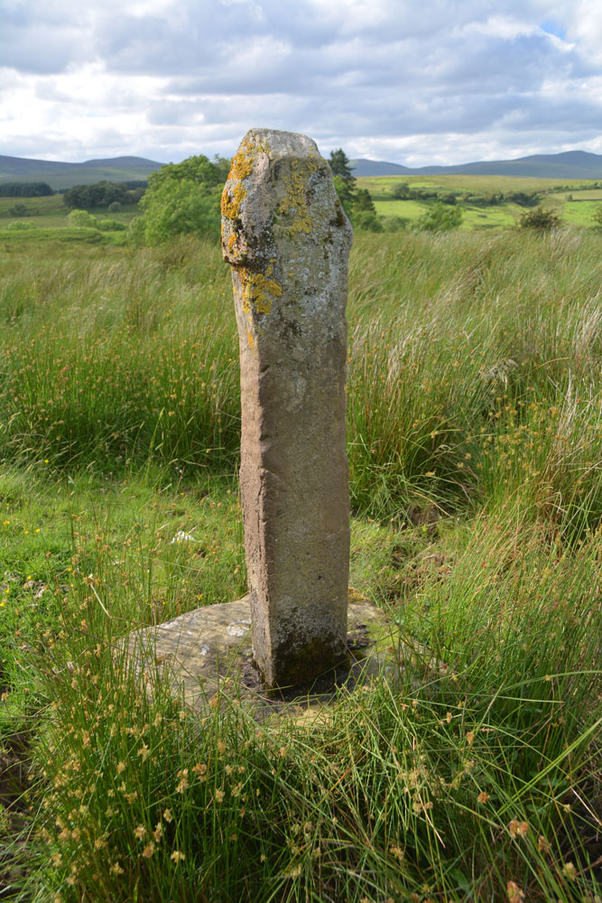
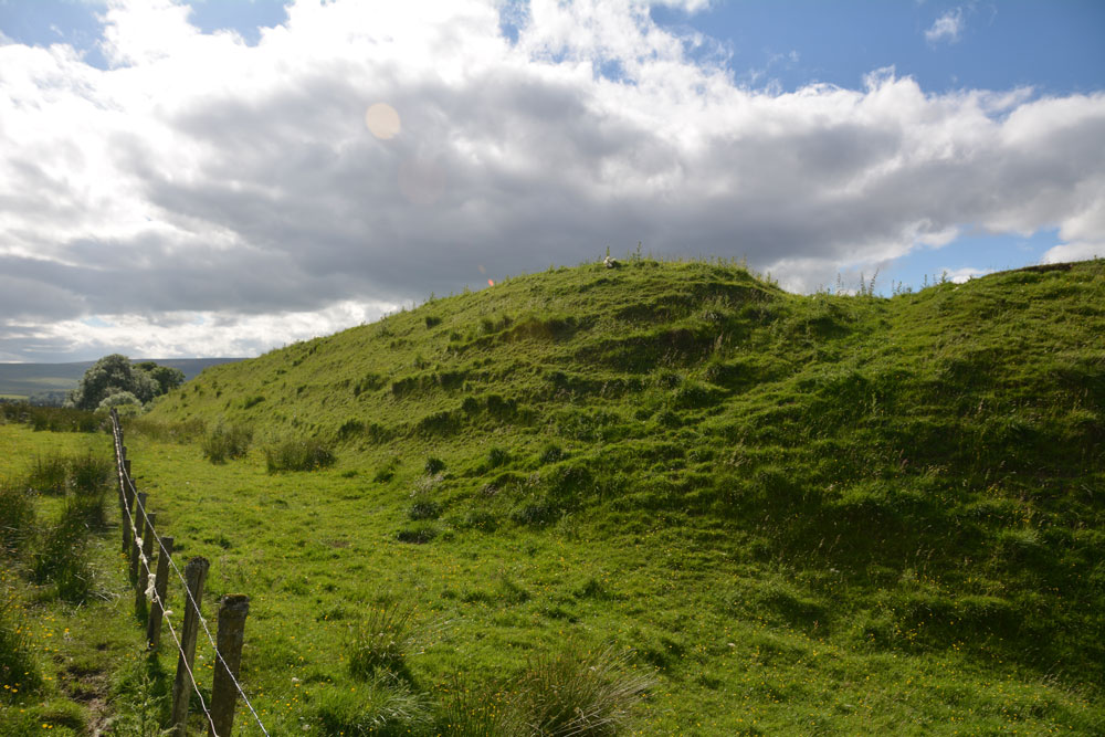
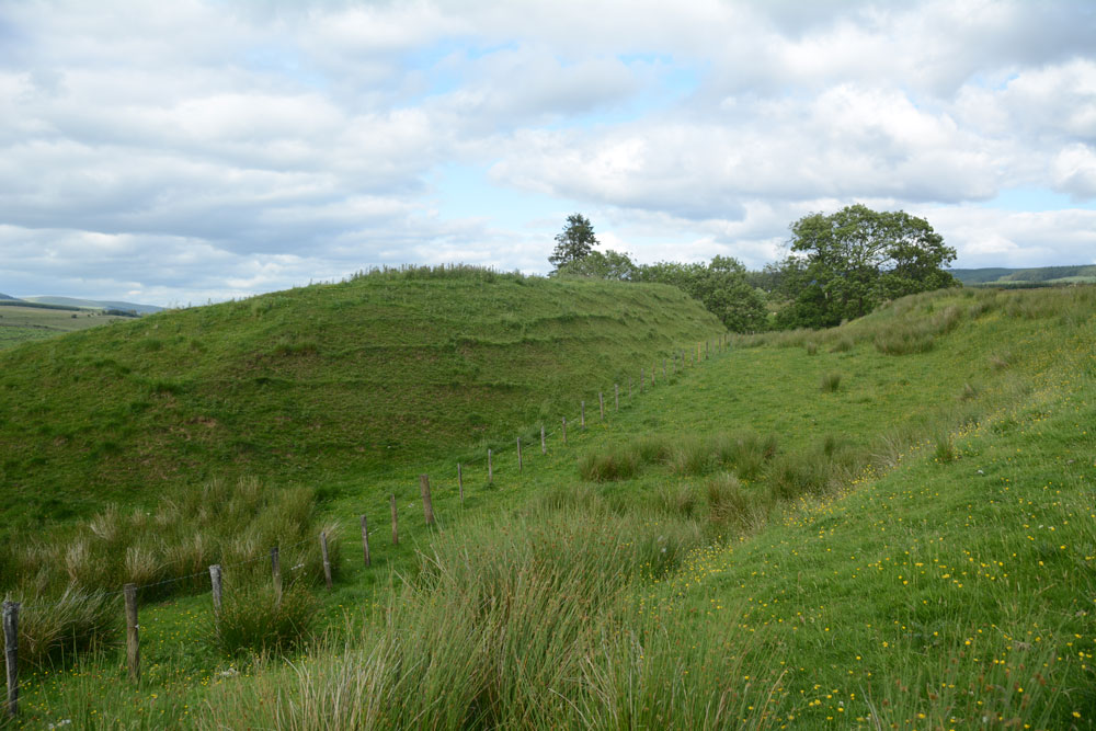
This badly damaged cross sits in rough pastures towards the edge of a field at Old Castleton, just over 150 metres from the south east edge of the Liddel Castle/Old Castleton earthworks. The cross can be seen from the road, although if you venture into the field to take a closer look, the gate is opposite the cemetery just down the B6357 to the west.
The cross is recorded as Canmore ID 96376 which says a "pseudo-antique concrete shaft has recently been set up in the original socket. This is the base of the market cross of the ancient village of Castleton, which stood in its immediate vicinity." The cross stands on a small bank and various 'lumps and bumps' of the remains of the village can be seen around it.
As St. Martin's church was granted by David I to Jedburgh Abbey in around 1147, it must have established well beforehand, so instinct says this might have been the site of a preaching cross. St. Martin's was demolished in 1808 to make way for a new parish church; all the remains is the graveyard with its interesting grave markers.
With the strange and enigmatic cemetery of St. Martin 200 metres away and the earthworks of Liddel/Old Castleton Castle nearby, this is a spot with views and worth taking the time to stop and appreciate the history. [Note: St. Martin's church was granted by David I to Jedburgh Abbey in around 1147, so must have existed well beforehand, but it demolished in 1808 to make way for a new parish church; all the remains is the graveyard with its interesting grave markers).
You may be viewing yesterday's version of this page. To see the most up to date information please register for a free account.

Do not use the above information on other web sites or publications without permission of the contributor.
Click here to see more info for this site
Nearby sites
Key: Red: member's photo, Blue: 3rd party photo, Yellow: other image, Green: no photo - please go there and take one, Grey: site destroyed
Download sites to:
KML (Google Earth)
GPX (GPS waypoints)
CSV (Garmin/Navman)
CSV (Excel)
To unlock full downloads you need to sign up as a Contributory Member. Otherwise downloads are limited to 50 sites.
Turn off the page maps and other distractions
Nearby sites listing. In the following links * = Image available
191m NW 317° Old Castleton (Newcastleton)* Misc. Earthwork (NY50978997)
5.1km SW 222° Milnholm (Newcastleton)* Ancient Cross (NY4763986111)
5.8km SSW 200° Carby Hill* Ancient Village or Settlement (NY4906084360)
6.4km N 354° The Buck Stone (Buckstone Rig)* Standing Stone (Menhir) (NY50509622)
7.5km N 5° Ninestanes Rig* Stone Circle (NY51809731)
7.7km SSW 207° Will O'Greena's Stane* Standing Stone (Menhir) (NY47578303)
9.1km WSW 241° Tinnis Hill* Cairn (NY43098545)
9.2km WSW 239° Tinnis Well* Holy Well or Sacred Spring (NY431852)
10.0km SW 233° Windy Edge Stone Stone Circle (NY43048389)
10.1km SW 233° Windy Edge* Chambered Cairn (NY42958391)
10.1km SW 233° Windy Edge* Chambered Cairn (NY429839)
11.1km NE 39° Caddrounburn Calvert* Ancient Village or Settlement (NY58199836)
13.4km ENE 76° Devil's Lapful* Long Barrow (NY6419392866)
14.0km SSW 202° Priest's Well (Catlowdy)* Holy Well or Sacred Spring (NY4573976887)
14.6km SSE 159° Hobbie Nobles Well (Bewcastle) Holy Well or Sacred Spring (NY5624076200)
14.6km ENE 68° Gibbie's Knowe (Kielder)* Ancient Village or Settlement (NY6474595077)
14.9km SSE 155° Grey Hill Settlement Ancient Village or Settlement (NY57317626)
15.0km SSW 197° Holywell (Catlowdy)* Holy Well or Sacred Spring (NY4649175570)
15.1km SSW 198° Solport Holy Well (Catlowdy) Holy Well or Sacred Spring (NY4637075490)
15.9km W 262° Barntalloch (Langholm)* Misc. Earthwork (NY35258776)
16.2km SSE 160° Bewcastle Cross* Ancient Cross (NY5653574550)
16.2km SSE 160° Priest's Well (Bewcastle)* Holy Well or Sacred Spring (NY56607454)
16.5km NE 49° The Kielder Stone* Natural Stone / Erratic / Other Natural Feature (NT63690050)
16.6km NNW 346° The Dod* Ancient Village or Settlement (NT47260600)
16.8km NW 307° Wrangway Burn* Rock Art (NT377001)
View more nearby sites and additional images



 We would like to know more about this location. Please feel free to add a brief description and any relevant information in your own language.
 Wir möchten mehr über diese Stätte erfahren. Bitte zögern Sie nicht, eine kurze Beschreibung und relevante Informationen in Deutsch hinzuzufügen.
 Nous aimerions en savoir encore un peu sur les lieux. S'il vous plaît n'hesitez pas à ajouter une courte description et tous les renseignements pertinents dans votre propre langue.
 Quisieramos informarnos un poco más de las lugares. No dude en añadir una breve descripción y otros datos relevantes en su propio idioma.