

<< Our Photo Pages >> Rough Hill Round Cairn - Round Cairn in England in Cumbria
Submitted by MonumentMan on Wednesday, 29 July 2020 Page Views: 484
Neolithic and Bronze AgeSite Name: Rough Hill Round CairnCountry: England
NOTE: This site is 0.977 km away from the location you searched for.
County: Cumbria Type: Round Cairn
Nearest Town: Penrith Nearest Village: Helton
Map Ref: NY4994219544
Latitude: 54.568627N Longitude: 2.775755W
Condition:
| 5 | Perfect |
| 4 | Almost Perfect |
| 3 | Reasonable but with some damage |
| 2 | Ruined but still recognisable as an ancient site |
| 1 | Pretty much destroyed, possibly visible as crop marks |
| 0 | No data. |
| -1 | Completely destroyed |
| 5 | Superb |
| 4 | Good |
| 3 | Ordinary |
| 2 | Not Good |
| 1 | Awful |
| 0 | No data. |
| 5 | Can be driven to, probably with disabled access |
| 4 | Short walk on a footpath |
| 3 | Requiring a bit more of a walk |
| 2 | A long walk |
| 1 | In the middle of nowhere, a nightmare to find |
| 0 | No data. |
| 5 | co-ordinates taken by GPS or official recorded co-ordinates |
| 4 | co-ordinates scaled from a detailed map |
| 3 | co-ordinates scaled from a bad map |
| 2 | co-ordinates of the nearest village |
| 1 | co-ordinates of the nearest town |
| 0 | no data |
Internal Links:
External Links:
")
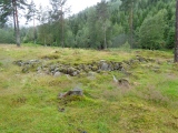
At least one larger boulder is found on the southern edge of the cairn. It is possible the cairn has been excavated/disturbed and added to by field clearance in the past.
This is a link
You may be viewing yesterday's version of this page. To see the most up to date information please register for a free account.
")
")
Do not use the above information on other web sites or publications without permission of the contributor.
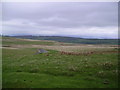
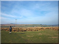
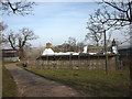
Nearby Images from Geograph Britain and Ireland:
©2006(licence)
©2015(licence)
©2015(licence)
©2013(licence)
©2019(licence)
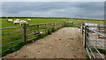
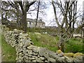
The above images may not be of the site on this page, they are loaded from Geograph.
Please Submit an Image of this site or go out and take one for us!
Click here to see more info for this site
Nearby sites
Key: Red: member's photo, Blue: 3rd party photo, Yellow: other image, Green: no photo - please go there and take one, Grey: site destroyed
Download sites to:
KML (Google Earth)
GPX (GPS waypoints)
CSV (Garmin/Navman)
CSV (Excel)
To unlock full downloads you need to sign up as a Contributory Member. Otherwise downloads are limited to 50 sites.
Turn off the page maps and other distractions
Nearby sites listing. In the following links * = Image available
467m WSW 253° Rough Hill Tarn Stone Row/Alignment* Stone Row / Alignment (NY4949219413)
833m N 357° Heltondale Tumulus* Round Cairn (NY4990420377)
1.7km SSW 198° Towtop Kirk* Ancient Village or Settlement (NY494179)
2.1km N 350° Cop Stone* Standing Stone (Menhir) (NY49602160)
2.2km NNW 342° Moor Divock Cairn* Cairn (NY493216)
2.3km NNW 348° Moor Divock 2* Standing Stones (NY49472183)
2.4km N 351° Askham Fell Round Cairn A Round Cairn (NY4958021879)
2.4km N 350° Askham Fell Round Cairn B Round Cairn (NY4956621935)
2.4km NNW 346° Moor Divock 3* Cairn (NY4936921917)
2.5km NNW 347° Askham Fell Cairn Stone Row* Stone Row / Alignment (NY4940321951)
2.5km NNW 347° Moor Divock 4* Stone Circle (NY49402196)
2.5km NNW 345° Moor Divock carved stone* Rock Art (NY493220)
2.6km NNW 347° Moor Divock 4 to 5 Stone Avenue Stone Row / Alignment (NY4937322033)
2.6km S 186° Drybarrows Stone Row/Alignment* Stone Row / Alignment (NY4962016958)
2.7km NNW 343° Moor Divock* Multiple Stone Rows / Avenue (NY492221)
2.7km NW 326° Threepow Raise Ring Cairn Ring Cairn (NY4847721781)
2.7km NNW 346° Moor Divock Round Cairn C Cairn (NY4933022158)
2.7km NNW 346° Moor Divock 5* Cairn (NY4930322183)
2.7km ESE 118° Bampton Grange Cross* Ancient Cross (NY5232218227)
2.7km NNW 346° Moor Divock Round Cairn D* Cairn (NY4929822204)
2.8km NNW 341° Moor Divock* Cairn (NY4907122166)
2.8km NNE 25° Mark's Well (Helton)* Holy Well or Sacred Spring (NY5114222090)
2.8km NNW 344° Moor Divock 6, 7 and 8 Cairn (NY49192226)
2.9km NNW 343° Moor Divock 9 Cairn (NY4914122304)
2.9km NNW 343° Askham Fell Stone Row* Stone Row / Alignment (NY4914322307)
View more nearby sites and additional images


 We would like to know more about this location. Please feel free to add a brief description and any relevant information in your own language.
 Wir möchten mehr über diese Stätte erfahren. Bitte zögern Sie nicht, eine kurze Beschreibung und relevante Informationen in Deutsch hinzuzufügen.
 Nous aimerions en savoir encore un peu sur les lieux. S'il vous plaît n'hesitez pas à ajouter une courte description et tous les renseignements pertinents dans votre propre langue.
 Quisieramos informarnos un poco más de las lugares. No dude en añadir una breve descripción y otros datos relevantes en su propio idioma.