


<< Our Photo Pages >> Westbury Camp - Hillfort in England in Somerset
Submitted by ermine on Sunday, 22 October 2023 Page Views: 121
Iron Age and Later PrehistorySite Name: Westbury CampCountry: England
NOTE: This site is 0.373 km away from the location you searched for.
County: Somerset Type: Hillfort
Nearest Town: Wells Nearest Village: Rodney Stoke
Map Ref: ST49205112
Latitude: 51.256968N Longitude: 2.729355W
Condition:
| 5 | Perfect |
| 4 | Almost Perfect |
| 3 | Reasonable but with some damage |
| 2 | Ruined but still recognisable as an ancient site |
| 1 | Pretty much destroyed, possibly visible as crop marks |
| 0 | No data. |
| -1 | Completely destroyed |
| 5 | Superb |
| 4 | Good |
| 3 | Ordinary |
| 2 | Not Good |
| 1 | Awful |
| 0 | No data. |
| 5 | Can be driven to, probably with disabled access |
| 4 | Short walk on a footpath |
| 3 | Requiring a bit more of a walk |
| 2 | A long walk |
| 1 | In the middle of nowhere, a nightmare to find |
| 0 | No data. |
| 5 | co-ordinates taken by GPS or official recorded co-ordinates |
| 4 | co-ordinates scaled from a detailed map |
| 3 | co-ordinates scaled from a bad map |
| 2 | co-ordinates of the nearest village |
| 1 | co-ordinates of the nearest town |
| 0 | no data |
Internal Links:
External Links:
")
Historic England list this as a slight univallate hillfort, which is selling it short, it is a whopping big Iron Age fort though much stone has been robbed. You're rewarded with fabulous panoramic views across the Somerset Levels, you can see Glastonbury Tor in the distance one way, and Brean down and all the way to Wales on a clear day.
Heritage Gateway and Somerset HER say
A hillslope enclosure damaged by surface quarrying. The main enclosure is surrounded by a small narrow-topped bank about 1m high, possibly a dry stone wall (reference to OS record). The interior slopes to the south west.
Accessed either from Draycott Sleights Nature reserve, parking is a bear on a steep road out of Draycott, or you can walk about 2km W mostly on the flat from where the the West Mendip Way leaves the main road at ST511513. Access is through the Butterfly Conservation reserve which they call Stoke Camp
You may be viewing yesterday's version of this page. To see the most up to date information please register for a free account.
")
")
")
Do not use the above information on other web sites or publications without permission of the contributor.
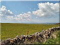
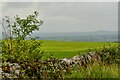
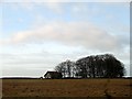
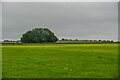
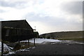
Nearby Images from Geograph Britain and Ireland:
©2021(licence)
©2023(licence)
©2007(licence)
©2023(licence)
©2006(licence)
The above images may not be of the site on this page, they are loaded from Geograph.
Please Submit an Image of this site or go out and take one for us!
Click here to see more info for this site
Nearby sites
Key: Red: member's photo, Blue: 3rd party photo, Yellow: other image, Green: no photo - please go there and take one, Grey: site destroyed
Download sites to:
KML (Google Earth)
GPX (GPS waypoints)
CSV (Garmin/Navman)
CSV (Excel)
To unlock full downloads you need to sign up as a Contributory Member. Otherwise downloads are limited to 50 sites.
Turn off the page maps and other distractions
Nearby sites listing. In the following links * = Image available
1.5km NW 311° Batcombe Hollow north stone* Standing Stone (Menhir) (ST4810452088)
1.5km WNW 297° Batcombe Hollow south standing stone* Standing Stone (Menhir) (ST4782451823)
1.8km ESE 114° Westbury-Sub-Mendip Cave or Rock Shelter (ST50855036)
1.9km ENE 72° Bristol Plain Farm Barrow Cemetery* Barrow Cemetery (ST5097951665)
2.2km NE 50° Cheddar Head Stone Circle (ST509525)
2.2km E 95° Priddy long barrow* Long Barrow (ST5141550915)
2.4km ENE 76° Townsend Farm Barrow Cemetery* Barrow Cemetery (ST5152851658)
2.6km NNW 338° Totty Pot Cave or Rock Shelter (ST48255358)
3.4km E 85° Priddy Church Barrows* Barrow Cemetery (ST526514)
3.5km SE 132° Deerleap Stones* Standing Stones (ST51804876)
3.7km NW 319° Soldier's Hole Cave or Rock Shelter (ST468539)
3.7km NW 318° Goughs Cave (Cheddar)* Cave or Rock Shelter (ST46715392)
3.8km NW 317° Cheddar Museum of Prehistory* Museum (ST46655393)
3.9km NW 320° Sun Hole* Cave or Rock Shelter (ST467541)
3.9km NW 312° Flint Jack's Cave Cave or Rock Shelter (ST463538)
4.5km N 349° Longwood Tumulus* Round Barrow(s) (ST4841955518)
4.7km E 85° Priddy Nine Barrows* Barrow Cemetery (ST53925149)
4.7km NNE 14° Charterhouse settlement* Misc. Earthwork (ST504557)
4.8km ENE 78° Ashen Hill Barrows* Barrow Cemetery (ST53905205)
4.8km N 350° Gorsey Bigbury Henge* Henge (ST48435584)
4.9km NE 45° Wright's Piece barrows (S)* Barrow Cemetery (ST527545)
4.9km NNE 18° Nordrach Tumulus* Round Barrow(s) (ST5078755765)
4.9km ENE 73° Priddy Circles S* Henge (ST53945255)
5.0km SE 127° Wookey Hole Caves* Cave or Rock Shelter (ST53194801)
5.1km ENE 70° Priddy Circles* Henge (ST54005280)
View more nearby sites and additional images


 We would like to know more about this location. Please feel free to add a brief description and any relevant information in your own language.
 Wir möchten mehr über diese Stätte erfahren. Bitte zögern Sie nicht, eine kurze Beschreibung und relevante Informationen in Deutsch hinzuzufügen.
 Nous aimerions en savoir encore un peu sur les lieux. S'il vous plaît n'hesitez pas à ajouter une courte description et tous les renseignements pertinents dans votre propre langue.
 Quisieramos informarnos un poco más de las lugares. No dude en añadir una breve descripción y otros datos relevantes en su propio idioma.