


<< Text Pages >> Hobbie Nobles Well (Bewcastle) - Holy Well or Sacred Spring in England in Cumbria
Submitted by Anne T on Monday, 04 July 2022 Page Views: 435
Springs and Holy WellsSite Name: Hobbie Nobles Well (Bewcastle) Alternative Name: Hobbie Nobles Well (Park Head)Country: England
NOTE: This site is 1.874 km away from the location you searched for.
County: Cumbria Type: Holy Well or Sacred Spring
Nearest Town: Carlisle Nearest Village: Bewcastle
Map Ref: NY5624076200
Latitude: 55.078311N Longitude: 2.686944W
Condition:
| 5 | Perfect |
| 4 | Almost Perfect |
| 3 | Reasonable but with some damage |
| 2 | Ruined but still recognisable as an ancient site |
| 1 | Pretty much destroyed, possibly visible as crop marks |
| 0 | No data. |
| -1 | Completely destroyed |
| 5 | Superb |
| 4 | Good |
| 3 | Ordinary |
| 2 | Not Good |
| 1 | Awful |
| 0 | No data. |
| 5 | Can be driven to, probably with disabled access |
| 4 | Short walk on a footpath |
| 3 | Requiring a bit more of a walk |
| 2 | A long walk |
| 1 | In the middle of nowhere, a nightmare to find |
| 0 | No data. |
| 5 | co-ordinates taken by GPS or official recorded co-ordinates |
| 4 | co-ordinates scaled from a detailed map |
| 3 | co-ordinates scaled from a bad map |
| 2 | co-ordinates of the nearest village |
| 1 | co-ordinates of the nearest town |
| 0 | no data |
Be the first person to rate this site - see the 'Contribute!' box in the right hand menu.
Internal Links:
External Links:
Holy Well or Sacred Spring in Cumbria
Information about this holy well comes from the Cumbria Historic Environment Record, reference HER 113. This simply tells us: "there is a local tradition that this was once a ha' or holy well'. There is a fenced off natural spring with no evidence of stonework".
The well is shown on the OS 6-inch map of 1957, and a pool/depression is visible on Google Earth images.
The well is also featured in the Old Cumbria Gazetteer - see their entry for Hobby Noble's Well, but they classify this as simply a spring, with relatively recent origins. Hobby Noble was an outlaw or 'freebooter' who fled to the Scottish Borders, and is also the hero of a folk ballad.
Does anyone have any more information about this well? Are you able to confirm that it is a holy well or not? If a holy well, do you know what healing and/or restorative uses its waters were used for?
Has anyone visited this site? Do you have any photographs you can add? Thank you.
You may be viewing yesterday's version of this page. To see the most up to date information please register for a free account.
Do not use the above information on other web sites or publications without permission of the contributor.
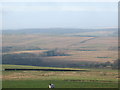
Nearby Images from Geograph Britain and Ireland:
©2006(licence)
©2016(licence)
©2016(licence)
©2010(licence)
©2010(licence)
The above images may not be of the site on this page, they are loaded from Geograph.
Please Submit an Image of this site or go out and take one for us!
Click here to see more info for this site
Nearby sites
Key: Red: member's photo, Blue: 3rd party photo, Yellow: other image, Green: no photo - please go there and take one, Grey: site destroyed
Download sites to:
KML (Google Earth)
GPX (GPS waypoints)
CSV (Garmin/Navman)
CSV (Excel)
To unlock full downloads you need to sign up as a Contributory Member. Otherwise downloads are limited to 50 sites.
Turn off the page maps and other distractions
Nearby sites listing. In the following links * = Image available
1.1km E 86° Grey Hill Settlement Ancient Village or Settlement (NY57317626)
1.7km S 169° Bewcastle Cross* Ancient Cross (NY5653574550)
1.7km SSE 167° Priest's Well (Bewcastle)* Holy Well or Sacred Spring (NY56607454)
3.1km SE 133° Woodhead Round Cairn* Round Cairn (NY58507402)
3.4km S 169° Towerbrae Cairn* Cairn (NY56867282)
4.8km SSE 162° Robin Hood's Well (Askerton) Holy Well or Sacred Spring (NY57677161)
5.5km S 170° Gillalees Ring Cairn (NY571708)
5.7km S 186° Askerton Park* Ancient Village or Settlement (NY55567053)
7.7km SW 229° Bride's Well (Stapleton)* Holy Well or Sacred Spring (NY50397119)
8.5km SSE 157° Waterhead Holy Well (King Water)* Holy Well or Sacred Spring (NY5951068340)
9.3km ESE 116° Standingstone Rigg Standing Stone (Cumbria) Standing Stone (Menhir) (NY6458271969)
9.7km W 266° Holywell (Catlowdy)* Holy Well or Sacred Spring (NY4649175570)
9.9km W 265° Solport Holy Well (Catlowdy) Holy Well or Sacred Spring (NY4637075490)
10.5km W 273° Priest's Well (Catlowdy)* Holy Well or Sacred Spring (NY4573976887)
10.8km NW 318° Carby Hill* Ancient Village or Settlement (NY4906084360)
10.9km SE 137° Popping Stone* Natural Stone / Erratic / Other Natural Feature (NY63556815)
11.0km NW 308° Will O'Greena's Stane* Standing Stone (Menhir) (NY47578303)
11.1km SE 139° Gilsland Spa Sulphur Spring Holy Well or Sacred Spring (NY63476776)
11.1km SE 138° Gilsland Spa Well* Holy Well or Sacred Spring (NY6354067815)
11.5km S 174° Banks East Ancient Village or Settlement (NY574647)
12.3km SE 144° Hadrian's Wall (Poltross Burn)* Stone Fort or Dun (NY6340166198)
12.4km SSW 198° St Mary's Church (Walton)* Ancient Cross (NY5220864492)
13.1km NW 319° Milnholm (Newcastleton)* Ancient Cross (NY4763986111)
14.6km NNW 339° Castleton (Newcastleton)* Ancient Cross (NY51108983)
14.7km NNW 339° Old Castleton (Newcastleton)* Misc. Earthwork (NY50978997)
View more nearby sites and additional images


 We would like to know more about this location. Please feel free to add a brief description and any relevant information in your own language.
 Wir möchten mehr über diese Stätte erfahren. Bitte zögern Sie nicht, eine kurze Beschreibung und relevante Informationen in Deutsch hinzuzufügen.
 Nous aimerions en savoir encore un peu sur les lieux. S'il vous plaît n'hesitez pas à ajouter une courte description et tous les renseignements pertinents dans votre propre langue.
 Quisieramos informarnos un poco más de las lugares. No dude en añadir una breve descripción y otros datos relevantes en su propio idioma.