Featured: Current Archaeology Book of the Year 2019!

Current Archaeology Book of the Year 2019!

Random Image


Asak Cemetery

A Little History of Astro-Archaeology £4.99+p&p

A Little History of Astro-Archaeology £4.99+p&p

Who's Online

There are currently, 372 guests and 0 members online.

You are a guest. To join in, please register for free by clicking here

Sponsors

<< Our Photo Pages >> Corscombe - Standing Stones in England in Dorset

Submitted by enkidu41 on Wednesday, 19 January 2022  Page Views: 21336

Date UncertainSite Name: Corscombe
Country: England
NOTE: This site is 3.844 km away from the location you searched for.

County: Dorset Type: Standing Stones
Nearest Town: Yeovil  Nearest Village: Corscombe
Map Ref: ST514048  Landranger Map Number: 194
Latitude: 50.840674N  Longitude: 2.691598W
Condition:
5Perfect
4Almost Perfect
3Reasonable but with some damage
2Ruined but still recognisable as an ancient site
1Pretty much destroyed, possibly visible as crop marks
0No data.
-1Completely destroyed
2 Ambience:
5Superb
4Good
3Ordinary
2Not Good
1Awful
0No data.
4 Access:
5Can be driven to, probably with disabled access
4Short walk on a footpath
3Requiring a bit more of a walk
2A long walk
1In the middle of nowhere, a nightmare to find
0No data.
4 Accuracy:
5co-ordinates taken by GPS or official recorded co-ordinates
4co-ordinates scaled from a detailed map
3co-ordinates scaled from a bad map
2co-ordinates of the nearest village
1co-ordinates of the nearest town
0no data
3

Internal Links:
External Links:

I have visited· I would like to visit

graemefield would like to visit

philw visited on 21st Dec 2022 - their rating: Cond: 3 Amb: 4 Access: 3
Corscombe
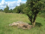
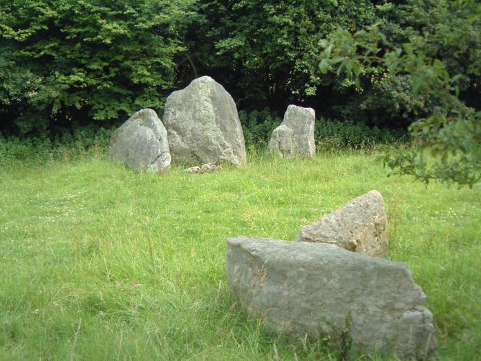
Corscombe submitted by enkidu41 : ST 514048 The 3 stones in the background are probably the remains of the crescentic forecourt of a chambered long barrow similar to Grey Mare & Her Colts. The centre stone is nearly 6'6" high. The stones in the foreground lie to the west and may be the end stones of the forecourt. (Vote or comment on this photo)
This site may well be the remains of a chambered long barrow, but Historic England don't think it is for various reasons expanded on in our comments section. It's well worthy of further investigation though. Situated in a small field on a public footpath running between a minor road just off the north side of the A356 and the village of Corscombe in Dorset. It lies in a grassy valley with a small wood on the east side and steep sloping fields rising on the west side giving an air of tranquillity and seclusion.

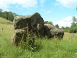
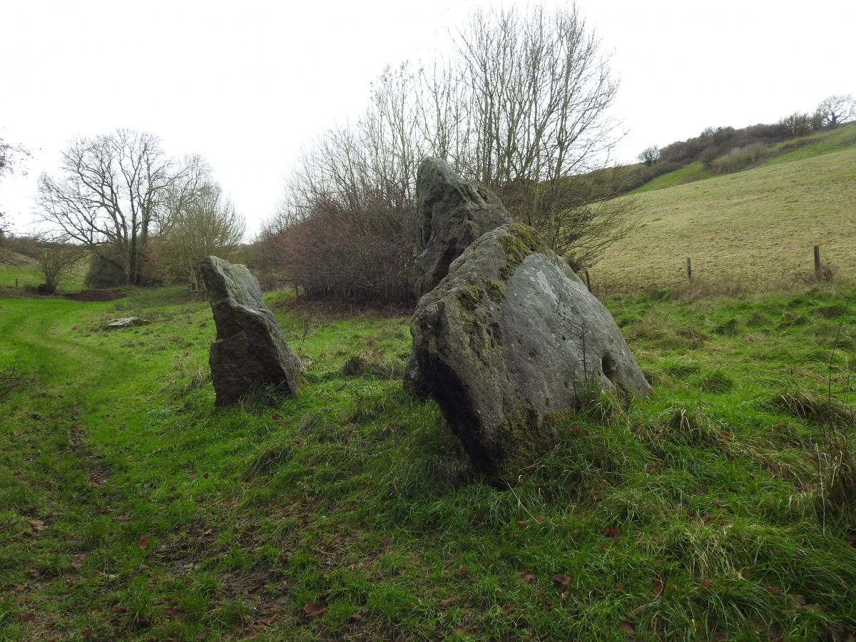
There are 10 stones (ignoring the small ones lying strewn) in 3 apparently separate groups. The principal group to the NE comprises 3 stones standing similarly to those at Grey Mare & Her Colts and are may be the remains of a crescentic forecourt. The centre stone of the three is pointed and 6'6" high. It is flanked by 2 smaller stones, the one on the northern side lies on its long axis, the other on the southern side is blocky, 4'6" high and shaped as to allow sitting. Locally it is referred to as 'The Devil's Chair' or, more prosaically, 'Granny's Armchair'.

The second group of 5 stones lies to the west of the first group. It is not clear what their relationship is but they may be the end stones of the forecourt.

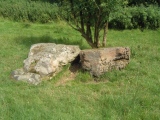
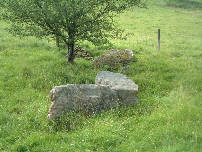
The third group comprises two large stones, both prone, lying under an alder tree 150' away to the SW from the first group. The larger is 8'6" long and 2' thick, the smaller 6' long. Their relationship to the first group is unclear.

Page originally by Vicky.
You may be viewing yesterday's version of this page. To see the most up to date information please register for a free account.

Corscombe
Corscombe submitted by philw : taken 21 12 2022 (Vote or comment on this photo)

Corscombe
Corscombe submitted by rogerkread : Another view. (Vote or comment on this photo)

Corscombe
Corscombe submitted by rogerkread : The main group of stones, showing their nearness to habitation. (Vote or comment on this photo)

Corscombe
Corscombe submitted by philw : taken 21 12 2022 (Vote or comment on this photo)

Corscombe
Corscombe submitted by enkidu41 : ST 514048 A group of 5 stones lying about 25' to the west of the main group of 3 stones which are probably the remains of a facade of a chambered long barrow. The stones in this shot may be the remains of the end stones of the facade. (Vote or comment on this photo)

Corscombe
Corscombe submitted by enkidu41 : ST 514048 2 large stones lying under an alder tree 150' away to the SW from the main group shown in the background which are probably the remains of the facade of a chambered long barrow. The larger of the 2 stones at the rear is 8'6" long and the smaller in the foreground 6'.

Corscombe
Corscombe submitted by enkidu41 : ST 514048 2 large stones lying under an alder tree 150' away to the SW from the main group which are probably the remains of the facade of a chambered long barrow. The larger of the 2 stones on the left is 8'6" long and the smaller on the right 6'.

Corscombe
Corscombe submitted by enkidu41 : ST 514048 The largest group of stones on this site. These 3 are probably the remains of the crescentic forecourt of a chambered long barrow similar to Grey Mare & Her Colts. The centre stone is nearly 6'6" high.

Do not use the above information on other web sites or publications without permission of the contributor.
Click here to see more info for this site

Nearby sites

Click here to view sites on an interactive OS map

Key: Red: member's photo, Blue: 3rd party photo, Yellow: other image, Green: no photo - please go there and take one, Grey: site destroyed

Download sites to:
KML (Google Earth)
GPX (GPS waypoints)
CSV (Garmin/Navman)
CSV (Excel)

To unlock full downloads you need to sign up as a Contributory Member. Otherwise downloads are limited to 50 sites.


Turn off the page maps and other distractions

Nearby sites listing. In the following links * = Image available
 744m WSW 258° Higher Ground Meadow Modern Burial Mound* Artificial Mound (ST5066904650)
 1.4km SSE 164° Hore Stones* Standing Stones (ST5178603403)
 4.3km W 275° Pickett Farm Neolithic Site Misc. Earthwork (ST47100519)
 5.8km E 91° St John's Well (Evershot)* Holy Well or Sacred Spring (ST5721304596)
 6.0km SE 134° Wraxall Cromlech Burial Chamber or Dolmen (ST557006)
 6.2km E 90° Evershot Stones* Standing Stones (ST57600469)
 7.4km NE 44° Closworth Cursus Cursus (ST56581008)
 8.3km WSW 256° St Dunstan's Well* Holy Well or Sacred Spring (ST433028)
 8.3km SE 145° Toller Porcorum* Standing Stones (SY561979)
 8.5km WSW 244° Lewesdon Hillfort Hillfort (ST437012)
 8.6km N 10° Holy Well (West Coker)* Holy Well or Sacred Spring (ST52951325)
 9.1km WNW 304° Pople's Well* Holy Well or Sacred Spring (ST4387909886)
 9.3km ESE 120° The Castle Hillfort (ST594001)
 9.4km SE 124° Cattistock holy well Holy Well or Sacred Spring
 9.9km NE 53° St Andrew (Yetminster) Ancient Cross (ST59421066)
 10.4km SSE 164° Eggardon Hill* Hillfort (SY54129472)
 10.7km WSW 250° Pilsdon Pen* Hillfort (ST413013)
 10.7km SSE 162° Eggardon earthwork* Henge (SY54689460)
 11.1km ENE 72° Leigh Miz Maze* Turf Maze (ST62000818)
 11.8km SSE 159° Two Gates (Dorset)* Burial Chamber or Dolmen (SY5548593770)
 11.8km WSW 248° Bettiscombe Stone Natural Stone / Erratic / Other Natural Feature (ST4036800561)
 11.8km E 94° Cross and Hand Stone* Standing Stone (Menhir) (ST632038)
 12.1km ESE 114° The Combe (Dorset) Misc. Earthwork (SY624997)
 12.4km SE 128° Hog Cliff Bottom Barrow Round Barrow(s) (SY61209711)
 12.5km SSE 155° West Compton Bowl Barrow Round Barrow(s) (SY56619347)
View more nearby sites and additional images

<< Bofickil wedge tomb

Bouker Stones >>

Please add your thoughts on this site

Prehistoric Dorset

Prehistoric Dorset

Sponsors

Auto-Translation (Google)

Translate from English into:

"Corscombe" | Login/Create an Account | 8 News and Comments
  
Go back to top of page    Comments are owned by the poster. We aren't responsible for their content.
Re: Corscombe by Anonymous on Sunday, 30 January 2022
So much that cannot be known, BUT, has anyone concerned tried to establish where the stones came from. i.e. are they the same as the underlying rock? If so I would give up trying to give a reason for their location. If they were found to have been brought to the site from a distant location then the curious might consider if it is worth further investigation.
[ Reply to This ]

Re: Corscombe by robinwiley on Tuesday, 02 June 2020
(User Info | Send a Message)
Here's the best way to get to the stones:
Turn north on Hackney Road from the A356.
(The signpost on the A356 pointing north to Hackney Road says "Corscombe" and "Burial Ground".)
About 1 km along Hackney Road, turn right on Linhay Road and follow it until you see a "Public Bridleway" sign.
Find a place to park nearby, then walk south down to the end of Linhay Road (not "Upper Linhay").
The paved road ends and becomes a dirt track.
(It may be possible to drive down that dirt track but I did not want to risk it, and it's not far to walk.)
Follow that track for about 100 metres where you will see a vehicle gate with a pedestrian gate to the left of it.
Go through the pedestrian gate and the stones are about 20 metres further on.
Here's a Google satellite image of the area.
If you zoom in on the row of trees running nearly north-south in the centre of the image, you can barely see the stones to the left of the trees.
[ Reply to This ]

Re: Corscombe by rogerkread on Monday, 08 July 2013
(User Info | Send a Message)
If visiting the site, note that the lane shown heading SW up from Corscombe is little used and hard work! It is possible however to drive down the other end of this lane, off the road marked on the map as 'Hackney', and park by the lower of the two small 'developments' off this lane.

I found the stones interesting but quite odd. Is this really a megalithic site? Strange Pevsner (Buildings of England) shouldn't mention it when much less impressive sites in the area such as the Hore Stones (Toller Down stones) are listed and described.
[ Reply to This ]

Re: Corscombe by enkidu41 on Tuesday, 24 August 2004
(User Info | Send a Message)
The grid reference given for this site may be slightly inaccurate, particularly the northings element which may be 049 or even 050. An accurate reading from anyone visiting this site with a GPS would, I'm sure, be appreciated.
[ Reply to This ]

Re: Corscombe by enkidu41 on Tuesday, 20 July 2004
(User Info | Send a Message)
Note that this site is not marked on either the Landranger (194) or Explorer (117) OS maps.
[ Reply to This ]
    Re: Corscombe by angieweekender on Saturday, 03 August 2019
    (User Info | Send a Message)
    Maybe because it’s not considered to be a monument by Historic England's predecessors.
    [ Reply to This ]
      Re: Corscombe by Andy B on Monday, 17 January 2022
      (User Info | Send a Message)
      This is based on visits in 1955 and then 1987 where they "don't think it is a prehistoric monument as the site is 'topographically unsuitable', the orientation (NNE-SSW) is unusual, and the stones do not have the appearance of great age"

      They do seem worthy of further investigation though.
      [ Reply to This ]
        Re: Corscombe by Andy B on Sunday, 23 January 2022
        (User Info | Send a Message)
        Some more information from Peter Knight: In 1925 Vere Oliver thought the site to be a chambered long barrow similar to The Grey Mare and Her Colts and it was listed by the Royal Commission at the time as 'three standing stones'. Peter has made a plan of the stones and writes: The smaller stones nearby (F in his plan) suggest that the barrow was orientated SE-NW, He also thinks they were a barrow. Source: Old Stones of Dorset, Peter Knight 1996
        [ Reply to This ]

Your Name: Anonymous [ Register Now ]
Subject:


Add your comment or contribution to this page. Spam or offensive posts are deleted immediately, don't even bother

<<< What is five plus one as a number? (Please type the answer to this question in the little box on the left)
You can also embed videos and other things. For Youtube please copy and paste the 'embed code'.
For Google Street View please include Street View in the text.
Create a web link like this: <a href="https://www.megalithic.co.uk">This is a link</a>  

Allowed HTML is:
<p> <b> <i> <a> <img> <em> <br> <strong> <blockquote> <tt> <li> <ol> <ul> <object> <param> <embed> <iframe>

We would like to know more about this location. Please feel free to add a brief description and any relevant information in your own language.
Wir möchten mehr über diese Stätte erfahren. Bitte zögern Sie nicht, eine kurze Beschreibung und relevante Informationen in Deutsch hinzuzufügen.
Nous aimerions en savoir encore un peu sur les lieux. S'il vous plaît n'hesitez pas à ajouter une courte description et tous les renseignements pertinents dans votre propre langue.
Quisieramos informarnos un poco más de las lugares. No dude en añadir una breve descripción y otros datos relevantes en su propio idioma.