


<< Text Pages >> King Arthur's Hall Cave - Cave or Rock Shelter in England in Herefordshire
Submitted by coldrum on Tuesday, 05 January 2010 Page Views: 3975
Natural PlacesSite Name: King Arthur's Hall CaveCountry: England County: Herefordshire Type: Cave or Rock Shelter
Nearest Town: Monmouth Nearest Village: Symonds Yat
Map Ref: SO53901600
Latitude: 51.840690N Longitude: 2.670533W
Condition:
| 5 | Perfect |
| 4 | Almost Perfect |
| 3 | Reasonable but with some damage |
| 2 | Ruined but still recognisable as an ancient site |
| 1 | Pretty much destroyed, possibly visible as crop marks |
| 0 | No data. |
| -1 | Completely destroyed |
| 5 | Superb |
| 4 | Good |
| 3 | Ordinary |
| 2 | Not Good |
| 1 | Awful |
| 0 | No data. |
| 5 | Can be driven to, probably with disabled access |
| 4 | Short walk on a footpath |
| 3 | Requiring a bit more of a walk |
| 2 | A long walk |
| 1 | In the middle of nowhere, a nightmare to find |
| 0 | No data. |
| 5 | co-ordinates taken by GPS or official recorded co-ordinates |
| 4 | co-ordinates scaled from a detailed map |
| 3 | co-ordinates scaled from a bad map |
| 2 | co-ordinates of the nearest village |
| 1 | co-ordinates of the nearest town |
| 0 | no data |
Be the first person to rate this site - see the 'Contribute!' box in the right hand menu.
Internal Links:
External Links:
Cave or Rock Shelter in the Wye Valley
From Pastscape:
"A small fissurre cave located on the south eastern corner of Little Doward hillfort (SO 51 NW 6). A human skeleton and a large "brass-headed" spear tip were apparently found in the 18th century, but nothing else is known about these finds, and their association with this cave is by no means certain. The cave was examined in 1994 as part of the Wye Valley Caves Project, when the cave and its entrance area were surveyed and a test pit excavated. Animal remains of Holocene date were found, but the cave does not appear to contain any Pleistocene deposits."
http://www.pastscape.org.uk/hob.aspx?hob_id=1043786
You may be viewing yesterday's version of this page. To see the most up to date information please register for a free account.
Do not use the above information on other web sites or publications without permission of the contributor.
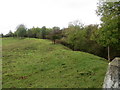
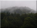
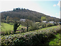
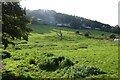
Nearby Images from Geograph Britain and Ireland:

©2013(licence)
©2016(licence)
©2008(licence)
©2008(licence)
©2023(licence)
The above images may not be of the site on this page, they are loaded from Geograph.
Please Submit an Image of this site or go out and take one for us!
Click here to see more info for this site
Nearby sites
Key: Red: member's photo, Blue: 3rd party photo, Yellow: other image, Green: no photo - please go there and take one, Grey: site destroyed
Download sites to:
KML (Google Earth)
GPX (GPS waypoints)
CSV (Garmin/Navman)
CSV (Excel)
To unlock full downloads you need to sign up as a Contributory Member. Otherwise downloads are limited to 50 sites.
Turn off the page maps and other distractions
Nearby sites listing. In the following links * = Image available
1m E 90° Little Doward Barrows Round Barrow(s) (SO539160)
100m E 89° Little Doward* Hillfort (SO5416)
775m ESE 121° King Arthur's Cave* Cave or Rock Shelter (SO54561559)
809m ESE 120° King Arthur's North* Cave or Rock Shelter (SO54601559)
916m SSE 167° Far Hearkening Rock* Natural Stone / Erratic / Other Natural Feature (SO5410515107)
988m SE 135° Cavall's Cave Cave or Rock Shelter (SO546153)
1.1km SE 134° Madawg Rockshelter Cave or Rock Shelter (SO54651526)
1.8km ESE 123° Biblins Cave or Rock Shelter (SO554150)
1.8km ESE 112° Merlin's Cave (Herefordshire) Cave or Rock Shelter (SO556153)
1.9km ESE 104° Symonds Yat West Cave or Rock Shelter (SO55701555)
1.9km ESE 120° Lord's Wood Cave Cave or Rock Shelter (SO55551503)
2.0km SE 140° The Biblins Cave Cave or Rock Shelter (SO55161446)
2.0km S 171° Staunton Suck Stone (Gloucestershire)* Natural Stone / Erratic / Other Natural Feature (SO54211401)
2.0km SSE 168° Near Hearkening Rock* Natural Stone / Erratic / Other Natural Feature (SO54311401)
2.1km E 89° Symonds Yat East Rockshelter Cave or Rock Shelter (SO56001600)
2.2km E 101° Wye Rapids Cave Cave or Rock Shelter (SO56101555)
2.2km E 101° Symonds Yat Cave 2 Cave or Rock Shelter (SO56101555)
2.2km E 101° Symonds Yat Cave Cave or Rock Shelter (SO56101555)
2.2km E 101° Symonds Yat Cave 3 Cave or Rock Shelter (SO56101555)
2.3km ESE 104° Bowler's Hole Cave or Rock Shelter (SO56101545)
2.3km SE 144° Whipping Brook Cave Cave or Rock Shelter (SO55251410)
2.3km ENE 69° Huntsham Hill Rockshelters Cave or Rock Shelter (SO561168)
2.4km E 97° Symonds Yat Fort* Hillfort (SO563157)
3.1km NE 44° The Queen Stone* Standing Stone (Menhir) (SO561182)
3.1km E 97° Coldwell Rocks Cave or Rock Shelter (SO570156)
View more nearby sites and additional images


 We would like to know more about this location. Please feel free to add a brief description and any relevant information in your own language.
 Wir möchten mehr über diese Stätte erfahren. Bitte zögern Sie nicht, eine kurze Beschreibung und relevante Informationen in Deutsch hinzuzufügen.
 Nous aimerions en savoir encore un peu sur les lieux. S'il vous plaît n'hesitez pas à ajouter une courte description et tous les renseignements pertinents dans votre propre langue.
 Quisieramos informarnos un poco más de las lugares. No dude en añadir una breve descripción y otros datos relevantes en su propio idioma.