


<< Our Photo Pages >> Risbury Camp - Hillfort in England in Herefordshire
Submitted by ESgt on Monday, 01 March 2010 Page Views: 11292
Iron Age and Later PrehistorySite Name: Risbury CampCountry: England
NOTE: This site is 1.195 km away from the location you searched for.
County: Herefordshire Type: Hillfort
Map Ref: SO542554
Latitude: 52.194923N Longitude: 2.671463W
Condition:
| 5 | Perfect |
| 4 | Almost Perfect |
| 3 | Reasonable but with some damage |
| 2 | Ruined but still recognisable as an ancient site |
| 1 | Pretty much destroyed, possibly visible as crop marks |
| 0 | No data. |
| -1 | Completely destroyed |
| 5 | Superb |
| 4 | Good |
| 3 | Ordinary |
| 2 | Not Good |
| 1 | Awful |
| 0 | No data. |
| 5 | Can be driven to, probably with disabled access |
| 4 | Short walk on a footpath |
| 3 | Requiring a bit more of a walk |
| 2 | A long walk |
| 1 | In the middle of nowhere, a nightmare to find |
| 0 | No data. |
| 5 | co-ordinates taken by GPS or official recorded co-ordinates |
| 4 | co-ordinates scaled from a detailed map |
| 3 | co-ordinates scaled from a bad map |
| 2 | co-ordinates of the nearest village |
| 1 | co-ordinates of the nearest town |
| 0 | no data |
Internal Links:
External Links:
")
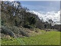
These are now much destroyed. On E side high inner rampart with its ditch beyond which are 2 wide berms with medial ditch, whole terminating in 2 ramparts with medial ditch. 2 entrances: main one a little to S of middle of W side (inner rampart slightly inturned) & on S scarped berm forming long protected approach. Entrance on mid of E side straight cut. Condition of inner rampart good, rising 15' above inner inclosure, on W side rampart found to contain a dry built stone wall, faced externally.
Source: Herefordshire SMR
You may be viewing yesterday's version of this page. To see the most up to date information please register for a free account.
")
")
Do not use the above information on other web sites or publications without permission of the contributor.
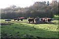
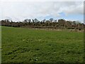
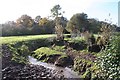
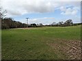
Nearby Images from Geograph Britain and Ireland:
©2006(licence)
©2024(licence)
©2006(licence)
©2024(licence)
©2024(licence)
The above images may not be of the site on this page, they are loaded from Geograph.
Please Submit an Image of this site or go out and take one for us!
Click here to see more info for this site
Nearby sites
Key: Red: member's photo, Blue: 3rd party photo, Yellow: other image, Green: no photo - please go there and take one, Grey: site destroyed
Download sites to:
KML (Google Earth)
GPX (GPS waypoints)
CSV (Garmin/Navman)
CSV (Excel)
To unlock full downloads you need to sign up as a Contributory Member. Otherwise downloads are limited to 50 sites.
Turn off the page maps and other distractions
Nearby sites listing. In the following links * = Image available
1.3km NW 306° Blackwardine Crossroads* Modern Stone Circle etc (SO5318656161)
4.1km NE 43° Uphampton Camp Hillfort (SO57005838)
4.1km SSW 212° Dinmore Hill Hillfort (SO520519)
4.8km N 4° Bach Camp* Hillfort (SO546602)
5.8km W 263° Ivington Camp* Hillfort (SO484547)
8.8km SSW 199° St Ethelbert's Well (Marden)* Holy Well or Sacred Spring (SO512471)
9.2km S 190° Sutton Walls* Hillfort (SO525464)
9.8km NW 325° Luston Holy Well* Holy Well or Sacred Spring (SO4859563407)
10.0km WSW 246° Bush Bank* Standing Stone (Menhir) (SO4496251449)
10.1km NE 50° Garmsley Camp* Hillfort (SO620618)
11.2km WNW 301° St Michael's Church (Kingsland)* Ancient Cross (SO4468461269)
11.5km S 186° The Wergin's Stone* Standing Stone (Menhir) (SO5297543981)
13.8km NW 320° Bircher Common* Misc. Earthwork (SO454661)
14.0km NNE 21° St Mary's Church cross fragment* Ancient Cross (SO5944268368)
14.2km SW 219° Credenhill Camp* Hillfort (SO451445)
14.5km ESE 105° Stanford Bishop Church Stone* Standing Stone (Menhir) (SO682515)
15.0km NW 319° Croft Ambrey* Hillfort (SO444668)
15.1km NW 309° St John the Baptist and St Alkmund (Aymestrey)* Ancient Cross (SO4256065130)
15.7km SSW 213° Holy Well (Garway)* Holy Well or Sacred Spring (SO45554224)
15.9km SSW 191° Hereford Museum and Art Gallery* Museum (SO5090039851)
16.0km SSW 191° The King's Ditch Natural Stone / Erratic / Other Natural Feature (SO50873974)
16.0km S 191° St Ethelbert's Well (Hereford)* Holy Well or Sacred Spring (SO5112239684)
16.0km SSE 157° St Edith's Well (Herefordshire)* Holy Well or Sacred Spring (SO604406)
16.1km NW 313° Pyon Wood* Hillfort (SO424664)
17.1km SSE 164° Backbury* Hillfort (SO587389)
View more nearby sites and additional images


 We would like to know more about this location. Please feel free to add a brief description and any relevant information in your own language.
 Wir möchten mehr über diese Stätte erfahren. Bitte zögern Sie nicht, eine kurze Beschreibung und relevante Informationen in Deutsch hinzuzufügen.
 Nous aimerions en savoir encore un peu sur les lieux. S'il vous plaît n'hesitez pas à ajouter une courte description et tous les renseignements pertinents dans votre propre langue.
 Quisieramos informarnos un poco más de las lugares. No dude en añadir una breve descripción y otros datos relevantes en su propio idioma.