


<< Our Photo Pages >> Dolmen De Theix - Burial Chamber or Dolmen in France in Bretagne:Morbihan (56)
Submitted by karolus on Monday, 20 November 2017 Page Views: 1297
Neolithic and Bronze AgeSite Name: Dolmen De TheixCountry: France
NOTE: This site is 1.88 km away from the location you searched for.
Département: Bretagne:Morbihan (56) Type: Burial Chamber or Dolmen
Nearest Town: Theix
Latitude: 47.631870N Longitude: 2.6796W
Condition:
| 5 | Perfect |
| 4 | Almost Perfect |
| 3 | Reasonable but with some damage |
| 2 | Ruined but still recognisable as an ancient site |
| 1 | Pretty much destroyed, possibly visible as crop marks |
| 0 | No data. |
| -1 | Completely destroyed |
| 5 | Superb |
| 4 | Good |
| 3 | Ordinary |
| 2 | Not Good |
| 1 | Awful |
| 0 | No data. |
| 5 | Can be driven to, probably with disabled access |
| 4 | Short walk on a footpath |
| 3 | Requiring a bit more of a walk |
| 2 | A long walk |
| 1 | In the middle of nowhere, a nightmare to find |
| 0 | No data. |
| 5 | co-ordinates taken by GPS or official recorded co-ordinates |
| 4 | co-ordinates scaled from a detailed map |
| 3 | co-ordinates scaled from a bad map |
| 2 | co-ordinates of the nearest village |
| 1 | co-ordinates of the nearest town |
| 0 | no data |
Internal Links:
External Links:
")
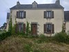
A massive bunch of stones superbly sited on a classic hillock looking down to the east end of Morbihan Bay. Looks to be a Dolmen with some scattered stones lying about. Alas it is in a private garden, so no access, and is not listed or named on any maps.
You may be viewing yesterday's version of this page. To see the most up to date information please register for a free account.
Do not use the above information on other web sites or publications without permission of the contributor.
Nearby Images from Flickr
The above images may not be of the site on this page, but were taken nearby. They are loaded from Flickr so please click on them for image credits.
Click here to see more info for this site
Nearby sites
Click here to view sites on an interactive map of the areaKey: Red: member's photo, Blue: 3rd party photo, Yellow: other image, Green: no photo - please go there and take one, Grey: site destroyed
Download sites to:
KML (Google Earth)
GPX (GPS waypoints)
CSV (Garmin/Navman)
CSV (Excel)
To unlock full downloads you need to sign up as a Contributory Member. Otherwise downloads are limited to 50 sites.
Turn off the page maps and other distractions
Nearby sites listing. In the following links * = Image available
5.1km ENE 64° Cromlech de Theix Stone Circle
5.6km WSW 242° Gornevez Dolmen* Burial Chamber or Dolmen
6.4km WSW 240° Dolmen de l'île de Boëd 1 Burial Chamber or Dolmen
6.5km WSW 243° Dolmen de l'île de Boëd 2 Burial Chamber or Dolmen
6.5km WNW 295° Musée d'Archéologie du Morbihan* Museum
7.5km NNW 329° Lec'h de la Chapelle Notre-Dame-du-Loc* Standing Stone (Menhir)
7.6km SE 138° Menhirs de Bergard* Standing Stones
8.5km W 276° Dolmen dit Er-Roch Burial Chamber or Dolmen
8.8km W 269° Dolmen de Ker Henry* Burial Chamber or Dolmen
9.3km W 274° Dolmen de Kerarhoet Burial Chamber or Dolmen
9.4km ESE 118° Dolmens de Talhouët Burial Chamber or Dolmen
10.0km ESE 117° Dolmen de Rangliac* Burial Chamber or Dolmen
10.2km S 179° Caden tumulus Chambered Tomb
10.2km WSW 242° Dolmen de Pen Raz Burial Chamber or Dolmen
11.5km WSW 239° Dolmen de la Pointe de Liouse Burial Chamber or Dolmen
12.2km SE 130° Dolmen de Kergloanec Burial Chamber or Dolmen
12.2km SSW 197° Cohporh Menhir* Standing Stone (Menhir)
12.2km WSW 248° Menhirs de Brouel Standing Stone (Menhir)
13.2km SSW 192° Menhir de Kerbiguiet* Standing Stone (Menhir)
13.4km SE 139° Menhir du Bois (Ambon) Standing Stone (Menhir)
13.7km WSW 251° Kergonan Cromlech* Stone Circle
13.7km SSW 196° Château de Suscinio* Museum
13.9km SW 225° Dolmen dit Lannek-er-Men* Burial Chamber or Dolmen
14.1km WSW 249° Dolmen De Kerno II* Burial Chamber or Dolmen
14.3km S 178° Menhirs les Trois Pierres Blanches* Standing Stones
View more nearby sites and additional images


 We would like to know more about this location. Please feel free to add a brief description and any relevant information in your own language.
 Wir möchten mehr über diese Stätte erfahren. Bitte zögern Sie nicht, eine kurze Beschreibung und relevante Informationen in Deutsch hinzuzufügen.
 Nous aimerions en savoir encore un peu sur les lieux. S'il vous plaît n'hesitez pas à ajouter une courte description et tous les renseignements pertinents dans votre propre langue.
 Quisieramos informarnos un poco más de las lugares. No dude en añadir una breve descripción y otros datos relevantes en su propio idioma.