


<< Our Photo Pages >> The Wergin's Stone - Standing Stone (Menhir) in England in Herefordshire
Submitted by jfarrar on Saturday, 21 November 2009 Page Views: 11115
Neolithic and Bronze AgeSite Name: The Wergin's StoneCountry: England
NOTE: This site is 2.495 km away from the location you searched for.
County: Herefordshire Type: Standing Stone (Menhir)
Nearest Town: Hereford Nearest Village: Sutton St Nicholas
Map Ref: SO5297543981
Latitude: 52.092165N Longitude: 2.687799W
Condition:
| 5 | Perfect |
| 4 | Almost Perfect |
| 3 | Reasonable but with some damage |
| 2 | Ruined but still recognisable as an ancient site |
| 1 | Pretty much destroyed, possibly visible as crop marks |
| 0 | No data. |
| -1 | Completely destroyed |
| 5 | Superb |
| 4 | Good |
| 3 | Ordinary |
| 2 | Not Good |
| 1 | Awful |
| 0 | No data. |
| 5 | Can be driven to, probably with disabled access |
| 4 | Short walk on a footpath |
| 3 | Requiring a bit more of a walk |
| 2 | A long walk |
| 1 | In the middle of nowhere, a nightmare to find |
| 0 | No data. |
| 5 | co-ordinates taken by GPS or official recorded co-ordinates |
| 4 | co-ordinates scaled from a detailed map |
| 3 | co-ordinates scaled from a bad map |
| 2 | co-ordinates of the nearest village |
| 1 | co-ordinates of the nearest town |
| 0 | no data |
Internal Links:
External Links:
I have visited· I would like to visit
SumDoood would like to visit
")
It was recorded that on Wednesday 16th February 1642 an extraordinarily strong wind dragged the upright Wergins Stone 120 yards away, making an 18" dent in the ground the whole distance, and carried the base stone 440 yards away through the air and a satanic black dog was seen running before one of the stones.
The reference to stones, in the plural, tends to reinforce an old story, recorded by Daniel Defoe, that there were two stones there in the 18th century.
You may be viewing yesterday's version of this page. To see the most up to date information please register for a free account.
")
")
")
")
Do not use the above information on other web sites or publications without permission of the contributor.
Nearby Images from Geograph Britain and Ireland:
©2015(licence)
©2008(licence)
©2008(licence)
©2015(licence)
©2015(licence)
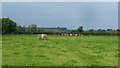
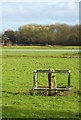
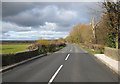
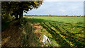
The above images may not be of the site on this page, they are loaded from Geograph.
Please Submit an Image of this site or go out and take one for us!
Click here to see more info for this site
Nearby sites
Key: Red: member's photo, Blue: 3rd party photo, Yellow: other image, Green: no photo - please go there and take one, Grey: site destroyed
Download sites to:
KML (Google Earth)
GPX (GPS waypoints)
CSV (Garmin/Navman)
CSV (Excel)
To unlock full downloads you need to sign up as a Contributory Member. Otherwise downloads are limited to 50 sites.
Turn off the page maps and other distractions
Nearby sites listing. In the following links * = Image available
2.5km NNW 348° Sutton Walls* Hillfort (SO525464)
3.6km NNW 330° St Ethelbert's Well (Marden)* Holy Well or Sacred Spring (SO512471)
4.6km SSW 206° Hereford Museum and Art Gallery* Museum (SO5090039851)
4.7km SSW 203° St Ethelbert's Well (Hereford)* Holy Well or Sacred Spring (SO5112239684)
4.7km SSW 206° The King's Ditch Natural Stone / Erratic / Other Natural Feature (SO50873974)
7.1km S 187° Rotherwas Ribbon* Ancient Trackway (SO52053690)
7.6km S 184° Dinedor Camp* Hillfort (SO524364)
7.6km WSW 256° Holy Well (Garway)* Holy Well or Sacred Spring (SO45554224)
7.6km SE 131° Backbury* Hillfort (SO587389)
7.9km W 273° Credenhill Camp* Hillfort (SO451445)
8.0km N 352° Dinmore Hill Hillfort (SO520519)
8.1km ESE 114° St Edith's Well (Herefordshire)* Holy Well or Sacred Spring (SO604406)
8.9km WSW 238° Eaton Camp* Promontory Fort / Cliff Castle (SO454393)
9.0km S 186° Holy Well (Dinedor)* Holy Well or Sacred Spring (SO52013501)
9.5km WSW 256° Holy Well (Swainshill)* Holy Well or Sacred Spring (SO43724177)
10.0km SSE 151° Cherry Hill* Hillfort (SO577352)
10.7km S 189° St Ann's Well (Aconbury)* Holy Well or Sacred Spring (SO51173338)
10.9km NW 313° Bush Bank* Standing Stone (Menhir) (SO4496251449)
11.2km SSW 193° Aconbury Hill* Hillfort (SO504331)
11.5km N 6° Risbury Camp* Hillfort (SO542554)
11.6km NNW 336° Ivington Camp* Hillfort (SO484547)
12.2km N 0° Blackwardine Crossroads* Modern Stone Circle etc (SO5318656161)
12.7km S 188° Higgin's Well* Holy Well or Sacred Spring (SO51163141)
12.7km SSE 150° Capler Camp* Hillfort (SO593329)
14.9km NNE 15° Uphampton Camp Hillfort (SO57005838)
View more nearby sites and additional images


 We would like to know more about this location. Please feel free to add a brief description and any relevant information in your own language.
 Wir möchten mehr über diese Stätte erfahren. Bitte zögern Sie nicht, eine kurze Beschreibung und relevante Informationen in Deutsch hinzuzufügen.
 Nous aimerions en savoir encore un peu sur les lieux. S'il vous plaît n'hesitez pas à ajouter une courte description et tous les renseignements pertinents dans votre propre langue.
 Quisieramos informarnos un poco más de las lugares. No dude en añadir una breve descripción y otros datos relevantes en su propio idioma.