 with our Megalithic Portal iPhone app")


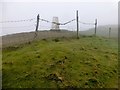
<< Our Photo Pages >> Helm Hill - Hillfort in England in Cumbria
Submitted by vicky on Wednesday, 18 September 2002 Page Views: 8973
Iron Age and Later PrehistorySite Name: Helm HillCountry: England
NOTE: This site is 6.296 km away from the location you searched for.
County: Cumbria Type: Hillfort
Nearest Town: Kendal Nearest Village: Natland
Map Ref: SD531887 Landranger Map Number: 97
Latitude: 54.291758N Longitude: 2.722024W
Condition:
| 5 | Perfect |
| 4 | Almost Perfect |
| 3 | Reasonable but with some damage |
| 2 | Ruined but still recognisable as an ancient site |
| 1 | Pretty much destroyed, possibly visible as crop marks |
| 0 | No data. |
| -1 | Completely destroyed |
| 5 | Superb |
| 4 | Good |
| 3 | Ordinary |
| 2 | Not Good |
| 1 | Awful |
| 0 | No data. |
| 5 | Can be driven to, probably with disabled access |
| 4 | Short walk on a footpath |
| 3 | Requiring a bit more of a walk |
| 2 | A long walk |
| 1 | In the middle of nowhere, a nightmare to find |
| 0 | No data. |
| 5 | co-ordinates taken by GPS or official recorded co-ordinates |
| 4 | co-ordinates scaled from a detailed map |
| 3 | co-ordinates scaled from a bad map |
| 2 | co-ordinates of the nearest village |
| 1 | co-ordinates of the nearest town |
| 0 | no data |
Internal Links:
External Links:
")
Have you visited this site? Please add a comment below.
You may be viewing yesterday's version of this page. To see the most up to date information please register for a free account.
")
")
")
")
Do not use the above information on other web sites or publications without permission of the contributor.
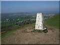
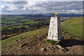
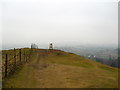
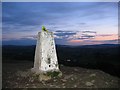
Nearby Images from Geograph Britain and Ireland:
©2009(licence)
©2010(licence)
©2011(licence)
©2008(licence)
©2014(licence)
The above images may not be of the site on this page, they are loaded from Geograph.
Please Submit an Image of this site or go out and take one for us!
Click here to see more info for this site
Nearby sites
Key: Red: member's photo, Blue: 3rd party photo, Yellow: other image, Green: no photo - please go there and take one, Grey: site destroyed
Download sites to:
KML (Google Earth)
GPX (GPS waypoints)
CSV (Garmin/Navman)
CSV (Excel)
To unlock full downloads you need to sign up as a Contributory Member. Otherwise downloads are limited to 50 sites.
Turn off the page maps and other distractions
Nearby sites listing. In the following links * = Image available
3.5km SW 224° Leven's Park ringcairn* Ring Cairn (SD506862)
3.6km NNW 332° Anchorite Well (Kendal)* Holy Well or Sacred Spring (SD5140691932)
3.7km NNW 337° The Kendal Cross* Ancient Cross (SD5168692141)
3.8km SW 222° Levens Park ring cairn 2* Ring Cairn (SD5053385945)
4.0km WSW 242° Sizergh Fell Round Cairn 2* Round Cairn (SD4952486868)
4.0km WSW 242° Sizergh Settlement* Ancient Village or Settlement (SD49528686)
4.1km WSW 243° Sizergh Fell Round Cairn 1* Round Cairn (SD4938886886)
4.3km WSW 245° Sizergh Fell Stone Circle* Stone Circle (SD492869)
4.6km NNW 344° Kendal Museum* Museum (SD519931)
6.3km SSW 213° St Mary's Well (Heversham)* Holy Well or Sacred Spring (SD4958383452)
6.4km SSW 213° St Peter's Church (Heversham)* Ancient Cross (SD4960083390)
6.5km SW 214° Heversham Ancient Wall Misc. Earthwork (SD494834)
8.6km S 172° Holme Park Fell 1* Rock Outcrop (SD5419280141)
8.8km S 171° Holme Park Fell 2* Rock Outcrop (SD5439879957)
9.2km SSW 209° Haverbrack Fell Misc. Earthwork (SD486807)
9.3km SSW 202° Bela Stone Row* Stone Row / Alignment (SD495801)
9.9km SSW 209° The Dog Hole Cave or Rock Shelter (SD482801)
9.9km SSW 210° Haverbrack Cairn Cairn (SD480802)
9.9km SSW 210° Dog Hole possible dolmen/propped stone* Natural Stone / Erratic / Other Natural Feature (SD481801)
10.0km SSW 199° The Rent Stone* Natural Stone / Erratic / Other Natural Feature (SD498792)
10.5km NNW 344° Potter Fell* Ring Cairn (SD503988)
10.6km SSW 203° The Fairy Steps* Natural Stone / Erratic / Other Natural Feature (SD488790)
11.0km SSE 152° Gallowber Lane Romano-British Settlement/Enclosure* Ancient Village or Settlement (SD5823678908)
11.1km SSE 160° Hutton Roof Crag perched Limestone Boulder* Natural Stone / Erratic / Other Natural Feature (SD5686878268)
11.5km SE 125° Howerigg* Ancient Village or Settlement (SD62488192)
View more nearby sites and additional images


 We would like to know more about this location. Please feel free to add a brief description and any relevant information in your own language.
 Wir möchten mehr über diese Stätte erfahren. Bitte zögern Sie nicht, eine kurze Beschreibung und relevante Informationen in Deutsch hinzuzufügen.
 Nous aimerions en savoir encore un peu sur les lieux. S'il vous plaît n'hesitez pas à ajouter une courte description et tous les renseignements pertinents dans votre propre langue.
 Quisieramos informarnos un poco más de las lugares. No dude en añadir una breve descripción y otros datos relevantes en su propio idioma.