 with our Megalithic Portal iPhone app")


<< Text Pages >> Ilchester Museum - Museum in England in Somerset
Submitted by vicky on Saturday, 30 November 2002 Page Views: 6460
MuseumsSite Name: Ilchester MuseumCountry: England
NOTE: This site is 4.864 km away from the location you searched for.
County: Somerset Type: Museum
Nearest Town: Ilchester
Map Ref: ST521226 Landranger Map Number: 183
Latitude: 51.000785N Longitude: 2.684001W
Condition:
| 5 | Perfect |
| 4 | Almost Perfect |
| 3 | Reasonable but with some damage |
| 2 | Ruined but still recognisable as an ancient site |
| 1 | Pretty much destroyed, possibly visible as crop marks |
| 0 | No data. |
| -1 | Completely destroyed |
| 5 | Superb |
| 4 | Good |
| 3 | Ordinary |
| 2 | Not Good |
| 1 | Awful |
| 0 | No data. |
| 5 | Can be driven to, probably with disabled access |
| 4 | Short walk on a footpath |
| 3 | Requiring a bit more of a walk |
| 2 | A long walk |
| 1 | In the middle of nowhere, a nightmare to find |
| 0 | No data. |
| 5 | co-ordinates taken by GPS or official recorded co-ordinates |
| 4 | co-ordinates scaled from a detailed map |
| 3 | co-ordinates scaled from a bad map |
| 2 | co-ordinates of the nearest village |
| 1 | co-ordinates of the nearest town |
| 0 | no data |
Be the first person to rate this site - see the 'Contribute!' box in the right hand menu.
Internal Links:
External Links:
Museum in Somerset
A display showing the history of Ilchester from prehistory to the 20th century
Address: High Street, BA22 8NQ
Phone: 01935 841247
Opening Hours: Open: Easter (Sat) - End Sept. Thurs & Sat 1000 - 1600.
Admission: Charge
Visit their web site
You may be viewing yesterday's version of this page. To see the most up to date information please register for a free account.
Do not use the above information on other web sites or publications without permission of the contributor.
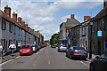
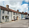
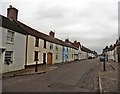
Nearby Images from Geograph Britain and Ireland:
![ST5222 : Ilchester houses [15] by Michael Dibb](https://s3.geograph.org.uk/geophotos/07/51/22/7512235_b83bcb14_120x120.jpg)
©2023(licence)
©2012(licence)
©2016(licence)
![ST5222 : Ilchester houses [16] by Michael Dibb](https://s0.geograph.org.uk/geophotos/07/51/22/7512236_1674cf27_120x120.jpg)
©2023(licence)
©2017(licence)
The above images may not be of the site on this page, they are loaded from Geograph.
Please Submit an Image of this site or go out and take one for us!
Click here to see more info for this site
Nearby sites
Key: Red: member's photo, Blue: 3rd party photo, Yellow: other image, Green: no photo - please go there and take one, Grey: site destroyed
Download sites to:
KML (Google Earth)
GPX (GPS waypoints)
CSV (Garmin/Navman)
CSV (Excel)
To unlock full downloads you need to sign up as a Contributory Member. Otherwise downloads are limited to 50 sites.
Turn off the page maps and other distractions
Nearby sites listing. In the following links * = Image available
6.7km NE 36° Wimble Toot* Round Barrow(s) (ST56052800)
7.0km SW 217° Ham Hill stone circle* Modern Stone Circle etc (ST478171)
7.1km SW 215° Ham Hill (Somerset)* Hillfort (ST480168)
9.4km S 174° Holy Well (West Coker)* Holy Well or Sacred Spring (ST52951325)
10.0km NNW 338° Dundon Beacon Barrow* Round Barrow(s) (ST485319)
10.3km NNW 338° Dundon Hill* Hillfort (ST484322)
10.6km NW 318° High Ham Cursus Cursus (ST45013048)
10.7km N 350° New Ditch* Ancient Village or Settlement (ST504332)
11.0km ENE 76° South Cadbury Castle* Hillfort (ST62812515)
11.0km ENE 75° Queen Anne's Well, Cadbury Castle* Holy Well or Sacred Spring (ST628254)
11.2km ENE 76° King Arthur's Well* Holy Well or Sacred Spring (ST630253)
11.4km E 90° St Andrew's Well (Corton Denham)* Holy Well or Sacred Spring (ST635225)
13.3km SSE 160° Closworth Cursus Cursus (ST56581008)
14.0km SSE 148° St Andrew (Yetminster) Ancient Cross (ST59421066)
15.1km SSW 212° Pople's Well* Holy Well or Sacred Spring (ST4387909886)
15.1km N 4° Ponter's Ball Dyke Ancient Village or Settlement (ST533377)
16.0km N 354° Chalice Well* Holy Well or Sacred Spring (ST507385)
16.0km N 355° White Spring (Somerset)* Holy Well or Sacred Spring (ST5073238506)
16.0km N 356° Glastonbury Tor* Ancient Village or Settlement (ST51223861)
16.1km W 271° St. Catherine's Well (Swell)* Holy Well or Sacred Spring (ST360231)
16.2km N 352° Omphalos Stone (Glastonbury Abbey)* Natural Stone / Erratic / Other Natural Feature (ST501387)
16.4km N 352° St Joseph's Well* Holy Well or Sacred Spring (ST49993883)
16.4km N 352° Glastonbury Lake Village Museum* Museum (ST499389)
16.5km N 352° Market Cross (Glastonbury) Ancient Cross (ST4987538924)
16.8km NW 310° Greylake Mesolithic open-air cemetery Natural Stone / Erratic / Other Natural Feature (ST393335)
View more nearby sites and additional images


 We would like to know more about this location. Please feel free to add a brief description and any relevant information in your own language.
 Wir möchten mehr über diese Stätte erfahren. Bitte zögern Sie nicht, eine kurze Beschreibung und relevante Informationen in Deutsch hinzuzufügen.
 Nous aimerions en savoir encore un peu sur les lieux. S'il vous plaît n'hesitez pas à ajouter une courte description et tous les renseignements pertinents dans votre propre langue.
 Quisieramos informarnos un poco más de las lugares. No dude en añadir una breve descripción y otros datos relevantes en su propio idioma.