


<< Text Pages >> Cueva de Montesinos - Cave or Rock Shelter in Spain in Castilla La Mancha y Madrid
Submitted by holger_rix on Wednesday, 23 December 2015 Page Views: 1290
Natural PlacesSite Name: Cueva de MontesinosCountry: Spain
NOTE: This site is 32.259 km away from the location you searched for.
Region: Castilla La Mancha y Madrid Type: Cave or Rock Shelter
Nearest Village: Ossa de Montiel
Latitude: 38.940343N Longitude: 2.808808W
Condition:
| 5 | Perfect |
| 4 | Almost Perfect |
| 3 | Reasonable but with some damage |
| 2 | Ruined but still recognisable as an ancient site |
| 1 | Pretty much destroyed, possibly visible as crop marks |
| 0 | No data. |
| -1 | Completely destroyed |
| 5 | Superb |
| 4 | Good |
| 3 | Ordinary |
| 2 | Not Good |
| 1 | Awful |
| 0 | No data. |
| 5 | Can be driven to, probably with disabled access |
| 4 | Short walk on a footpath |
| 3 | Requiring a bit more of a walk |
| 2 | A long walk |
| 1 | In the middle of nowhere, a nightmare to find |
| 0 | No data. |
| 5 | co-ordinates taken by GPS or official recorded co-ordinates |
| 4 | co-ordinates scaled from a detailed map |
| 3 | co-ordinates scaled from a bad map |
| 2 | co-ordinates of the nearest village |
| 1 | co-ordinates of the nearest town |
| 0 | no data |
Be the first person to rate this site - see the 'Contribute!' box in the right hand menu.
Internal Links:
External Links:
Cave or Rock Shelter in Castilla La Mancha y Madrid
You may be viewing yesterday's version of this page. To see the most up to date information please register for a free account.
Do not use the above information on other web sites or publications without permission of the contributor.
Nearby Images from Flickr
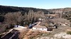
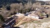
The above images may not be of the site on this page, but were taken nearby. They are loaded from Flickr so please click on them for image credits.
Click here to see more info for this site
Nearby sites
Click here to view sites on an interactive map of the areaKey: Red: member's photo, Blue: 3rd party photo, Yellow: other image, Green: no photo - please go there and take one, Grey: site destroyed
Download sites to:
KML (Google Earth)
GPX (GPS waypoints)
CSV (Garmin/Navman)
CSV (Excel)
To unlock full downloads you need to sign up as a Contributory Member. Otherwise downloads are limited to 50 sites.
Turn off the page maps and other distractions
Nearby sites listing. In the following links * = Image available
60.6km W 281° Motilla del Azuer* Hillfort
80.8km W 261° Cerro de La Encatada* Castro or Chafurdão
87.4km NNE 31° Honrubia Castro or Chafurdão
92.0km SW 224° Los Escolares* Cave or Rock Shelter
96.0km ESE 114° Minetada Caves* Cave or Rock Shelter
100.9km SE 140° Yacimiento Prehistórico de Bagil Ancient Village or Settlement
100.9km SE 140° Dolmen de Bagil* Burial Chamber or Dolmen
107.1km ESE 116° El Canajo Castro or Chafurdão
120.7km SSW 195° Cámara Sepulcral Ibérica de Toya* Ancient Village or Settlement
129.1km SE 142° Cueva Negra* Natural Stone / Erratic / Other Natural Feature
129.3km SW 215° Conjunto Arqueológico de Cástulo* Ancient Village or Settlement
134.6km S 170° Necropolis de Tutugui* Ancient Village or Settlement
134.9km ESE 101° Las Cazoletas del Arabilejo Ancient Village or Settlement
135.0km ESE 101° Petroglifos del Arabilejo Rock Art
135.1km E 101° La Cueva Horadada* Cave or Rock Shelter
135.2km E 101° Cantos de la Visera Rock Art
136.0km SSW 205° La Cueva de la Graja* Rock Art
138.0km SSE 153° La Cueva de Ambrosio* Cave or Rock Shelter
140.0km WSW 246° Cueva de Peña Escrita* Cave or Rock Shelter
140.2km WSW 247° La Batanera Pinturas Rupestres Rock Art
145.9km NW 315° Museo de Santa Cruz* Museum
146.7km ESE 105° Abrigo del Canto de la Visera* Cave or Rock Shelter
147.2km NE 41° Selva Pascuala cave mural Cave or Rock Shelter
150.6km NNW 343° Cuevas de Perales de Tajuña* Cave or Rock Shelter
151.0km ESE 103° Tobanilla Castro or Chafurdão
View more nearby sites and additional images


 We would like to know more about this location. Please feel free to add a brief description and any relevant information in your own language.
 Wir möchten mehr über diese Stätte erfahren. Bitte zögern Sie nicht, eine kurze Beschreibung und relevante Informationen in Deutsch hinzuzufügen.
 Nous aimerions en savoir encore un peu sur les lieux. S'il vous plaît n'hesitez pas à ajouter une courte description et tous les renseignements pertinents dans votre propre langue.
 Quisieramos informarnos un poco más de las lugares. No dude en añadir una breve descripción y otros datos relevantes en su propio idioma.