


<< Our Photo Pages >> Knole Park Camp - Hillfort in England in Gloucestershire
Submitted by 4clydesdale7 on Thursday, 29 March 2012 Page Views: 7055
Iron Age and Later PrehistorySite Name: Knole Park CampCountry: England
NOTE: This site is 1.405 km away from the location you searched for.
County: Gloucestershire Type: Hillfort
Nearest Town: Bristol Nearest Village: Almondsbury
Map Ref: ST59638334
Latitude: 51.547499N Longitude: 2.583578W
Condition:
| 5 | Perfect |
| 4 | Almost Perfect |
| 3 | Reasonable but with some damage |
| 2 | Ruined but still recognisable as an ancient site |
| 1 | Pretty much destroyed, possibly visible as crop marks |
| 0 | No data. |
| -1 | Completely destroyed |
| 5 | Superb |
| 4 | Good |
| 3 | Ordinary |
| 2 | Not Good |
| 1 | Awful |
| 0 | No data. |
| 5 | Can be driven to, probably with disabled access |
| 4 | Short walk on a footpath |
| 3 | Requiring a bit more of a walk |
| 2 | A long walk |
| 1 | In the middle of nowhere, a nightmare to find |
| 0 | No data. |
| 5 | co-ordinates taken by GPS or official recorded co-ordinates |
| 4 | co-ordinates scaled from a detailed map |
| 3 | co-ordinates scaled from a bad map |
| 2 | co-ordinates of the nearest village |
| 1 | co-ordinates of the nearest town |
| 0 | no data |
Internal Links:
External Links:
I have visited· I would like to visit
4clydesdale7 visited on 29th Mar 2012 - their rating: Cond: 2 Amb: 3 Access: 4 Virtually destroyed by needless development and now (even today) more destructive works - all (originally) for a view - the same has happened elsewhere in Gloucestershire - take a look round Cheltenham
")
Immediately to the Northeast of the mouth of the River Avon stand three camps - this camp, Kings Weston Down Camp and Blaise Castle Camp (not the modern folly). Not only did they guard the Ridgeway but also the harbour at the mouth of the Avon which the Romans called Abone now silted up and called Sea Mills just east of Shirehampton. Cribb's Causeway gave its name to the massive regional shopping mall complex you see from the M5 on your way down to Devon and Cornwall. Believe it or not as you pass the Asda Hypermarket (at CC) there is a Round Barrow just opposite on the W side of the motorway - I digress - back to the activities of the Victorians and Edwardians.
This Hillfort also stood immediately over a Romano British Settlement known as Cattybrook (at the foot of the W end of the Camp's NW scarp). The settlement (now long gone) is divided now into two distinct parts; a garden nursery (formerly brickworks) and a massive stone quarry. Just to the North lay a deer park.
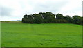
And the Camp? At first came a large house with terraced garden (since replaced with faux stone houses/cottages of no architectural distinction at all) and a lodge (a grade 2 listed building). So what used to be a beautifully situate hillfort has become a 'between the wars' unremarkable housing estate which used to have a superb view, which has now been spoiled, not just by development within the camp and at the foot of the scarp, but also by the fact that most of the aspect is now hidden by trees (inappropriately planted when the old house was built). You get the occasional glimpse of the two modern River Severn Road Bridges. Most of the univallate earthworks disappeared with the old terracing (with more terracing for the more modern houses) and all that terracing also defaced the scarp. All for a 'room with a view' which lasted at best for 100 years!
And the Archaeology? Lost forever it seems - some black Glastonbury pottery seen in 1923 but not recovered, the greedy developers had by then virtually destroyed any potential.
Mentioned in:-
(a) Samuel Rudders New History of Gloucestershire 1779 p222
(b) G.Witts Archaeological Handbook Gloucestershire 1888 Camp No.59
(c) Ed J Burrow Ancient Entrenchments and Camps of Gloucestershire 1924 p131
(d) pastscape South Gloucestershire; Almondsbury; Mon. 198659
You may be viewing yesterday's version of this page. To see the most up to date information please register for a free account.
")
")
Do not use the above information on other web sites or publications without permission of the contributor.
Nearby Images from Geograph Britain and Ireland:
©2008(licence)
©2012(licence)
©2007(licence)
©2007(licence)
©2008(licence)
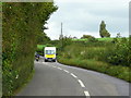
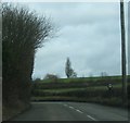
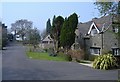
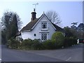
The above images may not be of the site on this page, they are loaded from Geograph.
Please Submit an Image of this site or go out and take one for us!
Click here to see more info for this site
Nearby sites
Key: Red: member's photo, Blue: 3rd party photo, Yellow: other image, Green: no photo - please go there and take one, Grey: site destroyed
Download sites to:
KML (Google Earth)
GPX (GPS waypoints)
CSV (Garmin/Navman)
CSV (Excel)
To unlock full downloads you need to sign up as a Contributory Member. Otherwise downloads are limited to 50 sites.
Turn off the page maps and other distractions
Nearby sites listing. In the following links * = Image available
2.5km S 188° Highwood Road Modern Menhir* Modern Stone Circle etc (ST5928080878)
3.2km NNE 22° Rams Well* Holy Well or Sacred Spring (ST6085186266)
3.4km NNE 12° Miles Well* Holy Well or Sacred Spring (ST6036486654)
5.2km NNE 13° Elberton Camp* Hillfort (ST60808840)
5.3km NE 43° Fishmonger's Swallet Cave or Rock Shelter (ST63318720)
5.7km SSW 197° Southmead Barrow* Round Barrow(s) (ST5794477902)
5.8km NNE 30° Alveston Round Barrow* Round Barrow(s) (ST62608831)
6.2km SW 217° Blaise Castle* Hillfort (ST55857837)
6.3km SSE 164° Stoke Park Long Barrow* Long Barrow (ST6132077294)
6.6km SW 217° King's Weston Hillfort* Hillfort (ST55597813)
6.7km SW 218° King's Weston Hill stockpound* Misc. Earthwork (ST55417807)
7.0km SE 127° Bury Hill Camp (Winterbourne)* Hillfort (ST652791)
7.0km SW 219° King's Weston Hill barrow cemetary* Barrow Cemetery (ST55127793)
7.3km NNE 16° St Arilds Well* Holy Well or Sacred Spring (ST61759030)
7.4km SSE 150° Oldbury Court Camp Ancient Village or Settlement (ST633769)
7.6km NE 45° Abbey Camp* Hillfort (ST65008870)
8.0km SSW 206° Druid Stoke* Chambered Tomb (ST56107620)
8.2km NW 324° St Tecla's Chapel & Holy Well Holy Well or Sacred Spring (ST5484390020)
8.4km E 89° Iron Acton Churchyard Cross* Ancient Cross (ST6807583467)
8.4km NE 53° Tytherington Camp* Promontory Fort / Cliff Castle (ST66438834)
8.5km ESE 120° The Beeracres Stone* Modern Stone Circle etc (ST6779)
8.6km S 191° Redland Park* Standing Stone (Menhir) (ST57947492)
8.7km N 7° St Arilda's, Oldbury-on-Severn* Artificial Mound (ST60839191)
9.1km N 9° Oldbury Standing Stone* Standing Stone (Menhir) (ST61169234)
9.5km N 8° The Toots (Oldbury)* Hillfort (ST611927)
View more nearby sites and additional images


 We would like to know more about this location. Please feel free to add a brief description and any relevant information in your own language.
 Wir möchten mehr über diese Stätte erfahren. Bitte zögern Sie nicht, eine kurze Beschreibung und relevante Informationen in Deutsch hinzuzufügen.
 Nous aimerions en savoir encore un peu sur les lieux. S'il vous plaît n'hesitez pas à ajouter une courte description et tous les renseignements pertinents dans votre propre langue.
 Quisieramos informarnos un poco más de las lugares. No dude en añadir una breve descripción y otros datos relevantes en su propio idioma.