


<< Our Photo Pages >> Toller Porcorum - Standing Stones in England in Dorset
Submitted by ermine on Sunday, 26 September 2004 Page Views: 10319
Neolithic and Bronze AgeSite Name: Toller Porcorum Alternative Name: St Andrew & St PeterCountry: England
NOTE: This site is 1.862 km away from the location you searched for.
County: Dorset Type: Standing Stones
Nearest Village: Toller Porcorum
Map Ref: SY561979
Latitude: 50.779006N Longitude: 2.624024W
Condition:
| 5 | Perfect |
| 4 | Almost Perfect |
| 3 | Reasonable but with some damage |
| 2 | Ruined but still recognisable as an ancient site |
| 1 | Pretty much destroyed, possibly visible as crop marks |
| 0 | No data. |
| -1 | Completely destroyed |
| 5 | Superb |
| 4 | Good |
| 3 | Ordinary |
| 2 | Not Good |
| 1 | Awful |
| 0 | No data. |
| 5 | Can be driven to, probably with disabled access |
| 4 | Short walk on a footpath |
| 3 | Requiring a bit more of a walk |
| 2 | A long walk |
| 1 | In the middle of nowhere, a nightmare to find |
| 0 | No data. |
| 5 | co-ordinates taken by GPS or official recorded co-ordinates |
| 4 | co-ordinates scaled from a detailed map |
| 3 | co-ordinates scaled from a bad map |
| 2 | co-ordinates of the nearest village |
| 1 | co-ordinates of the nearest town |
| 0 | no data |
Internal Links:
External Links:
I have visited· I would like to visit
ermine has visited here
")
The megalithic history of this site turned up as a surprise when part of the church wall collapsed around the turn of the millennium, revealing a pair of standing stones. These now stand either side of the main gate, christened St Peter and St Andrew (naturally - since it is the Church of St Andrew and St Peter). The site is mentioned in Julian Cope's "The Modern Antiquarian", where he refers to the possible pre-Christian nature of the circular churchyard.
You may be viewing yesterday's version of this page. To see the most up to date information please register for a free account.
")
Do not use the above information on other web sites or publications without permission of the contributor.
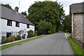
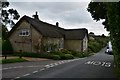
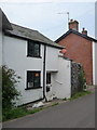
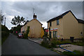
Nearby Images from Geograph Britain and Ireland:
©2017(licence)
©2017(licence)
©2016(licence)
©2009(licence)
©2017(licence)
The above images may not be of the site on this page, they are loaded from Geograph.
Please Submit an Image of this site or go out and take one for us!
Click here to see more info for this site
Nearby sites
Key: Red: member's photo, Blue: 3rd party photo, Yellow: other image, Green: no photo - please go there and take one, Grey: site destroyed
Download sites to:
KML (Google Earth)
GPX (GPS waypoints)
CSV (Garmin/Navman)
CSV (Excel)
To unlock full downloads you need to sign up as a Contributory Member. Otherwise downloads are limited to 50 sites.
Turn off the page maps and other distractions
Nearby sites listing. In the following links * = Image available
2.7km N 351° Wraxall Cromlech Burial Chamber or Dolmen (ST557006)
3.4km ENE 61° Cattistock holy well Holy Well or Sacred Spring
3.6km SSW 203° Eggardon earthwork* Henge (SY54689460)
3.7km SSW 211° Eggardon Hill* Hillfort (SY54129472)
4.0km NE 56° The Castle Hillfort (ST594001)
4.2km S 188° Two Gates (Dorset)* Burial Chamber or Dolmen (SY5548593770)
4.5km S 173° West Compton Bowl Barrow Round Barrow(s) (SY56619347)
4.6km SSE 163° West Compton Fort Hillfort (SY574935)
5.1km E 98° Hog Cliff Bottom Barrow Round Barrow(s) (SY61209711)
5.7km ESE 122° Notton Down Barrow Round Barrow(s) (SY60949486)
6.2km E 100° Hog Cliff Hill Barrow Round Barrow(s) (SY62179676)
6.2km S 184° Litton Cheney* Timber Circle (SY5562591741)
6.4km ESE 102° Hog Cliff Hill Settlement Ancient Village or Settlement (SY624965)
6.5km S 169° Kingston Russell Standing Stone* Standing Stone (Menhir) (SY57259149)
6.5km ENE 74° The Combe (Dorset) Misc. Earthwork (SY624997)
6.6km S 173° Martin's Down Round Barrows* Round Barrow(s) (SY569913)
6.7km SSW 207° Chilcombe Hill* Hillfort (SY530920)
6.8km SSE 168° Long Bredy A Cursus* Cursus (SY57419124)
6.8km SSE 168° Martin's Down Bell Barrows* Round Barrow(s) (SY57419124)
6.8km N 9° St John's Well (Evershot)* Holy Well or Sacred Spring (ST5721304596)
6.8km S 171° Long Bredy Bank Barrow* Long Barrow (SY57179115)
6.8km SSE 164° Kingston Russell Stone 1 Standing Stone (Menhir) (SY579913)
6.9km S 170° Long Bredy Barrow Cemetery* Barrow Cemetery (SY5726491115)
6.9km SSE 165° Long Bredy B Cursus Cursus (SY579912)
7.0km NNE 12° Evershot Stones* Standing Stones (ST57600469)
View more nearby sites and additional images


 We would like to know more about this location. Please feel free to add a brief description and any relevant information in your own language.
 Wir möchten mehr über diese Stätte erfahren. Bitte zögern Sie nicht, eine kurze Beschreibung und relevante Informationen in Deutsch hinzuzufügen.
 Nous aimerions en savoir encore un peu sur les lieux. S'il vous plaît n'hesitez pas à ajouter une courte description et tous les renseignements pertinents dans votre propre langue.
 Quisieramos informarnos un poco más de las lugares. No dude en añadir una breve descripción y otros datos relevantes en su propio idioma.