


<< Our Photo Pages >> Abdon Burf - Hillfort in England in Shropshire
Submitted by TimPrevett on Wednesday, 04 May 2005 Page Views: 11061
Iron Age and Later PrehistorySite Name: Abdon BurfCountry: England
NOTE: This site is 2.888 km away from the location you searched for.
County: Shropshire Type: Hillfort
Nearest Town: Craven Arms Nearest Village: Clee St Margaret
Map Ref: SO59508660
Latitude: 52.475817N Longitude: 2.597701W
Condition:
| 5 | Perfect |
| 4 | Almost Perfect |
| 3 | Reasonable but with some damage |
| 2 | Ruined but still recognisable as an ancient site |
| 1 | Pretty much destroyed, possibly visible as crop marks |
| 0 | No data. |
| -1 | Completely destroyed |
| 5 | Superb |
| 4 | Good |
| 3 | Ordinary |
| 2 | Not Good |
| 1 | Awful |
| 0 | No data. |
| 5 | Can be driven to, probably with disabled access |
| 4 | Short walk on a footpath |
| 3 | Requiring a bit more of a walk |
| 2 | A long walk |
| 1 | In the middle of nowhere, a nightmare to find |
| 0 | No data. |
| 5 | co-ordinates taken by GPS or official recorded co-ordinates |
| 4 | co-ordinates scaled from a detailed map |
| 3 | co-ordinates scaled from a bad map |
| 2 | co-ordinates of the nearest village |
| 1 | co-ordinates of the nearest town |
| 0 | no data |
Internal Links:
External Links:
I have visited· I would like to visit
TimPrevett has visited here
")
You may be viewing yesterday's version of this page. To see the most up to date information please register for a free account.
Do not use the above information on other web sites or publications without permission of the contributor.
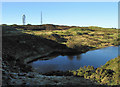
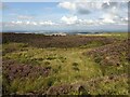
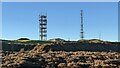
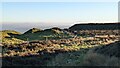
Nearby Images from Geograph Britain and Ireland:
©2012(licence)
©2023(licence)
©2022(licence)
©2022(licence)
©2019(licence)
The above images may not be of the site on this page, they are loaded from Geograph.
Please Submit an Image of this site or go out and take one for us!
Click here to see more info for this site
Nearby sites
Key: Red: member's photo, Blue: 3rd party photo, Yellow: other image, Green: no photo - please go there and take one, Grey: site destroyed
Download sites to:
KML (Google Earth)
GPX (GPS waypoints)
CSV (Garmin/Navman)
CSV (Excel)
To unlock full downloads you need to sign up as a Contributory Member. Otherwise downloads are limited to 50 sites.
Turn off the page maps and other distractions
Nearby sites listing. In the following links * = Image available
nankm 0° Giant's Shaft Standing Stone (Menhir) (SO595866)
2.3km S 184° Clee Burf* Hillfort (SO59338433)
2.7km SW 224° Nordy Bank* Hillfort (SO576847)
5.1km SSW 212° St Milburga's Well (Stoke St Milborough)* Holy Well or Sacred Spring (SO56778231)
8.3km NNW 336° Mogg Forest Hillfort* Hillfort (SO5621194262)
8.7km S 181° Titterstone Clee Camp* Hillfort (SO592779)
10.4km NE 45° Morville Cross* Ancient Cross (SO6695893875)
12.5km S 182° St John the Baptist (Hope Bagot)* Holy Well or Sacred Spring (SO5885874092)
12.6km NNE 13° St Milburgas Well (Much Wenlock)* Holy Well or Sacred Spring (SO625988)
13.4km SW 227° Bromfield Barrows* Barrow Cemetery (SO495776)
13.6km N 11° St Owens Well* Holy Well or Sacred Spring (SO622999)
13.6km NNE 11° Holy Trinity (Much Wenlock)* Ancient Cross (SO623999)
13.7km SW 230° Robin Hoods Butt 1 (Shropshire) Round Barrow(s) (SO48977787)
13.8km WNW 301° Hope Bowdler Hill* Cairn (SO47779389)
13.8km SSW 201° Caynham Camp* Hillfort (SO545737)
13.8km SSW 213° St Julian's Well (Ludlow)* Holy Well or Sacred Spring (SO5184275060)
14.3km SW 217° Boiling Well (Ludlow)* Holy Well or Sacred Spring (SO508752)
14.3km NW 307° Caer Caradoc Round Barrow* Round Barrow(s) (SO48059529)
14.6km SW 214° Ludlow Museum* Museum (SO512746)
14.6km NW 306° Caer Caradoc (Church Stretton)* Hillfort (SO477953)
14.8km NW 317° The Lawley (Summit)* Hillfort (SO49459745)
15.1km NW 322° The Lawley (Northern)* Hillfort (SO50289863)
15.3km W 267° Strefford Henge Henge (SO442858)
15.5km WSW 252° Norton Camp (Shropshire)* Hillfort (SO44728193)
15.5km NNW 336° The Frog Well Holy Well or Sacred Spring (SJ53340084)
View more nearby sites and additional images


 We would like to know more about this location. Please feel free to add a brief description and any relevant information in your own language.
 Wir möchten mehr über diese Stätte erfahren. Bitte zögern Sie nicht, eine kurze Beschreibung und relevante Informationen in Deutsch hinzuzufügen.
 Nous aimerions en savoir encore un peu sur les lieux. S'il vous plaît n'hesitez pas à ajouter une courte description et tous les renseignements pertinents dans votre propre langue.
 Quisieramos informarnos un poco más de las lugares. No dude en añadir una breve descripción y otros datos relevantes en su propio idioma.