 with our Megalithic Portal iPhone app")


<< Our Photo Pages >> Penhurrock - Multiple Stone Rows / Avenue in England in Cumbria
Submitted by Anonymous on Saturday, 17 July 2004 Page Views: 6606
Neolithic and Bronze AgeSite Name: PenhurrockCountry: England
NOTE: This site is 1.109 km away from the location you searched for.
County: Cumbria Type: Multiple Stone Rows / Avenue
Map Ref: NY62881043 Landranger Map Number: 91
Latitude: 54.487843N Longitude: 2.574506W
Condition:
| 5 | Perfect |
| 4 | Almost Perfect |
| 3 | Reasonable but with some damage |
| 2 | Ruined but still recognisable as an ancient site |
| 1 | Pretty much destroyed, possibly visible as crop marks |
| 0 | No data. |
| -1 | Completely destroyed |
| 5 | Superb |
| 4 | Good |
| 3 | Ordinary |
| 2 | Not Good |
| 1 | Awful |
| 0 | No data. |
| 5 | Can be driven to, probably with disabled access |
| 4 | Short walk on a footpath |
| 3 | Requiring a bit more of a walk |
| 2 | A long walk |
| 1 | In the middle of nowhere, a nightmare to find |
| 0 | No data. |
| 5 | co-ordinates taken by GPS or official recorded co-ordinates |
| 4 | co-ordinates scaled from a detailed map |
| 3 | co-ordinates scaled from a bad map |
| 2 | co-ordinates of the nearest village |
| 1 | co-ordinates of the nearest town |
| 0 | no data |
Internal Links:
External Links:
")
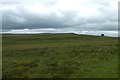
Sections of shap granite kerbstones can be seen on top of a mound/knoll, roughly describing a circle. Small quarries(?) into the mound have disturbed some of the stones. Disturbed in the 19th Century. and overall a confusing site. An uncertain site according to Burl.
This site is recorded as Pastscape Monument No. 13442, which reads: "This cairn has been mostly removed and now consists only of scattered stones and a few large boulders. Judging by the remains of the peristalith, it was probably about 55' in diameter. (2) It is said that when the cairn was removed burnt bones were found in a small cist-like hole cut into the rock ... The 'few large boulders' comprise the SW and SE arcs of the peristalith."
You may be viewing yesterday's version of this page. To see the most up to date information please register for a free account.
")
")
Do not use the above information on other web sites or publications without permission of the contributor.
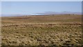
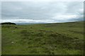
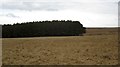
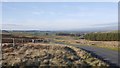
Nearby Images from Geograph Britain and Ireland:
©2019(licence)
©2020(licence)
©2013(licence)
©2019(licence)
©2020(licence)
The above images may not be of the site on this page, they are loaded from Geograph.
Please Submit an Image of this site or go out and take one for us!
Click here to see more info for this site
Nearby sites
Key: Red: member's photo, Blue: 3rd party photo, Yellow: other image, Green: no photo - please go there and take one, Grey: site destroyed
Download sites to:
KML (Google Earth)
GPX (GPS waypoints)
CSV (Garmin/Navman)
CSV (Excel)
To unlock full downloads you need to sign up as a Contributory Member. Otherwise downloads are limited to 50 sites.
![]()
Turn off the page maps and other distractions
Nearby sites listing. In the following links * = Image available
385m W 280° Howe Robin Ancient Village or Settlement (NY625105)
1.7km WNW 282° Kings Well spring* Holy Well or Sacred Spring (NY612108)
1.8km WNW 284° Hazel Moor Enclosure* Ancient Village or Settlement (NY611109)
2.0km ENE 67° Gaythorn Plain* Ring Cairn (NY647112)
2.0km NNW 340° Burwens Ancient Village or Settlement (NY622123)
2.1km NW 319° Cow Green Long Barrow* Long Barrow (NY61541199)
2.2km WNW 301° White Hag Round cairn* Round Cairn (NY61011158)
2.4km ESE 116° Castle Folds* Ancient Village or Settlement (NY64990936)
2.4km NE 52° Gaythorne Plain Round Cairns* Cairn (NY64811193)
2.5km WNW 298° White Hag* Stone Circle (NY60721160)
2.5km SSE 153° Gamelands* Stone Circle (NY64010816)
2.6km ENE 61° Hollin Stump Cairn* Cairn (NY652117)
2.7km NNE 17° Raise Howe Cairn* Cairn (NY63711303)
2.8km N 356° Howarcles Ancient Village or Settlement (NY627132)
2.8km WNW 297° Wicker Street* Cairn (NY60411173)
2.8km ESE 121° Raisbeck Wood* Round Cairn (NY65260896)
2.9km NW 323° Ewe Locks* Ancient Village or Settlement (NY6112512794)
3.3km E 81° Ling Bank North Settlement/Enclosures* Ancient Village or Settlement (NY6616310906)
3.5km E 84° Ling Bank South Prehistoric Settlement/Enclosures* Ancient Village or Settlement (NY6639910793)
3.6km W 277° Long Scar Pike* Cairn (NY5933810862)
3.6km NNW 328° Ewe Close* Ancient Village or Settlement (NY61021348)
3.6km NW 313° Seal Howe Cairn 3* Round Cairn (NY6025312925)
3.7km NNW 348° Crosby Ravensworth Stone Row* Multiple Stone Rows / Avenue (NY6212514022)
3.9km ESE 111° Little Kinmond Cairn* Cairn (NY66540899)
3.9km NW 306° Seal Howe Cairn 2* Round Cairn (NY5969912781)
View more nearby sites and additional images


 We would like to know more about this location. Please feel free to add a brief description and any relevant information in your own language.
 Wir möchten mehr über diese Stätte erfahren. Bitte zögern Sie nicht, eine kurze Beschreibung und relevante Informationen in Deutsch hinzuzufügen.
 Nous aimerions en savoir encore un peu sur les lieux. S'il vous plaît n'hesitez pas à ajouter une courte description et tous les renseignements pertinents dans votre propre langue.
 Quisieramos informarnos un poco más de las lugares. No dude en añadir una breve descripción y otros datos relevantes en su propio idioma.