


<< Our Photo Pages >> La Petite Longue Rocque des Granges - Standing Stone (Menhir) in Channel Islands and Isle of Man in Guernsey
Submitted by JJ on Sunday, 11 February 2001 Page Views: 4501
Neolithic and Bronze AgeSite Name: La Petite Longue Rocque des GrangesCountry: Channel Islands and Isle of Man
NOTE: This site is 0.714 km away from the location you searched for.
Island: Guernsey Type: Standing Stone (Menhir)
Nearest Town: St Peter Port Nearest Village: St Peter Port
Map Ref: WV326785
Latitude: 49.456341N Longitude: 2.551558W
Condition:
| 5 | Perfect |
| 4 | Almost Perfect |
| 3 | Reasonable but with some damage |
| 2 | Ruined but still recognisable as an ancient site |
| 1 | Pretty much destroyed, possibly visible as crop marks |
| 0 | No data. |
| -1 | Completely destroyed |
| 5 | Superb |
| 4 | Good |
| 3 | Ordinary |
| 2 | Not Good |
| 1 | Awful |
| 0 | No data. |
| 5 | Can be driven to, probably with disabled access |
| 4 | Short walk on a footpath |
| 3 | Requiring a bit more of a walk |
| 2 | A long walk |
| 1 | In the middle of nowhere, a nightmare to find |
| 0 | No data. |
| 5 | co-ordinates taken by GPS or official recorded co-ordinates |
| 4 | co-ordinates scaled from a detailed map |
| 3 | co-ordinates scaled from a bad map |
| 2 | co-ordinates of the nearest village |
| 1 | co-ordinates of the nearest town |
| 0 | no data |
Internal Links:
External Links:
I have visited· I would like to visit
tom_bullock has visited here
")
A medium sized granite megalith in someone's garden in St Peter Port. Again this stone was re-erected, and is the only one surviving in the town area.
Access: Perry's guide map square TC7
You may be viewing yesterday's version of this page. To see the most up to date information please register for a free account.
Do not use the above information on other web sites or publications without permission of the contributor.
Nearby Images from Flickr
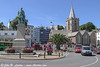
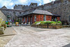
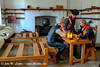

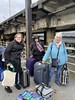

The above images may not be of the site on this page, but were taken nearby. They are loaded from Flickr so please click on them for image credits.
Click here to see more info for this site
Nearby sites
Click here to view sites on an interactive map of the areaKey: Red: member's photo, Blue: 3rd party photo, Yellow: other image, Green: no photo - please go there and take one, Grey: site destroyed
Download sites to:
KML (Google Earth)
GPX (GPS waypoints)
CSV (Garmin/Navman)
CSV (Excel)
To unlock full downloads you need to sign up as a Contributory Member. Otherwise downloads are limited to 50 sites.
![]()
Turn off the page maps and other distractions
Nearby sites listing. In the following links * = Image available
278m NNE 12° Courtil D'Ydol de St Jacques Standing Stone (Menhir)
460m NW 321° La Grande Pouquelaye Passage Grave
674m ENE 72° La Pierre de L'Hyvreuse Standing Stone (Menhir)
795m ENE 59° La Petite L'Hyvreuse Passage Grave
1.5km WNW 282° Castel (Guernsey)* Standing Stone (Menhir) (WV311788)
1.8km E 100° Guernsey Maritime Museum Museum
2.0km NNE 29° Le Chateau Du Marais* Artificial Mound
2.0km S 186° La Gran'mere du Chimquiere* Standing Stone (Menhir)
2.3km S 172° Sausmarez Manor Menhir* Standing Stone (Menhir)
3.0km NE 35° La Pointue Rocque* Standing Stone (Menhir)
3.0km NNE 26° Route St Clair* Standing Stone (Menhir) (WV339812)
3.2km NE 39° Delancey* Burial Chamber or Dolmen (WV346810)
3.6km N 8° L'Islet* Burial Chamber or Dolmen
3.7km N 5° Sandy Lane* Burial Chamber or Dolmen
4.1km NNW 335° Port Soif Dolmen* Burial Chamber or Dolmen
4.2km NNE 12° St Michel Du Valle* Not Known (by us)
4.4km W 274° Rocque a Chancre* Standing Stone (Menhir)
4.5km NNE 32° La Roque qui Sonne* Passage Grave
4.7km NNE 12° Les Fouaillages* Burial Chamber or Dolmen
4.7km N 357° Rousse Cists* Cist
4.8km NNE 12° La Platte Mare* Burial Chamber or Dolmen
5.2km NNE 16° La Mare es Mauves* Burial Chamber or Dolmen
5.2km NNE 12° La Varde* Passage Grave (WV337836)
5.3km NNE 16° Martello 7* Stone Circle
5.5km W 266° Rue de la Terre Norgiot Standing Stone (Menhir)
View more nearby sites and additional images


 We would like to know more about this location. Please feel free to add a brief description and any relevant information in your own language.
 Wir möchten mehr über diese Stätte erfahren. Bitte zögern Sie nicht, eine kurze Beschreibung und relevante Informationen in Deutsch hinzuzufügen.
 Nous aimerions en savoir encore un peu sur les lieux. S'il vous plaît n'hesitez pas à ajouter une courte description et tous les renseignements pertinents dans votre propre langue.
 Quisieramos informarnos un poco más de las lugares. No dude en añadir una breve descripción y otros datos relevantes en su propio idioma.