


<< Text Pages >> Hog Cliff Bottom Barrow - Round Barrow(s) in England in Dorset
Submitted by coldrum on Tuesday, 06 December 2011 Page Views: 2819
Neolithic and Bronze AgeSite Name: Hog Cliff Bottom BarrowCountry: England County: Dorset Type: Round Barrow(s)
Nearest Town: Maiden Newton
Map Ref: SY61209711
Latitude: 50.772267N Longitude: 2.551609W
Condition:
| 5 | Perfect |
| 4 | Almost Perfect |
| 3 | Reasonable but with some damage |
| 2 | Ruined but still recognisable as an ancient site |
| 1 | Pretty much destroyed, possibly visible as crop marks |
| 0 | No data. |
| -1 | Completely destroyed |
| 5 | Superb |
| 4 | Good |
| 3 | Ordinary |
| 2 | Not Good |
| 1 | Awful |
| 0 | No data. |
| 5 | Can be driven to, probably with disabled access |
| 4 | Short walk on a footpath |
| 3 | Requiring a bit more of a walk |
| 2 | A long walk |
| 1 | In the middle of nowhere, a nightmare to find |
| 0 | No data. |
| 5 | co-ordinates taken by GPS or official recorded co-ordinates |
| 4 | co-ordinates scaled from a detailed map |
| 3 | co-ordinates scaled from a bad map |
| 2 | co-ordinates of the nearest village |
| 1 | co-ordinates of the nearest town |
| 0 | no data |
Be the first person to rate this site - see the 'Contribute!' box in the right hand menu.
Internal Links:
External Links:
Round Barrow in Dorset
"The mound, a probable bowl barrow, is situated at SY 61209711 on a shelf below the crest of a spur. It measures 11.4m in diameter and 0.9m high and has been dug into from the south to ground level. There are slight traces of a ditch on the north-west."
Read More at Pastscape.
You may be viewing yesterday's version of this page. To see the most up to date information please register for a free account.
Do not use the above information on other web sites or publications without permission of the contributor.
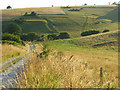
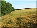
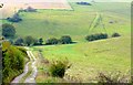
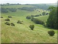
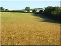
Nearby Images from Geograph Britain and Ireland:
©2008(licence)
©2008(licence)
©2008(licence)
©2007(licence)
©2008(licence)
The above images may not be of the site on this page, they are loaded from Geograph.
Please Submit an Image of this site or go out and take one for us!
Click here to see more info for this site
Nearby sites
Key: Red: member's photo, Blue: 3rd party photo, Yellow: other image, Green: no photo - please go there and take one, Grey: site destroyed
Download sites to:
KML (Google Earth)
GPX (GPS waypoints)
CSV (Garmin/Navman)
CSV (Excel)
To unlock full downloads you need to sign up as a Contributory Member. Otherwise downloads are limited to 50 sites.
Turn off the page maps and other distractions
Nearby sites listing. In the following links * = Image available
1.0km ESE 109° Hog Cliff Hill Barrow Round Barrow(s) (SY62179676)
1.3km ESE 117° Hog Cliff Hill Settlement Ancient Village or Settlement (SY624965)
2.3km S 186° Notton Down Barrow Round Barrow(s) (SY60949486)
2.9km NNE 24° The Combe (Dorset) Misc. Earthwork (SY624997)
3.2km NW 319° Cattistock holy well Holy Well or Sacred Spring
3.5km ESE 104° Jackman's Cross Bowl Barrow Round Barrow(s) (SY64559623)
3.5km NNW 329° The Castle Hillfort (ST594001)
3.6km ESE 116° Grimstone Down Barrow Cemetery Barrow Cemetery (SY644955)
3.7km ESE 112° Grimstone Down Settlements Ancient Village or Settlement (SY646957)
3.9km ESE 106° Jackman's Plantation Bowl Barrow Round Barrow(s) (SY64929604)
3.9km ESE 105° Lawyer's Plantation Cross Dyke Misc. Earthwork (SY64949606)
3.9km E 94° Crete Hill Field System Misc. Earthwork (SY651968)
4.0km ESE 103° Coronation Plantation Bowl Barrow Round Barrow(s) (SY65159620)
4.2km E 86° Furzey Down Road Ancient Trackway (SY654974)
4.4km E 84° Crete Hill Bowl Barrow Round Barrow(s) (SY656975)
4.5km ESE 107° Howde's Barrow Plantation Bowl Barrow Round Barrow(s) (SY65509574)
4.7km ENE 79° Nether Cerne Field System Misc. Earthwork (SY658980)
4.8km SSE 162° Frampton Long Barrow Long Barrow (SY627925)
4.9km ESE 111° Forston Settlement Ancient Village or Settlement (SY658953)
5.0km NE 42° Up Cerne/Sydling St Nicholas Boundary Stone Marker Stone (ST64610078)
5.0km ENE 63° Smacam Down Settlement Ancient Village or Settlement (SY657994)
5.1km ENE 63° Smacam Down Long Barrow Long Barrow (SY6572599389)
5.1km SE 130° Stratton Churchyard Cross* Ancient Cross (SY6510893793)
5.1km W 278° Toller Porcorum* Standing Stones (SY561979)
5.2km ENE 63° Smacam Down Bowl Barrow Round Barrow(s) (SY65859946)
View more nearby sites and additional images


 We would like to know more about this location. Please feel free to add a brief description and any relevant information in your own language.
 Wir möchten mehr über diese Stätte erfahren. Bitte zögern Sie nicht, eine kurze Beschreibung und relevante Informationen in Deutsch hinzuzufügen.
 Nous aimerions en savoir encore un peu sur les lieux. S'il vous plaît n'hesitez pas à ajouter une courte description et tous les renseignements pertinents dans votre propre langue.
 Quisieramos informarnos un poco más de las lugares. No dude en añadir una breve descripción y otros datos relevantes en su propio idioma.