

<< Our Photo Pages >> St John's Well (Spott) - Holy Well or Sacred Spring in Scotland in East Lothian
Submitted by Anne T on Monday, 05 November 2018 Page Views: 2705
Springs and Holy WellsSite Name: St John's Well (Spott)Country: Scotland
NOTE: This site is 0.588 km away from the location you searched for.
County: East Lothian Type: Holy Well or Sacred Spring
Nearest Town: Dunbar Nearest Village: Spott
Map Ref: NT67277561
Latitude: 55.972363N Longitude: 2.525981W
Condition:
| 5 | Perfect |
| 4 | Almost Perfect |
| 3 | Reasonable but with some damage |
| 2 | Ruined but still recognisable as an ancient site |
| 1 | Pretty much destroyed, possibly visible as crop marks |
| 0 | No data. |
| -1 | Completely destroyed |
| 5 | Superb |
| 4 | Good |
| 3 | Ordinary |
| 2 | Not Good |
| 1 | Awful |
| 0 | No data. |
| 5 | Can be driven to, probably with disabled access |
| 4 | Short walk on a footpath |
| 3 | Requiring a bit more of a walk |
| 2 | A long walk |
| 1 | In the middle of nowhere, a nightmare to find |
| 0 | No data. |
| 5 | co-ordinates taken by GPS or official recorded co-ordinates |
| 4 | co-ordinates scaled from a detailed map |
| 3 | co-ordinates scaled from a bad map |
| 2 | co-ordinates of the nearest village |
| 1 | co-ordinates of the nearest town |
| 0 | no data |
Internal Links:
External Links:
I have visited· I would like to visit
mp9 would like to visit
Anne T visited on 27th Oct 2018 - their rating: Cond: 3 Amb: 3 Access: 4 St John's Well, Spott: With the wind still whistling and starting to get dark, we really wanted to see this well and the nearby Easter Broomhouse standing stone before calling it a day. At the north eastern end of Spott, a gated stile by the small school lets you into the field, which, at the time of our visit, was full of very large, curious sheep.
Following the line of the first two telegraph poles, a gully comes into view. The well house is located at the top of this, at the bottom of the gully, so we needed to slither down the 6ft or so to the bottom to photograph the well.
Whilst the well cavity was dry, there was a pool of water a couple of metres further down the gulley.
Further down the field there was a very old, ruined building with an arched window. I am curious to know what this is – need to look it up on Canmore. Because of its location, my immediate thought was that it was a hermitage. No separate Canmore record, but is recorded on the map as a cistern.
 (PID:187931)")
This holy well is located at the northern end of High Road, Spott village. Just east of the school a gated stile gives access into a field of pasture, with an old sign pointing the way to "St John's Well". Walking just over 100 metres northwards towards a tree-lined gully, the concrete roof of the well doesn't comes into view until you are almost on top of it.
Located at the bottom of the gully, at its southern end, we needed to slide down the earth bank until we reached the well house and trough. Whilst the well appeared only marginally damp, there was a pool of water a few metres to the north of the well trough, indicating water is still flowing, but not into the well house itself.
Following the gully northwards, there is a very old building, whose roof barely comes above the level of the field the well is in. This is marked on Canmore's map as a cistern, presumably built when the water from the well was piped into Dunbar. For more information see Canmore ID 57649, and entry from the 1853 OS name booking telling us that this is: "An excellent spring well from which the town of Dunbar is supplied with water by means of lead pipes. The waterworks were constructed in 1767 at a cost of £1,700." Their most recent entry is from March 1966, adding: "The well, which is within a stone building, has been piped, and now issues about 20m to the N. There is a local tradition that the monks of Coldingham Priory (12th century) made an annual pilgrimage to this well."
You may be viewing yesterday's version of this page. To see the most up to date information please register for a free account.
 (PID:187936)")
 (PID:187935)")
 (PID:187934)")
 (PID:187933)")
 (PID:187932)")
Do not use the above information on other web sites or publications without permission of the contributor.
Click here to see more info for this site
Nearby sites
Key: Red: member's photo, Blue: 3rd party photo, Yellow: other image, Green: no photo - please go there and take one, Grey: site destroyed
Download sites to:
KML (Google Earth)
GPX (GPS waypoints)
CSV (Garmin/Navman)
CSV (Excel)
To unlock full downloads you need to sign up as a Contributory Member. Otherwise downloads are limited to 50 sites.
Turn off the page maps and other distractions
Nearby sites listing. In the following links * = Image available
545m SW 221° Witches' Stone (Spott)* Holy Well or Sacred Spring (NT66917520)
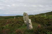
1.2km NE 36° Easter Broomhouse* Standing Stone (Menhir) (NT6800876615)
1.4km E 92° Doon Hill Dunbar* Ancient Village or Settlement (NT6868775539)
3.3km ENE 57° Broxmouth Hill Fort* Hillfort (NT7011177388)
5.0km WSW 256° Rood Well* Holy Well or Sacred Spring (NT6237674417)
5.9km WNW 289° Kirklandhill* Standing Stone (Menhir) (NT61687760)
7.7km WNW 288° Prestonkirk Cursus Cursus (NT60007809)
8.0km WNW 287° Prestonkirk Cursus Cursus (NT59657799)
8.2km WNW 285° St Baldred's Well* Holy Well or Sacred Spring (NT59317780)
8.3km WNW 286° Prestonkirk Cursus Cursus (NT59257798)
8.5km SSW 192° Yadlee* Stone Circle (NT65406732)
8.6km WNW 285° Prestonkirk Cursus Cursus (NT58927790)
9.0km W 264° Maiden Stone (East Lothian)* Standing Stone (Menhir) (NT5830774748)
9.2km SW 220° White Castle Fort* Hillfort (NT61356860)
9.2km SSW 200° Spartleton Edge Stone Circle (NT640670)
9.2km W 264° Traprain Law* Hillfort (NT5805674696)
9.2km W 277° Pencraig Brae* Standing Stone (Menhir) (NT58087681)
9.5km W 261° Loth Stone* Standing Stone (Menhir) (NT5782374146)
9.6km NW 308° Our Lady's Well (Whitekirk) Holy Well or Sacred Spring (NT598816)
9.6km S 177° Bothwell Water (Cranshaws) Natural Stone / Erratic / Other Natural Feature (NT67656598)
9.7km WSW 258° Standingstone (East Lothian)* Standing Stone (Menhir) (NT57737363)
10.1km SSW 211° Ragstone Rig (Cranshaws) Stone Row / Alignment (NT61956705)
10.1km SSW 208° Tavers Cleugh* Cairn (NT62386671)
11.1km ESE 114° Cockburnspath Cross* Ancient Cross (NT7743071100)
11.2km SSW 205° Nine Stones Rig* Stone Circle (NT62546549)
View more nearby sites and additional images


 We would like to know more about this location. Please feel free to add a brief description and any relevant information in your own language.
 Wir möchten mehr über diese Stätte erfahren. Bitte zögern Sie nicht, eine kurze Beschreibung und relevante Informationen in Deutsch hinzuzufügen.
 Nous aimerions en savoir encore un peu sur les lieux. S'il vous plaît n'hesitez pas à ajouter une courte description et tous les renseignements pertinents dans votre propre langue.
 Quisieramos informarnos un poco más de las lugares. No dude en añadir una breve descripción y otros datos relevantes en su propio idioma.