


<< Text Pages >> Up Cerne/Sydling St Nicholas Boundary Stone - Marker Stone in England in Dorset
Submitted by coldrum on Monday, 04 January 2010 Page Views: 5732
Multi-periodSite Name: Up Cerne/Sydling St Nicholas Boundary StoneCountry: England
NOTE: This site is 1.102 km away from the location you searched for.
County: Dorset Type: Marker Stone
Nearest Village: Cerne Abbas
Map Ref: ST64610078
Latitude: 50.805487N Longitude: 2.503606W
Condition:
| 5 | Perfect |
| 4 | Almost Perfect |
| 3 | Reasonable but with some damage |
| 2 | Ruined but still recognisable as an ancient site |
| 1 | Pretty much destroyed, possibly visible as crop marks |
| 0 | No data. |
| -1 | Completely destroyed |
| 5 | Superb |
| 4 | Good |
| 3 | Ordinary |
| 2 | Not Good |
| 1 | Awful |
| 0 | No data. |
| 5 | Can be driven to, probably with disabled access |
| 4 | Short walk on a footpath |
| 3 | Requiring a bit more of a walk |
| 2 | A long walk |
| 1 | In the middle of nowhere, a nightmare to find |
| 0 | No data. |
| 5 | co-ordinates taken by GPS or official recorded co-ordinates |
| 4 | co-ordinates scaled from a detailed map |
| 3 | co-ordinates scaled from a bad map |
| 2 | co-ordinates of the nearest village |
| 1 | co-ordinates of the nearest town |
| 0 | no data |
Be the first person to rate this site - see the 'Contribute!' box in the right hand menu.
Internal Links:
External Links:
Marker Stone in Dorset
From Pastscape: "Large natural boulder set on edge alongside trackway utilized as parish boundary. Possibly a boundary stone and/or way mark."
You may be viewing yesterday's version of this page. To see the most up to date information please register for a free account.
Do not use the above information on other web sites or publications without permission of the contributor.
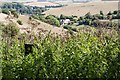
Nearby Images from Geograph Britain and Ireland:
©2010(licence)
©2018(licence)
©2011(licence)
©2008(licence)
©2018(licence)
The above images may not be of the site on this page, they are loaded from Geograph.
Please Submit an Image of this site or go out and take one for us!
Click here to see more info for this site
Nearby sites
Key: Red: member's photo, Blue: 3rd party photo, Yellow: other image, Green: no photo - please go there and take one, Grey: site destroyed
Download sites to:
KML (Google Earth)
GPX (GPS waypoints)
CSV (Garmin/Navman)
CSV (Excel)
To unlock full downloads you need to sign up as a Contributory Member. Otherwise downloads are limited to 50 sites.
Turn off the page maps and other distractions
Nearby sites listing. In the following links * = Image available
1.1km ESE 117° Dickley Hill Bowl Barrows Round Barrow(s) (ST65600026)
1.1km NE 43° Weam Commen Hill Field System Misc. Earthwork (ST654016)
1.2km ESE 116° Dickley Hill Settlement Ancient Village or Settlement (ST65650027)
1.2km N 8° Wancombe Hill Field System Misc. Earthwork (ST64790200)
1.6km NNE 17° Seldon Hill Settlement Ancient Village or Settlement (ST65100235)
1.8km SE 141° Smacam Down Settlement Ancient Village or Settlement (SY657994)
1.8km SE 141° Smacam Down Long Barrow Long Barrow (SY6572599389)
1.8km SE 136° Smacam Down Bowl Barrow Round Barrow(s) (SY65859946)
2.1km ENE 73° St Augustine's Well (Cerne Abbas)* Holy Well or Sacred Spring (ST6664001369)
2.2km ENE 66° Cerne Abbas Giant* Hill Figure or Geoglyph (ST66660168)
2.3km ENE 67° The Trendle* Misc. Earthwork (ST66730167)
2.3km ENE 64° Giant Hill Cross Ridge Dyke Misc. Earthwork (ST667018)
2.4km ENE 63° Giant Hill Bowl Barrow Round Barrow(s) (ST66760187)
2.5km WSW 244° The Combe (Dorset) Misc. Earthwork (SY624997)
2.6km E 96° Black Hill Farm Enclosure Ancient Village or Settlement (ST672005)
2.7km NNE 24° High Cank Henge Henge (ST65720319)
2.8km ENE 57° Giant Hill Settlement Ancient Village or Settlement (ST66950225)
2.8km ESE 119° Green Hill Barrows Barrow Cemetery (SY67069943)
2.8km ESE 102° Oxencombe Bottom Bowl Barrow Round Barrow(s) (ST67380018)
2.8km ENE 58° Bowl Barrow (Dorset) Round Barrow(s) (ST67030229)
2.9km NNE 26° Farm Hill Bowl Barrow Round Barrow(s) (ST65880334)
3.0km ESE 119° Green Hill Field System Misc. Earthwork (SY672993)
3.0km SSE 156° Nether Cerne Field System Misc. Earthwork (SY658980)
3.1km ENE 78° Alton Lane Field System Misc. Earthwork (ST677014)
3.3km NNW 335° Cross and Hand Stone* Standing Stone (Menhir) (ST632038)
View more nearby sites and additional images


 We would like to know more about this location. Please feel free to add a brief description and any relevant information in your own language.
 Wir möchten mehr über diese Stätte erfahren. Bitte zögern Sie nicht, eine kurze Beschreibung und relevante Informationen in Deutsch hinzuzufügen.
 Nous aimerions en savoir encore un peu sur les lieux. S'il vous plaît n'hesitez pas à ajouter une courte description et tous les renseignements pertinents dans votre propre langue.
 Quisieramos informarnos un poco más de las lugares. No dude en añadir una breve descripción y otros datos relevantes en su propio idioma.